Zbelovo (podvoz pod železnico) - Ljubična gora
Starting point: Zbelovo (podvoz pod železnico) (264 m)
| Latitude/Longitude: | 46,29580°N 15,53250°E |
| |
Walking time: 45 min
Difficulty: easy marked way
Elevation gain: 269 m
Elevation difference along the route: 269 m
Map:
Recommended equipment (summer):
Recommended equipment (winter): crampons
Views: 1.100
 | 3 people like this post |
Access to starting point:
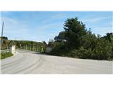
A) We leave the highway at the Slovenske Konjice exit and turn left, direction Žiče. In Žiče at the crossroads we turn left, direction Loče. In Loče at the roundabout we turn in the direction of Poljčane - Zbelovo. We drive through Zbelovo, where at the end of the settlement we see the underpass under the railway track. We drive through the underpass and immediately turn right, past the bus stop over an old wooden bridge, and on the left we park on a smaller parking lot.
B) We leave the highway at the Slovenska Bistrica-Jug exit and follow the signposts in the direction of Poljčane. We drive through Poljčane; at the end of the settlement the signs direct us right, direction Loče - Zbelovo. We follow the main road until we arrive at the underpass under the railway. We do not turn right through the underpass, but left before the bus stop onto the old wooden bridge, and then on the left we park on a smaller parking lot.
Route description:
When we park, we head along the access road to a smaller company, where a sign for the Loško-Zbelovska pot also directs us. At the company we keep left and go along the fence to the forest, where a macadam forest road begins. We follow the road all the time until we reach a larger parking lot for foresters. Here the road ends, but we turn sharply right onto a steep forest cart track. We follow the cart track all the time, since on part of the path due to a clearcut the blazes are missing. If we carefully follow the main cart track, we soon arrive at a smaller panoramic section, then again into the forest, where we turn right and follow the blazes to the chapel of St. Hubert. Here at the junction we turn right, and we follow the blazes with the letter L (Loško-Zbelovska pot) all the time. We follow the forest path until we notice a smaller weekend cottage on the left. By the weekend cottage we climb to an asphalt road, which we follow to the church of St. Mary. Past the church a sign directs us into the forest, where we ascend for some time more, then slightly descend to the cross on Marijine stopinje, where there is a logbook.

Along the route: Ljubična gora (533m)
Photos:
 1
1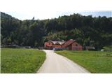 2
2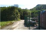 3
3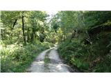 4
4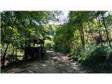 5
5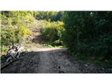 6
6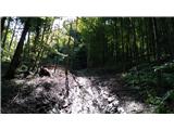 7
7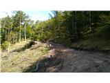 8
8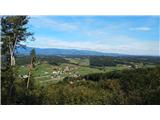 9
9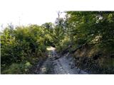 10
10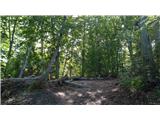 11
11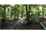 12
12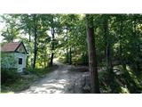 13
13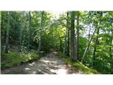 14
14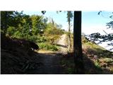 15
15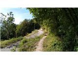 16
16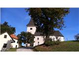 17
17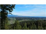 18
18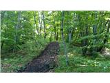 19
19 20
20
Discussion about the trip Zbelovo (podvoz pod železnico) - Ljubična gora
To post a comment you must log in:
If you do not yet have a username, you must first
register.