Starting point: Železniki (458 m)
| Latitude/Longitude: | 46,22050°N 14,15550°E |
| |
Walking time: 1 h 50 min
Difficulty: partly demanding marked way
Elevation gain: 553 m
Elevation difference along the route: 600 m
Map: Škofjeloško in Cerkljansko hribovje 1:50.000
Recommended equipment (summer):
Recommended equipment (winter): ice axe, crampons
Views: 2.255
 | 1 person like this post |
Access to starting point:
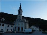
We drive to the parish church of St. Anton in Železniki, where we park on a marked asphalt parking lot between the church and the main road. The church is located a few 100 meters further from the company Domel, in the direction towards Zali Log.
Route description:
From the parking lot, we head towards the entrance to the church; slightly to the left of the church, we notice stairs by which there is a sign "Antonov vrtec". We climb the stairs, and at the top of the stairs we go right. We bypass the kindergarten and some houses on the left side, while we ascend along the cart track to a junction at the hunting observatory.
From the junction, we go right (left path along the cart track, by which it is also possible to reach Prtovč); a little further, we notice the next marking. On the hay meadow, the path completely disappears, but on a tree slightly higher we notice the next marking, from which we continue uphill, first along the edge of the forest, then through the forest, where a narrow path reappears, along which we quickly reach a somewhat wider path. There follows an ascent along the mentioned path, which ascends quite steeply through the forest. Higher up, the path levels out and leads us to a cart track, where it branches.
We continue left towards Prtovč (right Draboslovica) and continue along the cart track, which moderately ascends through the forest. A little further, we reach the ridge, along which we continue the ascent, following the markings at junctions. Higher up, the path levels out and a little further we reach the macadam road, which we follow to the left. While walking along the road, another path joins from the left along a cart track, but we continue the traverse. The road gradually leads onto the slopes of Štedel vrh (1145 m); shortly before its end, we leave it and continue slightly right onto the marked path. The path ahead also leads us across the slopes of the mentioned peak, but since it is little frequented and crosses some gullies and torrents and is poorly maintained, there is a risk of slipping on some steep sections. When the traverse ends, we step onto a cart track and, past an old hayloft, arrive at the point where the path from Jesenovec joins from the left. We continue straight ahead, where beneath the high-voltage power line route we reach the saddle between Pašk on the left and Štedel vrh on the right. From here, a nice view opens onto Ratitovec; we follow the cart track, which gently descends, all the way to the point where we join the asphalt road, along which in a few dozen steps we arrive at the church on Prtovč.

Photos:
 1
1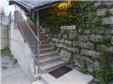 2
2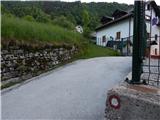 3
3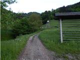 4
4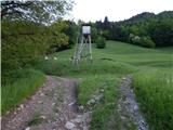 5
5 6
6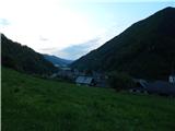 7
7 8
8 9
9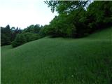 10
10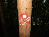 11
11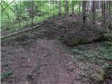 12
12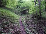 13
13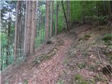 14
14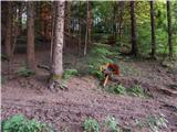 15
15 16
16 17
17 18
18 19
19 20
20 21
21 22
22 23
23 24
24 25
25 26
26 27
27 28
28 29
29 30
30 31
31 32
32 33
33 34
34 35
35 36
36 37
37 38
38 39
39 40
40 41
41
Discussion about the trip Železniki - Prtovč
|
| čomolungma14. 05. 2020 |
Nice, quiet and uncrowded. On a holiday Sunday met only one roe deer and a couple of birds  The path is quite steep in the first part, later it levels out. Very well marked. The path is quite steep in the first part, later it levels out. Very well marked.
|
|
|
To post a comment you must log in:
If you do not yet have a username, you must first
register.