Starting point: Želimlje (321 m)
| Latitude/Longitude: | 45,91510°N 14,57440°E |
| |
Walking time: 1 h 50 min
Difficulty: easy marked way
Elevation gain: 505 m
Elevation difference along the route: 535 m
Map:
Recommended equipment (summer):
Recommended equipment (winter): ice axe, crampons
Views: 9.621
 | 2 people like this post |
Access to starting point:
A) From Ljubljana or Grosuplje we drive to Škofljica, and from there we continue driving towards Kočevje. In the settlement Pijava Gorica signs for Želimlje point us to the right. When after a few kilometers we get to Želimlje, in some sort of triangular crossroads, in the middle of which is a chapel, we continue straight in the direction of Turjak. When a few 100 meters further on the right we notice an old quarry, and a few meters before the left turn also signposts for Kurešček, we are at the beginning of the described path. At the starting point, there aren't any appropriate parking spots.
B) First, we drive to Turjak, and there we go on the road which leads past the castle. Near the castle the road starts descending steeply and lower it brings us to a crossroad, where we continue right (left Ščurki, Četež pri Turjaku, Prazniki). Further, we drive along Želimeljščica, and then the valley widens and the road brings us into Želimlje. Through Želimlje we drive to the spot, where we notice signposts for Kurešček. At the starting point, there aren't any appropriate parking spots.
C) First, we drive to Ig, and from there we continue driving towards Škofljica. When a little before the end of Ig main road turns left, we continue straight on a somewhat narrower asphalt road which quickly brings us to Kremenica. Through the mentioned settlement we continue straight and also in a few smaller crossroads after the settlement we continue straight. Later we join the road which leads from Pijava Gorica towards Želimlje, and we follow it to the right. When after a few kilometers we get to Želimlje, in some sort of triangular crossroads, in the middle of which is a chapel, we continue straight in the direction of Turjak. When a few 100 meters further on the right we notice an old quarry, and a few meters before the left turn also signposts for Kurešček, we are at the beginning of the described path. At the starting point, there aren't any appropriate parking spots.
Route description:
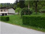
From the road signs for Kurešček point us to an at first almost unnoticeable footpath which ascends steeply by the hedge. When after a shorter steep ascent we step into the forest, the footpath becomes more distinct, and above the quarry turns left and quickly brings us to a cart track which we reach near the crossing.
We continue on an ascending cart track which turns slightly to the left, and then ascends diagonally. On the cart track, we ascend quite steeply mostly through the forest, only on one part a view opens up to the surrounding hills. Higher the cart track temporarily slightly descends, and we follow it to its end, from where temporarily again a view opens up.
From the end of the cart track, we continue straight on a marked path, which passes to steeper slopes. A little further, we also get help from steel cables (passage is undemanding, also in wet there is no significant danger, more caution is needed only if there is ice), which with a few breaks accompany us all the way until we get to a forested ridge, where a short unmarked footpath branches off to the left towards Stari grad, and to the right continues a marked path towards Kurešček.
At the mentioned crossing, we go right and continue the path by and later on the ridge, from which on a few spots a view opens up on the other side of Benšetov graben towards the church of St. Marjeta on Golem. A little further, the path from the ridge passes to the meadows of the nearby village Rogatec nad Želimljami, which we quite quickly also reach.
Before the first house we continue right, and then on the macadam road we quickly reach an asphalt road which we follow right in the direction of Kurešček. After the settlement the road returns into the forest and then leads us past a few individual houses of the neighbouring settlement Visoko. At two smaller crossroads we continue right, then a little higher we arrive at a somewhat larger crossroad, where we continue left in the direction of Kurešček.
From the crossroad we walk a few more minutes on the asphalt road, and then from the left turn we turn straight onto a footpath which starts ascending through the forest. Through the forest we follow the blazes, which bring us all the way to the Planinski dom na Kureščku.
We bypass the hut on the left side and immediately step onto an asphalt road (if we continue on the right side of the mountain hut we can ascend to the summit over a meadow on a somewhat shorter path). The road then leads us past the parking lot, behind it we start to lightly ascend a panoramic grassy slope. A little further, a path towards Turjak branches off to the left, and on the right turn before the cemetery the path from below Pirman or Turjak also joins us.
We continue on the road, from which immediately slightly to the right branches off the Way of the Cross. We can continue on the road, by which in approximately 3 minutes of further walking we arrive at the summit of Kurešček, or on the Way of the Cross. The latter path is a little longer, but does not run on the road.
Description and pictures refer to the condition in 2015 (May).

Photos:
 1
1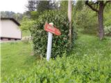 2
2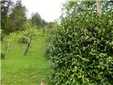 3
3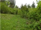 4
4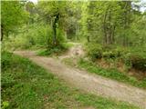 5
5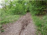 6
6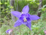 7
7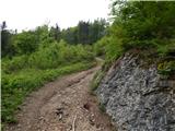 8
8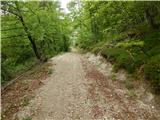 9
9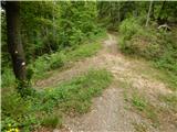 10
10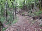 11
11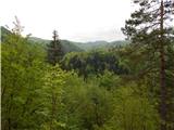 12
12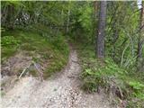 13
13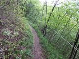 14
14 15
15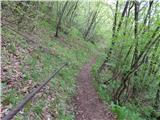 16
16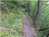 17
17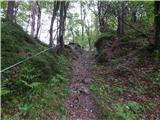 18
18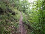 19
19 20
20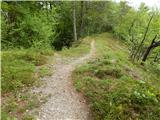 21
21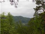 22
22 23
23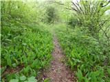 24
24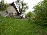 25
25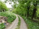 26
26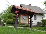 27
27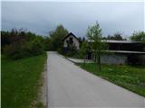 28
28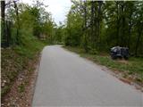 29
29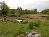 30
30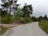 31
31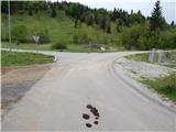 32
32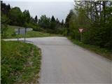 33
33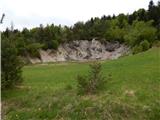 34
34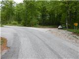 35
35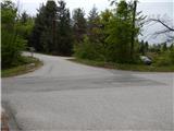 36
36 37
37 38
38 39
39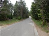 40
40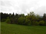 41
41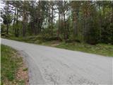 42
42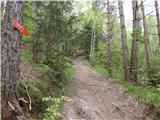 43
43 44
44 45
45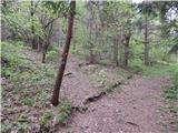 46
46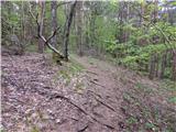 47
47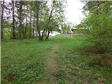 48
48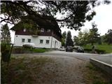 49
49 50
50 51
51 52
52 53
53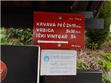 54
54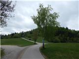 55
55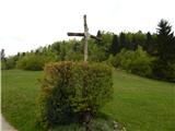 56
56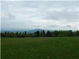 57
57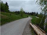 58
58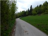 59
59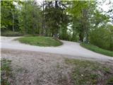 60
60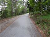 61
61 62
62
Discussion about the trip Želimlje - Kurešček
|
| KarmenT5. 03. 2018 |
Yesterday to Kurešček from Želimlje. Started at the parking lot by the church. Path snowy all the time. Track to Rogatec, then on bare asphalt, then along the pasture deep - sinking over the knees and finally on the sled track to the little church. Fog on top, no sun, but the path excellent nonetheless. Real winter atmosphere. On the path there's also a section with a steel cable that gives a bit of a mountaineering feel. We didn't meet anyone, only just below the top more sledders and a few walkers.
|
|
|
To post a comment you must log in:
If you do not yet have a username, you must first
register.