Želimlje - Sveta Marjeta on Golo (shortest path)
Starting point: Želimlje (320 m)
| Latitude/Longitude: | 45,92013°N 14,57260°E |
| |
Route name: shortest path
Walking time: 40 min
Difficulty: easy unmarked way
Elevation gain: 334 m
Elevation difference along the route: 334 m
Map: OpenTopoMap, OpenStreetMap
Recommended equipment (summer):
Recommended equipment (winter):
Views: 298
 | 1 person like this post |
Access to starting point:
We drive to Želimlje if we leave the road between Škofljica (the closest highway junctions are Ljubljana-jug and Šmarje-Sap) and Kočevje at the crossroad by the church in Pijava Gorica, where we turn right if driving from the Škofljica direction or left if driving from the Kočevje direction. From the mentioned crossroad, it is about 4 km of driving to Želimlje. From the Kočevje direction, we can also leave the main road in Turjak, where we turn left, drive past the castle, descend on a winding road into the valley, and then after about 5 km arrive in Želimlje from the southern direction. We can also drive to Želimlje from Ig via Kremenica, where at the crossroad about 3 km north of Želimlje we turn right and thus join the road from Pijava Gorica. In the village center of Želimlje, it is usually possible to park somewhere near the parish church or the gymnasium, where the starting point of the trail is also located.
Public transport: Želimlje is connected to Škofljica (where the closest railway station is located) by the integrated LPP bus line number 82, which ends next to the PGD not far from the church. The closest bus stop by the Škofljica - Kočevje road is called Smrjene, from where we descend directly to Želimlje about 140 elevation meters lower via a marked hiking path (towards Kurešček).
Route description:
The first part of the path coincides with the route of the European footpath E6 towards Klada, which is marked with red-yellow circles.
From the crossroad before the Želimlje church, we head south, but after just a few meters right before the basketball court or at the former telephone booth, which now serves as a Knjigobežnice book exchange station, we turn right towards the entrance to the branch primary school. Immediately after the school building, the asphalt ends, and we continue on a footpath that begins to ascend. Already after a few meters, when the forest on our right disappears, we turn right onto a sandy "scree" and continue on or alongside it. We soon reach an asphalt road that reaches us after a turn on the left, and we continue straight along it. At the left turn a little further ahead, the European footpath towards Klada branches off from the road, but we continue along the road into the left turn, relying solely on our own navigational skills from this point onward.
According to OTM and OSM, a footpath should branch off to the right a little further ahead from the road, but even a hawk’s eye somehow fails to find any suitable path at the expected spot. Therefore, we continue along the road a bit longer until the road emerges from the forest, turns right at a bend, and immediately after the bend we finally come across a path branching off to the right, which no map recognizes. Here we turn right, sticking to the right at forks to avoid heading straight into the steep slope ahead of us. Suddenly our path somehow "disappears," and we persist a little further straight (towards the north) on a poorly trodden "pathless" route until we finally cross a path that OTM and OSM recognize again.
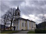
We turn left onto this path, which crosses a fairly steep slope. Unfortunately, in December 2023 this section was full of fallen trees, requiring considerable ingenuity to avoid them. After about 300 m of this section, which is crossed by at least two paths, we reach the forest edge, where on our right we will notice a small holiday cottage. We continue along the forest edge and soon reach a crossroad where the access to the mentioned cottage branches off from the asphalt road between Klada and (Dolenji) Golo. On the left, we will notice signs indicating that we are right at the border between the municipalities of Škofljica and Ig. At this crossroad, we cross the aforementioned asphalt road and continue straight on a forest path on the other side. This path first turns left, runs a few meters parallel to the asphalt road, then quickly turns right and finally "separates" from it. From here on, it may occasionally be necessary to avoid a fallen tree, but the walk becomes more pleasant. Along the path, we encounter a few more forks, but we never turn right. The path, which generally leads towards SE, will turn left at a certain bend and soon after leave the forest entirely. Here we can already see the church of St. Marjeta, and passing by the cemetery’s mortuary chapels we reach the parking lot in front of the church.
The description and pictures refer to the condition at the end of December 2023.

Photos:
 1
1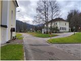 2
2 3
3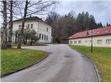 4
4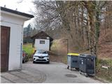 5
5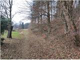 6
6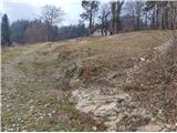 7
7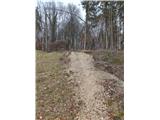 8
8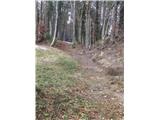 9
9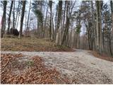 10
10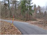 11
11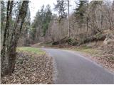 12
12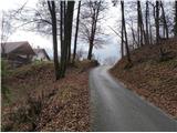 13
13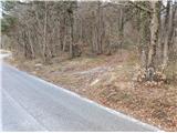 14
14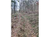 15
15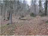 16
16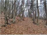 17
17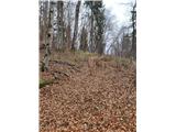 18
18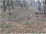 19
19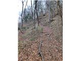 20
20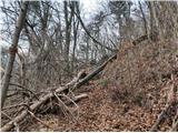 21
21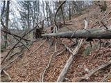 22
22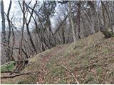 23
23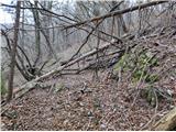 24
24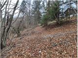 25
25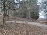 26
26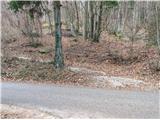 27
27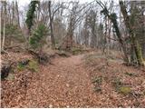 28
28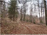 29
29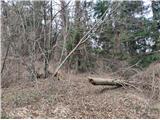 30
30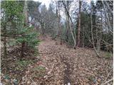 31
31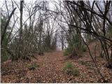 32
32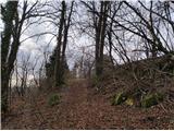 33
33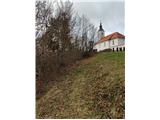 34
34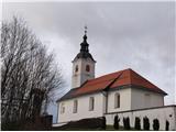 35
35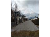 36
36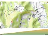 37
37
Discussion about the trip Želimlje - Sveta Marjeta on Golo (shortest path)
To post a comment you must log in:
If you do not yet have a username, you must first
register.