Sele / Zell-Pharre - Freiberg/Setiče
Starting point: Sele / Zell-Pharre (948 m)
| Latitude/Longitude: | 46,47180°N 14,38810°E |
| |
Walking time: 2 h 30 min
Difficulty: easy marked way
Elevation gain: 974 m
Elevation difference along the route: 974 m
Map: Karavanke - osrednji del 1:50.000
Recommended equipment (summer):
Recommended equipment (winter): ice axe, crampons
Views: 15.164
 | 2 people like this post |
Access to starting point:
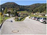
Through the Ljubelj border crossing we drive to Borovlje / Ferlach, where we turn right in the direction of the village Sele / Zell-Pharre. We follow the road, which mostly ascends further on, for about 10 km to the village Sele / Zell-Pharre, where we notice the signs for Setiče / Feiberg. Here we turn left and drive a few more meters to the parking lot by the road near the kindergarten.
Route description:
From the parking lot, we continue on the left road, which past the kindergarten and a few houses brings us to the chapel behind which the road ends. Further, we continue on a path, which gently ascends through a meadow and after a few minutes brings us to the edge of the forest, where we continue straight upwards between the meadow and the edge of the forest. On top of the meadow the path changes into a cart track and ascends above the stream, which we notice to the right below us. A little higher, the cart track crosses the stream and soon after that reaches the forest road. We follow the road only a short time because already after a few dozen meters left upwards through the clearing a footpath branches off. This path, which soon goes into the forest, we follow to the spot where we again join the road. When we cross the road we come to a junction, where we continue on the right path, in the direction of Setiče/Freiberg.
The path ahead on the right side bypasses a small cross by the path and then ascends on a wide vegetated ridge. The path ahead becomes steeper and eventually brings us to the hunting cottage, which we notice on the left side of the path. The steepness here decreases and the path brings us to the forest road, which we cross twice in a few meters. The path ahead again steeply ascends and then ascends through an ever thinner forest. The steepness then starts decreasing and the path brings us into a larch forest. A little further, the path brings us onto the unvegetated upper slopes of the mountain along which we ascend all the way to the top and which we reach after approximately 15 minutes of additional walking.

Photos:
 1
1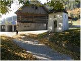 2
2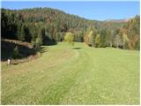 3
3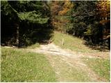 4
4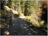 5
5 6
6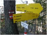 7
7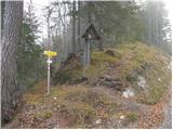 8
8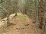 9
9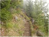 10
10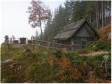 11
11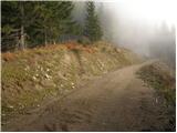 12
12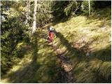 13
13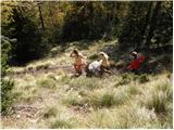 14
14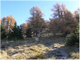 15
15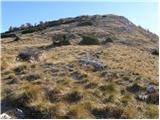 16
16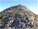 17
17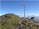 18
18
Discussion about the trip Sele / Zell-Pharre - Freiberg/Setiče
|
| jaz12. 10. 2008 |
Was there on Thursday, wonderful day, unique larches, no living soul anywhere. Lp!
|
|
|
|
| Biser gora24. 06. 2010 |
Very nice tour, with an even nicer view. I recommend!
|
|
|
|
| Majdag9. 05. 2011 |
...Setiče is an extraordinary mountain. All slopes are covered with forest, on the flat summit section, it's like in a fairy tale. Low grass, century-old larches, some low pines. The spacious summit invites us to rest and tempts with an excellent view. The northern side of the Košuta ridge is right there, Veliki and Mali Obir are right in front of us, we can also see the nearby Javornik and Mačno. The path itself is quite steep, but once you're at the top you're rewarded for all the effort, very nice, čav Majda
|
|
|
|
| Gorjan996. 06. 2012 |
Today we were on Setiče. Nice viewpoint, pity that the Košuta ridge was covered in clouds. Otherwise an exceptionally beautiful tour. Right from the start of the path a four-legged friend, a dog, joined us and accompanied us to the top and back.
Best, Gorjan
|
|
|
|
| Kriška3. 08. 2012 |
At the beginning of the trail, a change should be entered; namely, it is not permitted to go to the chapel at the farm, the path next to it is also closed with a ramp. Access is from the path across the meadow right next to the pasture fence, to the plot of the uninhabited house above the farm, where it is necessary to awkwardly cross the garden fence of that house twice, then it continues as described above.
At Užnikov križ, the fact that there are two crosses there might confuse someone - one to the right, the other to the left of the path (quite new, next to it there is a table and bench placed at a scenic spot). The trail naturally continues past the right (older) cross.
|
|
|
|
| ločanka17. 10. 2019 |
Wonderful hike, extraordinary summit. This is the highlight of the trip! Unmissable in these autumn colors!
After the trip, a loop around Reßnig lake, and the circle of beauties was complete.
|
|
|
|
| G Bend10. 01. 2025 20:23:13 |
I'm wondering how long it takes to hike to the hill considering there's snow up there now?
|
|
|
To post a comment you must log in:
If you do not yet have a username, you must first
register.