Žerjav - Uršlja gora (Plešivec)
Starting point: Žerjav (580 m)
| Latitude/Longitude: | 46,48190°N 14,89950°E |
| |
Walking time: 3 h 15 min
Difficulty: easy marked way
Elevation gain: 1119 m
Elevation difference along the route: 1119 m
Map: Kamniške in Savinjske Alpe 1:50.000
Recommended equipment (summer):
Recommended equipment (winter): ice axe, crampons
Views: 7.513
 | 3 people like this post |
Access to starting point:
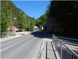
A) First, we drive to Šoštanj (from here from Velenje or the Savinja Valley), and then we continue driving towards Črna na Koroškem. Further on, the road starts to ascend towards the pass Spodnje Sleme (1081 m), which we reach after a few kilometers of winding road. This is followed by a descent through the valley of Javorski potok to Črna na Koroškem, where at the roundabout in the center of the settlement (roundabout in the middle of which there is a monument, near the bus station and the parish church of St. Ožbalt) we continue right in the direction of Žerjav. Further on, we drive past the mining museum and then through Mežiška Valley towards Žerjav. In Žerjav, past the TAB MPI factory and the Petrol gas station, we cross the bridge over the river Meža, but right after the bridge we continue right on a somewhat narrower asphalt road in the direction of Uršlja gora, Jazbina and Žerjav. The path ahead leads past a smaller Mercator store and a branch primary school, then barely noticeably ascends through the valley of Jazbinski potok. When the settlement Žerjav ends, we arrive at a junction, where we park in a suitable spot a few meters before the junction. From the junction, to the left the road continues towards Kristavčnik and the footpath towards Naravske ledine and Uršlja gora, straight ahead a worse cart track continues towards Jazbina, to the right the road to the Mrdavšič homestead.
B) First, we drive to Ravne na Koroškem (to here from Dravograd or Slovenj Gradec), then we continue driving in the direction of Mežica and Črna na Koroškem. When we arrive at the settlement Žerjav (Žerjav is a settlement between Mežica and Črna na Koroškem), just before the main road crosses the river Meža we continue left in the direction of Uršlja gora, Jazbina and Žerjav. The path ahead leads us past a smaller Mercator store and a branch primary school, then barely noticeably ascends through the valley of Jazbinski potok. When the settlement Žerjav ends, we arrive at a junction, where we park in a suitable spot a few meters before the junction. From the junction, to the left the road continues towards Kristavčnik and the footpath towards Naravske ledine and Uršlja gora, straight ahead a worse cart track continues towards Jazbina, to the right the road to the Mrdavšič homestead.
Route description:
From the starting point, we continue on the left road, which continues through the valley of Jazbinski potok. After the small bridge, the road loses its asphalt surface (May 2014), then we walk for about 15 minutes along the mentioned stream, where we arrive at a smaller junction. Signs for Naravske ledine and Uršlja gora direct us left onto a narrower macadam road, which begins to ascend somewhat more noticeably. Further on, the road leads us past the Krstavčnik homestead and also past a few smaller huts, then crosses the stream and behind it begins to ascend more steeply. In two hairpins, the road climbs quite high above the stream, then past the hunting observatory brings us to a marked junction, next to which there is also a table and two benches.
From the junction, we continue on the right marked path, which a few tens of meters further splits again into two parts. Again we continue slightly right (the branch-off is marked with an arrow on a tree), then ascend somewhat more steeply through the forest. A few minutes higher, we reach an interesting little ridge that leads us above two streams. The little ridge, which to the right is overgrown with forest and to the left crumbly descends towards the nearby stream, we soon leave, as the path turns somewhat to the right, where it ascends transversely through the forest. After a short traverse, we reach a small valley, then ascend along it to the edge of the forest, where there is a marked junction.
From the junction, we continue right (left Prežihova bajta, Ravne na Koroškem and Prevalje), then along the path that runs along the edge of a larger meadow, in 5 minutes we arrive at Koča na Naravskih ledinah.
At the hut, we step onto the road, along which we walk a few steps, then signs for Uršlja gora lead us right onto the meadow, across which we ascend moderately. At the upper edge of the meadow, we cross the road that leads from Naravske ledine towards Križan and the summit of Uršlja gora, and on the footpath we begin to ascend through the forest. After a few minutes of transverse ascent, the path levels out and approaches the road completely. At the place where we completely approach the road, in nice weather there are usually also some parked cars, but we continue left along the cart track, which a little further brings us out of the forest onto a somewhat larger meadow. Across the meadow, we follow the marked path, which higher takes us into the forest, where we continue the ascent along the wide path. From the path, which ascends transversely, temporarily some views open towards Peca, then from the left a relatively new or freshly churned track joins (May 2014). Along the relatively wide track, we ascend to the nearby holiday cottage, at which from the left also a marked path over Kozji hrbet joins.
We continue straight uphill along the wide and well-trodden path, from which somewhat higher some more views open, then the path gradually levels out and brings us into a less dense forest. At the part where the forest thins, we step onto a smaller junction, where we choose the left, somewhat steeper path that leads towards the summit of Uršlja gora (the right path bypasses the summit and leads directly to the church of St. Uršula and Dom na Uršlji gori). A short ascent follows through sparse forest, then the forest finally ends and with nice views we quickly reach the cross at the summit of Plešivec or. Uršlja gora.
From the summit, we can also walk in 5 minutes to the nearby church of St. Uršula and the mountain hut.
Žerjav - Koča na Naravskih ledinah 1:30, Koča na Naravskih ledinah - Uršlja gora 1:45.

Photos:
 1
1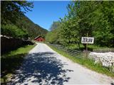 2
2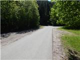 3
3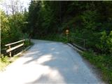 4
4 5
5 6
6 7
7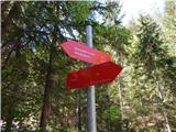 8
8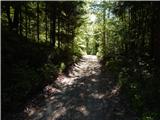 9
9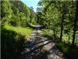 10
10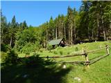 11
11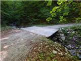 12
12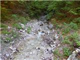 13
13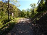 14
14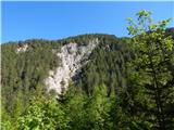 15
15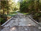 16
16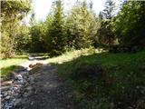 17
17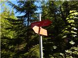 18
18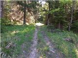 19
19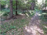 20
20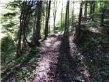 21
21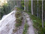 22
22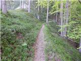 23
23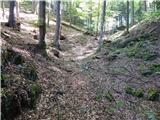 24
24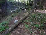 25
25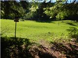 26
26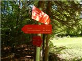 27
27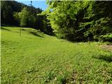 28
28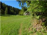 29
29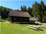 30
30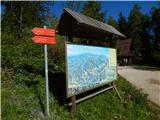 31
31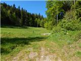 32
32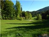 33
33 34
34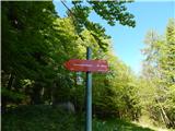 35
35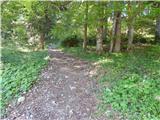 36
36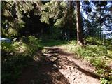 37
37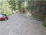 38
38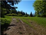 39
39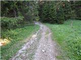 40
40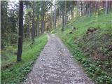 41
41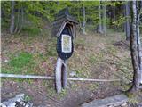 42
42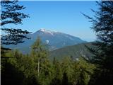 43
43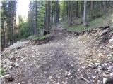 44
44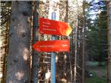 45
45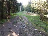 46
46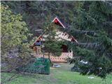 47
47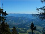 48
48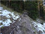 49
49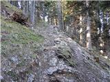 50
50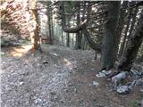 51
51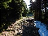 52
52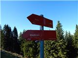 53
53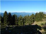 54
54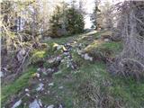 55
55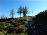 56
56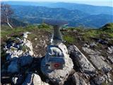 57
57 58
58 59
59
Discussion about the trip Žerjav - Uršlja gora (Plešivec)
To post a comment you must log in:
If you do not yet have a username, you must first
register.