Zgornja Besnica (Nova vas) - Rovnik (west path)
Starting point: Zgornja Besnica (Nova vas) (468 m)
| Latitude/Longitude: | 46,26970°N 14,26590°E |
| |
Route name: west path
Walking time: 40 min
Difficulty: easy unmarked way
Elevation gain: 239 m
Elevation difference along the route: 239 m
Map: Škofjeloško in Cerkljansko hribovje 1:50.000
Recommended equipment (summer):
Recommended equipment (winter):
Views: 4.368
 | 1 person like this post |
Access to starting point:
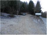
A) From Ljubljana, we drive on the old road towards Kranj, and there we stick to the main road, and we follow it to the bridge over the river Sava. Just before the bridge we leave the main road and continue driving straight in the direction of Besnica. Further, we drive through Rakovica and Spodnja Besnica to Zgornja Besnica, where at the sign for the end of Zgornja Besnica, we park in an appropriate place by numerous signposts.
B) From Jesenice or Bled, we drive on the highway towards Ljubljana, and we follow it to the exit Kranj - west. We continue driving on the old regional road towards Ljubljana, and we drive on it to Kranj, where immediately after the bridge over the river Sava we turn right in the direction of Besnica. Further, we drive through Rakovica and Spodnja Besnica to Zgornja Besnica, where at the sign for the end of Zgornja Besnica, we park in an appropriate place by numerous signposts.
C) To the starting point, we can also come from the direction of Železniki, namely if we drive through the villages Rudno and Dražgoše towards Kranj. When we arrive in Zgornja Besnica, we park in an appropriate place by the sign Zgornja Besnica.
Route description:
From the starting point, we go on a wide cart track which starts ascending diagonally towards the west. A moderately steep cart track which ascends through the forest, a little higher turns to the left and splits into two parts. We continue on the left wider cart track which further ascends through an indistinct valley. When the relatively wide cart track turns even more to the left, we leave it and continue the ascent a little to the right on a worse and also much steeper cart track. Higher up, a few less noticeable paths join the cart track, and we continue straight and on the cart track, which in the meantime has already changed into an easy-to-follow footpath, we ascend to a panoramic clearing.
From the clearing, from which a nice view opens up on the Karawanks and Kamnik Savinja Alps, the path returns into the forest and after 3 minutes of additional walking brings us to the forested peak Rovnik.
Photos:
 1
1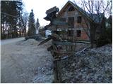 2
2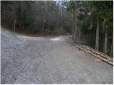 3
3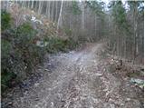 4
4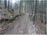 5
5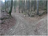 6
6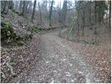 7
7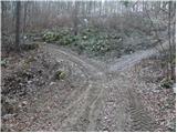 8
8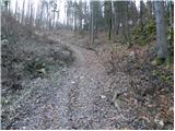 9
9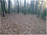 10
10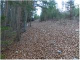 11
11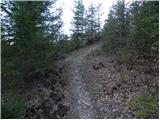 12
12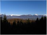 13
13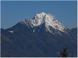 14
14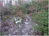 15
15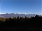 16
16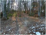 17
17 18
18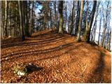 19
19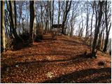 20
20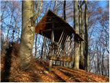 21
21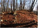 22
22 23
23
Discussion about the trip Zgornja Besnica (Nova vas) - Rovnik (west path)
To post a comment you must log in:
If you do not yet have a username, you must first
register.