Zgornja Besnica (Nova vas) - Šum waterfall
Starting point: Zgornja Besnica (Nova vas) (468 m)
| Latitude/Longitude: | 46,26970°N 14,26590°E |
| |
Walking time: 15 min
Difficulty: easy marked way
Elevation gain: -43 m
Elevation difference along the route: -43 m
Map: Škofjeloško in Cerkljansko hribovje 1:50.000
Recommended equipment (summer):
Recommended equipment (winter): crampons
Views: 24.797
 | 4 people like this post |
Access to starting point:
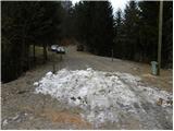
A) From Ljubljana, we drive on the old road towards Kranj, and there we stick to the main road, which we follow to the bridge over the Sava River. Just before the bridge we leave the main road and continue driving straight in the direction of Besnica. Further, we drive through Rakovica and Spodnja Besnica to Zgornja Besnica, where at the sign for the end of Zgornja Besnica, we park at a suitable place by numerous signposts.
B) From Jesenice or Bled, we drive on the highway towards Ljubljana, which we follow to the exit Kranj - west. We continue driving on the old regional road towards Ljubljana and drive along it to Kranj, where immediately after the bridge over the Sava River we turn right in the direction of Besnica. Further, we drive through Rakovica and Spodnja Besnica to Zgornja Besnica, where at the sign for the end of Zgornja Besnica, we park at a suitable place by numerous signposts.
C) To the starting point we can also arrive from the direction of Železniki, namely if we drive through the villages Rudno and Dražgoše towards Kranj. When we arrive in Zgornja Besnica, we park at a suitable place by the sign Zgornja Besnica.
Route description:
From the starting point, we walk along the main road to the hamlet Nova vas (direction Kranj), where signs for Slap Šum direct us sharply left (from direction Kranj right). We continue on the descending asphalt road, which past bar Jawa brings us to the place where the asphalt ends. From here we continue on a wide cart track for another good 10 m, then signs for Slap Šum direct us sharply left onto a well-maintained path. The path ahead first gently descends to the information board, then turns left into the forest, bringing us above the waterfall. From here we follow the well-secured path, descending below the waterfall in a few minutes.
Photos:
 1
1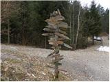 2
2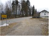 3
3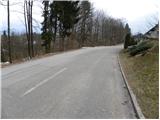 4
4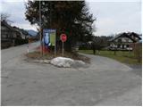 5
5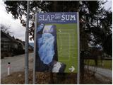 6
6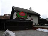 7
7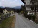 8
8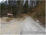 9
9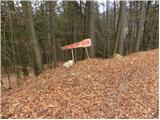 10
10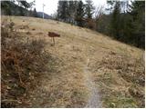 11
11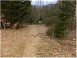 12
12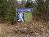 13
13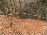 14
14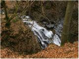 15
15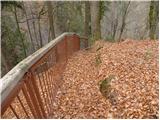 16
16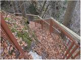 17
17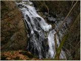 18
18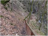 19
19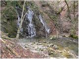 20
20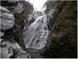 21
21 22
22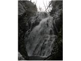 23
23
Discussion about the trip Zgornja Besnica (Nova vas) - Šum waterfall
|
| Skelo20. 10. 2017 |
The worst marked and unkempt path I've ever hiked...
|
|
|
|
| hikingman21. 10. 2017 |
I was there in spring, and it was really nice.
|
|
|
|
| heinz2. 04. 2018 |
Very well marked and excellently secured, well-maintained path. The waterfall is worth seeing.
|
|
|
To post a comment you must log in:
If you do not yet have a username, you must first
register.