Zgornja Besnica (Podrovnik) - Sveti Mohor (Zabrekve)
Starting point: Zgornja Besnica (Podrovnik) (446 m)
| Latitude/Longitude: | 46,25500°N 14,26740°E |
| |
Walking time: 1 h 45 min
Difficulty: easy marked way
Elevation gain: 506 m
Elevation difference along the route: 540 m
Map: Škofjeloško in Cerkljansko hribovje 1:50.000
Recommended equipment (summer):
Recommended equipment (winter):
Views: 10.820
 | 1 person like this post |
Access to starting point:
A) From Ljubljana, we drive on the old road towards Kranj, where we stick to the main road, which we follow to the bridge over the Sava River. Just before the bridge, we leave the main road and continue straight towards Besnica. Further on, we drive through the villages of Rakovica and Spodnja Besnica, following the road to Zgornja Besnica, where signs for the hamlet of Podrovnik direct us left. We continue through the mentioned hamlet, where at a small junction we bear left slightly downhill. The road continues along the Besnica stream, and we drive along it for approximately another 100 m beyond the sign "Gozdna cesta uporaba na lastno odgovornost" (forest road - use at your own risk) before parking in a suitable spot by a small junction.
B) From Jesenice or Bled, we drive on the motorway towards Ljubljana, following it to the Kranj - west exit. We continue on the old regional road towards Ljubljana to Kranj, where immediately after the bridge over the Sava River we turn right towards Besnica. Further on, we drive through the villages of Rakovica and Spodnja Besnica, following the road to Zgornja Besnica, where signs for the hamlet of Podrovnik direct us left. We continue through the mentioned hamlet, where at a small junction we bear left slightly downhill. The road continues along the Besnica stream, and we drive along it for approximately another 100 m beyond the sign "Gozdna cesta uporaba na lastno odgovornost" (forest road - use at your own risk) before parking in a suitable spot by a small junction.
Route description:
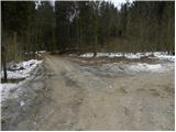
From the starting point, we continue on the left road, which quickly brings us to a small fork. We continue straight (left across the stream by the columnar spruce - the columnar spruce is similar to a cypress, and in Slovenia there are 4 such spruces) along the road, which after a few minutes leads over a small bridge, after which we leave the road and continue the ascent left on the marked path. The path ahead ascends moderately, then quickly levels out and leads us along a gentle cart track. The marked path returns to the road right at its end, where we notice a quite old signpost inscribed "Mohor", which directs us onto a wide ascending cart track. The cart track continues ascending beside the stream for a while longer, then leaves it and brings us partly through the forest, partly over short panoramic slopes to the main ridge of the mountains rising south of Zgornja Besnica. Here we reach a junction of mountain paths, and we continue right (left to Špičasti hrib and Sveti Jošt), where after a few steps of further walking we step onto a macadam road. We follow the road right and slightly uphill, and it quickly takes us out of the forest onto a panoramic grassy ridge. The road then returns into the forest, where it first descends slightly, then brings us in a gentle ascent to the chapel at the hamlet Bezovnica. Here the road descends to the houses there, where we notice signs for Sveti Mohor directing us slightly left. We walk through the yard of a farm outbuilding, then continue on the marked mountain path, which first ascends through a belt of forest, then levels out temporarily and brings us out of the forest, where after a few steps it joins the path from the villages Nemilje and Podblica.
Here we continue straight and after less than 5 minutes of further walking arrive at the summit with the church of St. Mohor.

Photos:
 1
1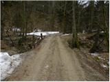 2
2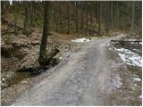 3
3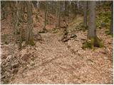 4
4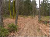 5
5 6
6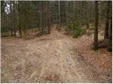 7
7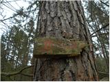 8
8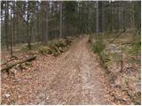 9
9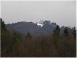 10
10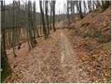 11
11 12
12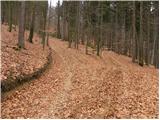 13
13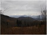 14
14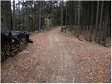 15
15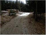 16
16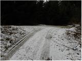 17
17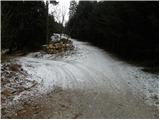 18
18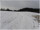 19
19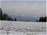 20
20 21
21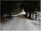 22
22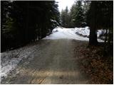 23
23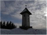 24
24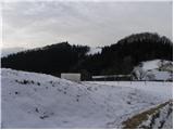 25
25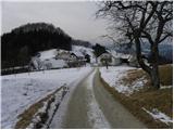 26
26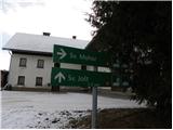 27
27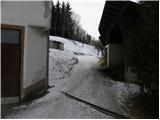 28
28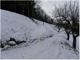 29
29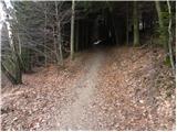 30
30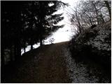 31
31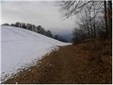 32
32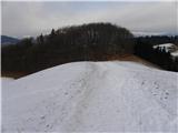 33
33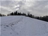 34
34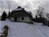 35
35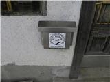 36
36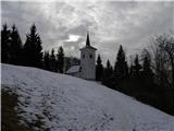 37
37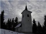 38
38 39
39
Discussion about the trip Zgornja Besnica (Podrovnik) - Sveti Mohor (Zabrekve)
|
| katty30. 01. 2012 |
For quite some time the thought has been buzzing towards Mohor . Well, today I headed there . Well, today I headed there . Started quite late, but it was fine anyway, even though I returned to the valley by headlamp light. At the top, a really nice view opens up to Ratitovec, the smoking Stari vrh, the entire Košuta ridge and of course Ksa with Kočna and Grintovec in the lead . Started quite late, but it was fine anyway, even though I returned to the valley by headlamp light. At the top, a really nice view opens up to Ratitovec, the smoking Stari vrh, the entire Košuta ridge and of course Ksa with Kočna and Grintovec in the lead . The stamp is located at one of the farmhouses in the village of Bezovnica. Otherwise, this walk is also suitable for young families, as the path winds nicely through the forest, and every now and then nice views open up to Kranj and the peaks above it. I recommend it. Oh, and now there are also a nativity scene by the church, just like the one in the picture here. . The stamp is located at one of the farmhouses in the village of Bezovnica. Otherwise, this walk is also suitable for young families, as the path winds nicely through the forest, and every now and then nice views open up to Kranj and the peaks above it. I recommend it. Oh, and now there are also a nativity scene by the church, just like the one in the picture here.
Safe travels in the mountains.
|
|
|
|
| katty30. 01. 2012 |
Oh, and one more thing... at the beginning there is a bit of a problem with the markings---they are in pretty bad condition , that picture 8 still holds true. So it would be nice if one of the mountaineering clubs would make an effort and renew these markings , that picture 8 still holds true. So it would be nice if one of the mountaineering clubs would make an effort and renew these markings  . .
|
|
|
|
| babica 520. 03. 2021 |
On Thursday I hiked this trail, and I'd correct part of the description: ...When we reach the scenic grassy ridge (picture 19), at the road junction we turn right. The road soon enters the forest, climbs for quite a while, but to the chapel we already descend a little bit. Otherwise, I really recommend this walk.
|
|
|
To post a comment you must log in:
If you do not yet have a username, you must first
register.