Zgornja Rečica (cerkev bl. Antona Martina Slomška) - Malič
Starting point: Zgornja Rečica (cerkev bl. Antona Martina Slomška) (365 m)
| Latitude/Longitude: | 46,17004°N 15,15818°E |
| |
Walking time: 2 h 20 min
Difficulty: easy marked way
Elevation gain: 571 m
Elevation difference along the route: 605 m
Map:
Recommended equipment (summer):
Recommended equipment (winter): ice axe, crampons
Views: 138
 | 1 person like this post |
Access to starting point:
We drive into Laško, and then at the traffic-light crossroads we drive in the direction of Spodnja Rečica. Further on, Laško ends, and we arrive in Spodnja Rečica, and later also in Zgornja Rečica, where we drive to the parking lot by the cemetery below the church of Blessed Anton Martin Slomšek.
Route description:
On the road by which we came to the starting point, we return a few minutes back, then we turn onto a side road by which there are signs for Šmohor. For a few minutes we ascend on the grassy part, then the road passes into the forest, where at a few crossroads we follow the blazes. We leave the asphalt road slightly below the farm Brezovar, where we turn right, then we ascend to the mentioned farm, where we continue through the yard; above the farm, the path passes into the forest and continues on a cart track. The cart track first ascends diagonally towards the right, then flattens and crosses some smaller springs, where the path becomes gradually more overgrown; a little further, it leaves the cart track and turns left onto a footpath by which the blazes continue, and for a few minutes it becomes entirely overgrown with tall grass, young bushes, and partly with blackberries.
We traverse the overgrown part in a diagonal ascent towards the right; the path becomes easier to pass when we reach a forested cart track, on which we continue to a meadow near the homestead Štitnikar, where we turn left towards the signs for Šmohor. The path ahead leads us on a cart track that returns to the forest; at the first crossing, we go right, at the second straight, then the signs for Šmohor direct us to the right, initially slightly downwards onto a cart track that continues without significant changes in altitude, crossing the slopes towards the right. In the last part of the crossing, we walk on grassy terrain, and the farm which we reach in a few minutes we bypass on the lower right side.
At the farm, we also reach the road, to which a little further a path from the starting point in Spodnja Rečica joins from the right.
From the crossroad, i.e., fork we continue right in the direction of Laško and Malič (left Dom na Šmohorju 2 minutes, sharply left church of St. Mohor) on the path which crosses a larger meadow, in the middle of which stands a house. We bypass the house, and on the other side of the meadow the path quickly brings us to the next crossroad, where the path to Liboje branches off to the left, and to Laško to the right.
Here we continue straight in the direction of the summit Malič, the path then enters the forest and ascends parallel with the road. With some ascents and descents, the path brings us to a paragliding takeoff point, where some views open up. Further, the path ascends steeply and quickly brings us to the summit along the forest-covered western ridge of Malič.
Zgornja Rečica - Dom na Šmohorju 1:40, Dom na Šmohorju - Malič 0:40.

Photos:
 1
1 2
2 3
3 4
4 5
5 6
6 7
7 8
8 9
9 10
10 11
11 12
12 13
13 14
14 15
15 16
16 17
17 18
18 19
19 20
20 21
21 22
22 23
23 24
24 25
25 26
26 27
27 28
28 29
29 30
30 31
31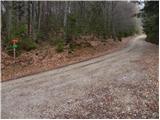 32
32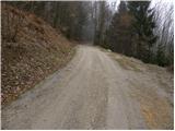 33
33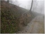 34
34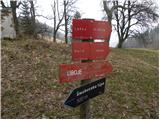 35
35 36
36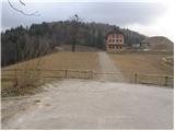 37
37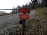 38
38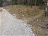 39
39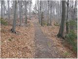 40
40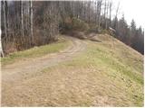 41
41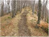 42
42 43
43
Discussion about the trip Zgornja Rečica (cerkev bl. Antona Martina Slomška) - Malič
To post a comment you must log in:
If you do not yet have a username, you must first
register.