Zgornje Danje - Altemaver (Ratitovec)
Starting point: Zgornje Danje (1070 m)
| Latitude/Longitude: | 46,23560°N 14,04930°E |
| |
Walking time: 1 h 45 min
Difficulty: easy marked way
Elevation gain: 608 m
Elevation difference along the route: 630 m
Map: Škofjeloško in Cerkljansko hribovje 1:50.000
Recommended equipment (summer):
Recommended equipment (winter): ice axe, crampons
Views: 24.702
 | 1 person like this post |
Access to starting point:
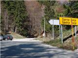
A) From upper Gorenjska we first drive to Bohinjska Bistrica, then continue driving towards Soriška planina. From Soriška planina we start descending towards Sorica, and at the beginning of the village we turn left towards Zgornje Danje. When we arrive in Zgornje Danje, at the crossroads before the houses we turn left uphill onto a somewhat steeper rougher macadam road, beside which after 100 m we park.
B) From central Slovenia we first drive to Škofja Loka, then continue driving towards Železniki and then to Soriška planina. At the end of Sorica village we turn right towards Zgornje Danje. Further we drive on the road which traverses the slopes towards the right, then just before the houses in Zgornje Danje we turn left onto a rough macadam road, beside which after 100 m we park.
C) From Primorska we first drive to Most na Soči or Bača pri Modreju, then continue driving towards Podbrdo and further towards Soriška planina. At the end of Sorica village we turn right towards Zgornje Danje. Further we drive on the road which traverses the slopes towards the right, then just before the houses in Zgornje Danje we turn left onto a rough macadam road, beside which after 100 m we park.
Route description:
From the road beside which we have parked we continue right and continue the path on a wide stony cart track, which we follow only to the nearby wooden shack. Here we will notice on the left side the beginning of the marked path which leads to Ratitovec.
The path first ascends through the forest, then crosses a relatively new clearing, where we also cross a cart track. At this spot due to fallen trees there are no marks, so orientation on this part is somewhat harder, but if we find the trail which continues in the same direction, we have no major problems. The path further for some time returns to the forest, then flattens and brings us to a larger meadow (mountain pasture Spodnji Jirn). On the other side of the meadow, at the watering place for animals the path turns slightly to the left and then right into the forest. The path further brings us to a poorer cart track, along which we walk only briefly, since then poorly visible marks direct us left onto the mountain path, along which through the forest we follow to a relatively new wooden log cabin.
From the log cabin, where we also step out of the forest, we continue in the same direction and continue the ascent on a poorly visible path, which ascends transversely slightly towards the right. The increasingly scenic path, from which beautiful views open up on Blegoš, Črni vrh and Porezen, brings us higher to an old military bunker, where we can rest or make a nice panoramic photo. From the bunker we continue for a few more minutes on a poorly trodden path, then join the path Soriška planina - Krekova koča.
Here we continue right and follow the path, which rises slightly and descends again a few times, to a marked junction, where the path to Altemaver branches off to the right.
We continue in the mentioned direction (slightly left Koča na Ratitovcu) and after 5 minutes of ascent we arrive at the panoramic summit.

Along the route: Spodnji Jirn (1334m)
Photos:
 1
1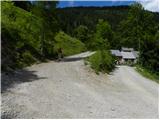 2
2 3
3 4
4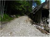 5
5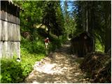 6
6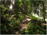 7
7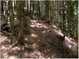 8
8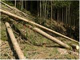 9
9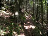 10
10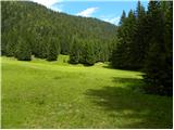 11
11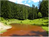 12
12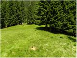 13
13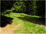 14
14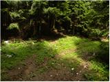 15
15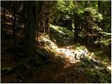 16
16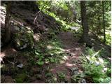 17
17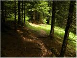 18
18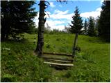 19
19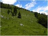 20
20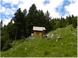 21
21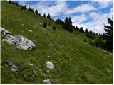 22
22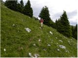 23
23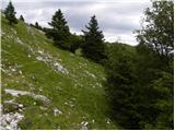 24
24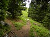 25
25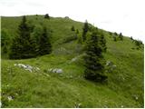 26
26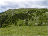 27
27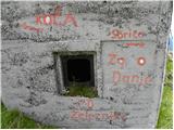 28
28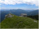 29
29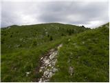 30
30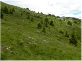 31
31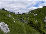 32
32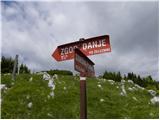 33
33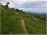 34
34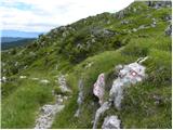 35
35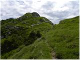 36
36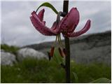 37
37 38
38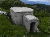 39
39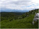 40
40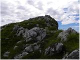 41
41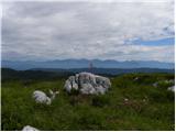 42
42 43
43
Discussion about the trip Zgornje Danje - Altemaver (Ratitovec)
|
| katty29. 01. 2013 |
On Saturday, the 26th of this month, we set off on this path. The path is not demanding otherwise, but in winter conditions it is quite long and strenuous... Up to the ridge we snowshoed in virgin snow, further on the ridge was trodden and ski-toured lengthwise and crosswise. The tour is fairytale-like in winter time, and in flowering season probably full of various plants, so we will return here.
|
|
|
|
| ločanka11. 12. 2016 |
Today along this path in an extended variant, namely from Prtovča via Poden, then along the road through all the sub-Ratitovec villages on this path, namely through Torka, Zabrdo, to Zgornje Danje, where the described path begins. A nice trip is already just the walk along the road, from which you can admire the views of the steep walls of Ratitovec, the real beauties you enjoy after coming out of the forest, because at that time you gently ascend along a narrow path among yellow grasses, on the ridge you can just stare at the beauties as today, when the Julijci were in white dress, the rest of the world also fairy-tale beautiful. To me, the path was much nicer than it looks from these photos. Altemaver is awesome anyway!
|
|
|
|
| gasssa24. 03. 2019 |
Sun all along the path except at the beginning through the forest. Still a little snow in places. Very pleasant path.
|
|
|
|
| miratan12. 01. 2021 |
Hello,
since I don't know the Škofja Loka-Cerkno hills, I'm interested in the conditions from Zgornje Danje to Ratitovec (avalanche danger?). We would go this weekend.
Thanks
|
|
|
|
| andraja12. 01. 2021 |
This trail is usually not used in snow, and now there is avalanche danger due to steep grassy slopes.
|
|
|
|
| MiaB.17. 03. 2021 |
Which is the best trail if coming from Primorska to Ratitovec and Krekova hut? Thanks.
|
|
|
|
| mirank17. 03. 2021 |
I also come from Primorska-Goriška and except twice always chose the longest - that's from Soriške peči. What you mean by best is very relative; this one from Zg Dajn is medium length, all are nice.
Those from Prtovča are a bit more distant for us, about roads around there I wouldn't
|
|
|
|
| MiaB.17. 03. 2021 |
Thanks... yes, I meant as best, since coming from Gorice, first from Goriška end to stop and park. I assume Zg.Danje or Torka...for now...in spring also from Soriske peči 
|
|
|
|
| Lop11. 02. 2023 21:53:20 |
Good evening. Avalanche danger? Crampons needed?
|
|
|
To post a comment you must log in:
If you do not yet have a username, you must first
register.