Zgornje Danje - Krekova koča na Ratitovcu
Starting point: Zgornje Danje (1070 m)
| Latitude/Longitude: | 46,23560°N 14,04930°E |
| |
Walking time: 2 h
Difficulty: easy marked way
Elevation gain: 572 m
Elevation difference along the route: 650 m
Map: Škofjeloško in Cerkljansko hribovje 1:50.000
Recommended equipment (summer):
Recommended equipment (winter): ice axe, crampons
Views: 35.028
 | 2 people like this post |
Access to starting point:
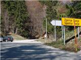
A) From upper Gorenjska we first drive to Bohinjska Bistrica, then we continue driving towards Soriška planina. From Soriška planina we begin to descend towards Sorica, and we at the beginning of the village turn left in the direction of Zgornje Danje. When we arrive in Zgornje Danje, at the crossroads before the houses we turn left uphill onto a somewhat steeper poorer macadam road, beside which we then park after 100 m.
B) From central Slovenia we first drive to Škofja Loka, then we continue driving towards Železniki and then to Soriška planina. At the end of the village Sorica we turn right in the direction of Zgornje Danje. Further we drive on the road which crosses the slopes to the right, then just before the houses in Zgornje Danje we turn left onto a poorer macadam road, beside which after 100 m we park.
C) From Primorska we first drive to Most na Soči or Bača pri Modreju, then we continue driving towards Podbrdo and further towards Soriška planina. At the end of the village Sorica we turn right in the direction of Zgornje Danje. Further we drive on the road which crosses the slopes to the right, then just before the houses in Zgornje Danje we turn left onto a poorer macadam road, beside which after 100 m we park.
Route description:
From the road beside which we have parked we continue right and continue the path on a wide stony cart track, which we follow only to the nearby wooden shack. Here we will notice on the left side the beginning of the marked path which leads to Ratitovec.
The path first ascends through the forest, then crosses a relatively new clearing, where we also cross a cart track. At this spot because of fallen trees there are no marks, so orientation on this part is somewhat harder, but if we find the trail which continues in the same direction, we have no bigger problems. The path further for some time returns into the forest, then flattens and brings us to a larger meadow (planina Spodnji Jirn). On the other side of the meadow, by the watering place for animals the path turns slightly to the left and then right into the forest. The path further brings us to a poorer cart track, on which we walk only a short time, since then poorly visible marks direct us left onto the mountain path, through the forest to a relatively new wooden log cabin.
From the log cabin, where we also step out of the forest, we continue in the same direction and continue the ascent on a poorly visible path, which ascends transversely slightly towards the right. The increasingly scenic path, from which beautiful views open up on Blegoš, Črni vrh and Porezen, brings us higher to an old military bunker, where we can rest or make a nice panoramic photo. From the bunker we continue a few minutes on a poorly trodden path, then we join the path Soriška planina - Krekova koča.
Here we continue right and follow the path, which slightly ascends and descends a few times, to a marked junction, where the path to Altemaver branches off to the right. Here we can continue right over the summit, or left on the path which bypasses the summit. On the other side of the summit the paths join again, then we begin to descend towards the watering place for animals, which is located on a smaller saddle below Gladki vrh. From the saddle only a short gentle ascent follows and the path past the winter bivouac quickly brings us to Krekova koča na Ratitovcu.

Along the route: Kremant (1658m), Altemaver (1678m)
Photos:
 1
1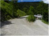 2
2 3
3 4
4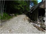 5
5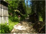 6
6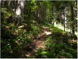 7
7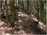 8
8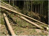 9
9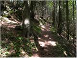 10
10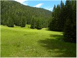 11
11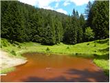 12
12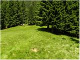 13
13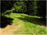 14
14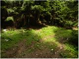 15
15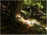 16
16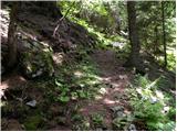 17
17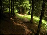 18
18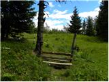 19
19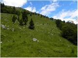 20
20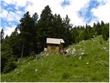 21
21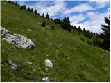 22
22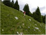 23
23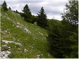 24
24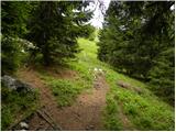 25
25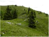 26
26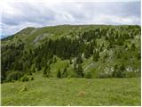 27
27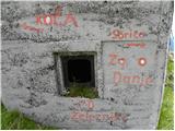 28
28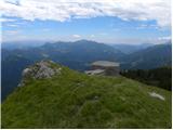 29
29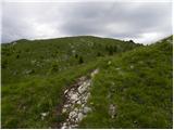 30
30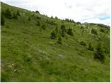 31
31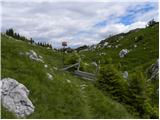 32
32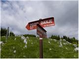 33
33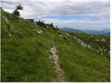 34
34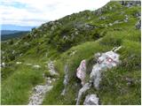 35
35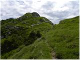 36
36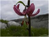 37
37 38
38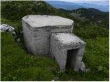 39
39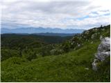 40
40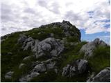 41
41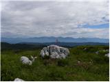 42
42 43
43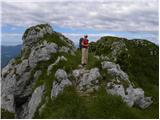 44
44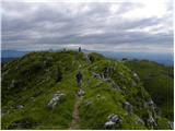 45
45 46
46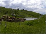 47
47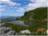 48
48 49
49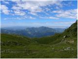 50
50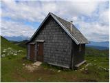 51
51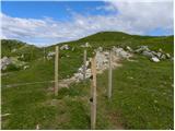 52
52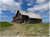 53
53
Discussion about the trip Zgornje Danje - Krekova koča na Ratitovcu
|
| tonej19. 02. 2008 |
16.2. At the beginning the path is partially icy and not trodden so snowshoes are recommended when crossing the clearings and also on the road where there is windblown snow. From the hunting hut at pic.5 we broke trail up to the edge of Kremant. At the top there are icy patches, towards Altemavr and the hut on R. there were several tracks in the snow. On the way back we descended the lower path and followed the ski tracks
to the hunting hut. There is very little snow on the southern slopes.
Tone
|
|
|
|
| tom6666. 01. 2009 |
On 3.1.09 we went with a friend. Quite a lot of snow and still poorly trodden, partly crusty, so quite strenuous. (Now it's surely much better). Windy on the ridge, visibility poorer. Tomaž
|
|
|
|
| mirobori5. 07. 2009 |
Yesterday with Olga went on this path. Before the clearing fresh bear tracks. Otherwise the path was quite wet, after the hunting hut we got a short shower. On the ridge of course full of flowers...
|
|
|
|
| akvarij23. 08. 2010 |
We were there the day before yesterday. The path from Zgornje Danje is really somewhat poorly marked (and little visited). Since we missed one marker and I strictly (and foolishly  ) followed the instructions here to keep right, we strayed a bit, but.. it all worked out; I had a good map and of course female intuition. We emerged at the hunting hut, just from the other side than expected. ) followed the instructions here to keep right, we strayed a bit, but.. it all worked out; I had a good map and of course female intuition. We emerged at the hunting hut, just from the other side than expected.
Regardless; a very very nice hike. The kids were excited. On Kremant we saw (some for the first time in life) edelweiss!
|
|
|
|
| matjaž4423. 08. 2010 |
Were there yesterday. To hunting hut no problem on "main road" (right after clearing take left, slightly less "main"), from hut on follow nose with eyes on Altemaver. Path loses itself several times, find another, repeats (what can you do, sheep), but can't miss. Being less visited is a plus. Definitely nicer path than from Prtovč. And correction: elevation gain 540 m, as Zgornje Danje altitude is around 1100 m.
|
|
|
|
| jani1426. 08. 2010 |
I was there too on 22.8. The path does get lost here and there a bit, but if you roughly imagine where you're going, you find it. It would be really nice if there were some more markers or signs in between.
|
|
|
|
| Hribolazec818. 07. 2017 |
Today I was up there, I couldn't find the starting point anywhere, so I followed the instructions exactly.
Otherwise I went by another path, reached the top in 45 min of very fast walking, at the top the most beautiful views, beautiful nature, paradise under the sky, I would praise only the hut – super offer, friendly 
|
|
|
|
| GregorC8. 07. 2017 |
The starting point is also described somewhat vaguely. Best to leave the car in or in front of Zgornje Danje at a suitable spot. In this case the start of the path is marked between the houses. No need to drive on poor tracks.
|
|
|
|
| miratan22. 03. 2019 |
Greetings,
yesterday at Krekova koča, start Zgornje Danje. Nice trip, sunny, we didn't have to break much trail, at the top even a bit frozen. We returned via the other side to the hamlet Torka.
|
|
|
|
| peteru31. 03. 2019 |
Yesterday wonderful trip in beautiful weather. Through the forest partly still snowy, sunny parts of the ridges mostly dry. Beautiful views all around. Recommended!
|
|
|
|
| georgia14. 07. 2019 |
We both followed the path without problems, it's trodden, just need to keep an eye on the markings all the time. Especially right at the beginning, when the path turns left steeply uphill from the forest road. We noticed it just in time. The path direction is always the same. You can park nicely in front of the village by the road and from there the junction is immediately marked, no need to go between the houses. Lots of flowers and views on the ridge... Enjoy!
|
|
|
|
| Minion2713. 10. 2019 |
Today we set off on the trail. Very nice and varied trail, where we also saw 2 military bunkers. Beautiful views of the surrounding high mountains throughout. The trail is well marked, except at a few spots where you need to follow intuition. Great atmosphere at the top. At the top Altenmaverja the stamp is damaged and hard to imprint.
|
|
|
|
| anica.zu27. 10. 2021 21:05:42 |
The start of the path is really poorly marked. I walked along forest roads because I missed the left turn at the beginning. I probably walked a bit longer because of that, but by intuition I eventually found the right path.
|
|
|
To post a comment you must log in:
If you do not yet have a username, you must first
register.