Zgornje Jezersko - Virnikov Grintovec
Starting point: Zgornje Jezersko (880 m)
| Latitude/Longitude: | 46,39520°N 14,49860°E |
| |
Walking time: 2 h 15 min
Difficulty: easy marked way
Elevation gain: 774 m
Elevation difference along the route: 800 m
Map: Karavanke - osrednji del 1:50.000
Recommended equipment (summer):
Recommended equipment (winter): ice axe, crampons
Views: 111.421
 | 8 people like this post |
Access to starting point:
From the Ljubljana - Jesenice highway, take the Kranj - East exit and follow the road ahead in the direction of Jezersko. At Zgornje Jezersko, at the intersection at the gas station, turn left towards the church of St. Ožbolt at Jezersko (straight ahead to border crossing Jezersko). Further on, drive past the hotel Planinka, but follow the road to the nearby church of St. Ožbolt. Park near the church, or a little lower on the designated parking lot by the cemetery.
Route description:
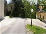
From the church, we continue on the asphalt road, which moderately ascends and brings us after some 10 steps to the spot where it ends. Here we will notice on a tree a signpost for Virnikov Grintovec, which directs us right onto a footpath that gently ascends along the edge of grassy meadows. The path, which then goes into the forest and starts to moderately ascend, brings us after 15 minutes of walking, immediately after the stream, to the homestead Žmitek, where we also step onto a macadam road.
The marked footpath only crosses the mentioned road, then starts steeply ascending through dense forest. After a few minutes of steep ascent, we join a gentler cart track, which we then follow to a smaller saddle between Olipov rob (other name Žmitkov špic) on the left and Žmitkov vrh on the right.
The cart track here turns into a pleasant footpath, which with some views of the surrounding hills brings us to a forest road. We continue along the road for about 100 m, then the blazes direct us right onto an ascending footpath. To the path, which further ascends diagonally through the forest, the path from Murnovo soon joins, but we continue straight in the direction of Virnikov Grintovec. Higher up, the path completely flattens and turns slightly to the right, where it crosses the slopes of Žarkove peči (1411 m). After a few minutes of easy walking, we step out of the forest onto a larger clearing (saddle Žingerc 1345 m), where the path from the Austrian side joins from the right.
We continue in the direction of Virnikov Grintovec on the path that goes into the forest, which then starts to ascend ever more steeply. The quite steep path brings us higher to the main ridge, where it turns left. On the ridge, from which beautiful views open up to the surrounding peaks, the steepness also eases. We follow this occasionally very scenic and on some spots slippery-dangerous path (in dry conditions there is no major danger) all the way to the summit of Virnikov Grintovec.
Starting point - Žingerc 1:30, Žingerc - Virnikov Grintovec 45 minutes.

Along the route: Žingerc (1345m)
Photos:
 1
1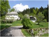 2
2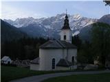 3
3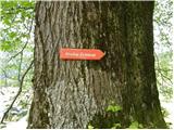 4
4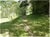 5
5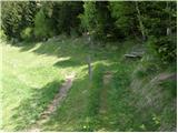 6
6 7
7 8
8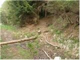 9
9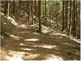 10
10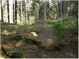 11
11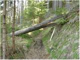 12
12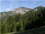 13
13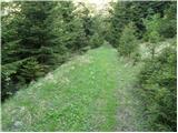 14
14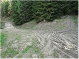 15
15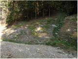 16
16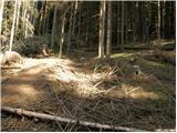 17
17 18
18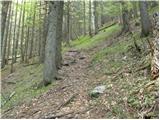 19
19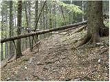 20
20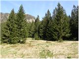 21
21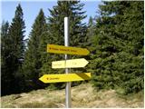 22
22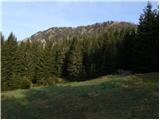 23
23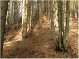 24
24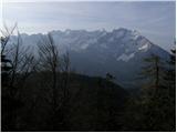 25
25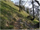 26
26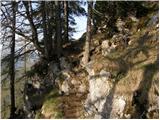 27
27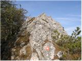 28
28 29
29 30
30 31
31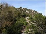 32
32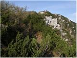 33
33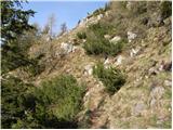 34
34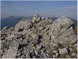 35
35 36
36
Discussion about the trip Zgornje Jezersko - Virnikov Grintovec
|
| Gost1. 12. 2006 |
Beautiful but very short trip
|
|
|
|
| Gost5. 12. 2006 |
Short but nice, that's for me.
|
|
|
|
| Gost24. 08. 2007 |
Brane V.-pleasant, short tour that rewards at the top of the mountain with a wonderful view in all directions. I went left after the bus stop as in the instructions and reached the old church which has no cemetery. At the church there is a sign for Virnikov Grintavec. From here to the Žingerc saddle, so to speak, there are no markings, you have to watch out not to get lost. At the Žingerc saddle the path marked Jezersko joins.
|
|
|
|
| Gost7. 09. 2007 |
Brane V. - today I realized that I went on the old path, which is officially abandoned. The correct one is the one described here. But for a change, one can sometimes go on that old one too.
|
|
|
|
| Gost24. 01. 2008 |
Wonderful trip in sunny weather. Halfway
along the path snow and ice start in places, so
crampons were very useful. Also the ice axe below
the summit wasn't superfluous. The view was unique.
|
|
|
|
| 6ar15. 03. 2008 |
beautiful trip and beautiful weather at the summit
|
|
|
|
| klavdy610. 01. 2009 |
extremely beautiful and relaxing trip especially in summer especially in summer
|
|
|
|
| mt29. 04. 2010 |
It was wonderful up there today, and on the way also to Žmitkov špic. Good path description.
|
|
|
|
| zabica26. 07. 2010 |
Yesterday we were up there. Gorgeous, rewarded with a wonderful view all the way to Triglav. The path is very nice, varied, larger part quite steep. The trip is indeed somewhat shorter, but therefore also suitable for autumn days when the days are shorter.
All praise to PD Jezersko for the very nicely arranged markings.
|
|
|
|
| strelec195418. 01. 2011 |
Really nice and quite panoramic peak, some chamois visited it today too.
|
|
|
|
| fpetel125. 04. 2011 |
Quite a short trip. At the top it is a bit exposed in a few places. Since I'm not particularly agile, I helped myself a bit with my hands in a few places. Personally, I would rate the last part below the summit as a difficult path (if I compare it to Vrtača and Storžič from Kališče, both marked as difficult and no more exposed)
|
|
|
|
| Janez Seliškar24. 12. 2011 |
We park at the church at -5°C, completely clear, only a few cm of snow. The track is trampled because there's too little snow, uncomfortably slippery. We progress nicely, views drifting left towards Storžič, glowing in the morning sun. Snow on top is about 30 cm, dry, collapses and mixes underfoot. The view is wonderful, a front approaching quickly from the west. No more sun soon, so we descend back to Jezersko.
|
|
|
|
| gorskarozica28. 04. 2012 |
On Friday, 27.4.2012, from the top of Vir. Grintovec to Jezersko, between 14 and 16 o'clock, I lost my camera in a bag, which is a dear memory to me. A young guy from Mengš to Jezersko by bike stayed at the top, arrived at the summit around 14 o'clock, didn't sign the book. He took a photo for us with the camera. Please leave your phone number at e-mail: pletenje.kralj@gmail.com
Otherwise it was sunny, no clouds, hot!
|
|
|
|
| katty6. 08. 2012 |
Wonderful viewpoint above Jezersko. The path is nice, and runs mostly through forest for a considerable part. Knees hurt only on one section where the path zigzags. Then on the ridge the sun shows its power, it really starts to bake. We had quite some company, which surprised me. Definitely coming back, as it's worth visiting probably in all seasons . .
|
|
|
|
| Sim7910. 08. 2012 |
Yesterday I was on this summit for the first time. The view from the top is wonderful, yesterday it was only slightly spoiled by clouds on the higher surrounding peaks. Very nicely marked path, varied and interesting; in places quite steep, but no major difficulties.
Towards the summit the path is really a bit more exposed and you have to use your hands here and there a bit, but it didn't seem particularly demanding to me, the eastern ridge of Storžič and Vrtača seem technically somewhat more demanding to me. In any case, you have to be careful
|
|
|
|
| ljubitelj gora4. 05. 2013 |
Was up there today, really nice path, the first half is a hike through spruce forest, the last part a bit steeper, the ridge is fantastic, up 1 hour and 10 minutes, down 50 minutes.
|
|
|
|
| petruša21. 05. 2014 |
I'm interested if the trail here is dry or still has snow? regards
|
|
|
|
| tomko21. 05. 2014 |
I was up there just today. The trail is completely dry and there's not even a trace of snow.
regards
|
|
|
|
| petruša22. 05. 2014 |
Thanks tomko, some I see have nothing better to do than write such comments. I think there's nothing wrong with asking what the path is like....
|
|
|
|
| Robie28. 05. 2016 |
Nice and short hike, actually almost the entire path in shade so suitable for summer. Just, when you park below at the church the priest might hold a morning sermon...
|
|
|
|
| Ninđa28. 05. 2016 |
Hi.
Did anyone perhaps continue the path along the ridge (from the summit onwards)? I tried but wasn't successful. The green dots and cairns end soon. I saw the last green dot about 15 m below the last cairn.
Thanks for info.
Best, Nino
|
|
|
|
| Nuši10. 04. 2017 |
We went with sister on Saturday 8.4.2017. Wonderful viewpoint. Didn't meet anyone on the path. Whoever wants peace and magnificent views, I warmly recommend this tour.
|
|
|
|
| Grenaleva19. 02. 2019 |
Has anyone hiked there these days? What are the conditions like?
|
|
|
|
| Darčka14. 09. 2019 |
Hello... in info: middle section of the path is destroyed due to new forest road construction. Just below the saddle you pick up the path again, which leads from the plain off the road towards the saddle. Otherwise very nice and popular.
|
|
|
|
| soraya200210. 10. 2020 |
Visited this summit yesterday. The trail is exemplarily marked even on the section where they were working on the forest road, or marked with ribbons on tree trunks. The stamp is in the box, the logbook too. Overall a very nice excursion, wonderful views, peace.... just right for autumn days. I highly recommend a detour to Žmitkov špic.
|
|
|
|
| anazala26. 08. 2021 20:56:23 |
I was on the mountain. Most foreign hikers. Some Slovenians too. The mountain has quite an ascent. Last part a bit exposed. A little attention doesn't hurt. Views beautiful, really beautiful. Košuta, Austria, Jezersko valley, Storžič. Go for oxygen and relaxation.
|
|
|
|
| tango19. 11. 2021 13:35:08 |
Beautiful day for visiting an easy summit that offers excellent views. A little wind on the summit ridge, otherwise nothing special and pleasantly warm. The owner's forgotten glove is still waiting at the top. We planned to return towards Planšarsko jezero, but at Žingerč saddle (picture 22) we got confused and instead of going towards Korte, we continued straight ahead, so we had to bushwhack back to the ascent path.
|
|
|
|
| J.P.24. 09. 2022 17:59:30 |
The path to Žingerc saddle is uninteresting and time-consuming. From the saddle onwards it's nice: steepness, ridge, great views and peace. I recommend parking under the church, not at...
|
|
|
|
| Marty11. 01. 2024 11:09:09 |
Has anyone been there in the last week?
|
|
|
|
| mirank11. 01. 2024 14:56:02 |
Yes, it was still standing, Virnikov Grintovec that is
|
|
|
|
| GreenAngel21. 04. 2026 15:08:50 |
Has the snow melted already? I plan to go up on Friday. Thanks
|
|
|
|
| lepenatka5. 05. 2026 08:36:41 |
One question for lovers of unmarked paths.
Does anyone know the path from the Educational Center on Virnikova planina to Virnikov Grintovec, along the western ridge?
There are quite a few paths, we climbed our own way to the initial Z ridge up to a height just over 1500 m, then turned back.
The last part is a very steep path, this time without reaching the final goal. A repeat will be necessary.
What is the path to the top of VG like?
|
|
|
|
| lepenatka5. 05. 2026 13:35:18 |
Polona, thanks.
Regards
Regina
|
|
|
|
| Rajmond8. 05. 2026 00:11:02 |
I climbed this 'trail' or rather pathless terrain to the summit on Monday; you can view the photos on my FB profile. I don't recommend it, because it's obvious no one maintains it and it's hard to follow the right direction. Without navigation on mapy.com I wouldn't have made it. Already from the Učni center onwards the forest is downed with a lot of broken trees, higher up very steep and dangerous for slipping. Before the rocky part I also pushed through the undergrowth that has overgrown the trail. There was some joy with short and easy climbing only just before the summit on the rocky section. I descended via the marked trail to the eastern side and via forest roads back to the starting point at the abandoned limestone quarry.
|
|
|
|
| lepenatka8. 05. 2026 06:59:25 |
The two of us started more to the left above the Educational Center and climbed up to the border and along it to the foot. Up to here the path is visible and easy.
Then right and steeply onto the Z ridge.
Not much was missing to the summit.
The descent was quite unpleasant.
|
|
|
|
| krempač22. 06. 2026 13:46:58 |
Hello,
I was recently twice on Virnikov Grintovec,
14 days ago after rain, in the cloud, I couldn't see a finger in front of my nose, but last Saturday almost a "crystal". But I'm wondering if the real summit is the one with the stone pyramid and cross or that one across the saddle to the east, where there is even less space...
hvlp
|
|
|
To post a comment you must log in:
If you do not yet have a username, you must first
register.