Starting point: Zgornje Poljčane (360 m)
| Latitude/Longitude: | 46,29710°N 15,58340°E |
| |
Walking time: 1 h 45 min
Difficulty: partly demanding marked way
Elevation gain: 618 m
Elevation difference along the route: 618 m
Map: Posavsko hribovje (Boč - Bohor) 1:50.000
Recommended equipment (summer): helmet
Recommended equipment (winter): helmet, ice axe, crampons
Views: 191
 | 1 person like this post |
Access to starting point:
a) Leave the Ljubljana - Maribor motorway at the Slovenske Konjice exit, then follow the signs for Žiče, Loče, Zbelovo and Poljčane. In Poljčane turn right and drive to Zgornje Poljčane, where follow the main road to the junction of the side road to the left towards Boč and the Mountain Hut on Boč. Park above the settlement on the gravel parking lot, near the hiking signposts.
b) Leave the Maribor - Ljubljana motorway at the Slovenska Bistrica south exit, then follow the road towards Poljčane and Podčetrtka. In Zgornje Poljčane follow the main road to the junction of the side road to the left towards Boč and the Mountain Hut on Boč. Park above the settlement on the gravel parking lot, near the hiking signposts.
c) From the Šentjur - Rogaška Slatina road at the Podplat settlement turn left (from the direction of Rogaška Slatina turn right) towards Slovenska Bistrica and Poljčane. Some ascent follows, after the Pečica pass we begin to descend. At the beginning of the Zgornje Poljčane settlement turn right towards Boč and the Mountain Hut on Boč. Park above the settlement on the gravel parking lot, near the hiking signposts.
Route description:
From the starting point, head to the path that continues along the Skodovec valley. There are signs for Boč and the Detička path (right path over Baba), but we ascend gently along it at first, then moderately further on. After a few minutes, cross the asphalt road leading towards the Hut on Boč and continue the ascent along the valley. The slopes above it gradually become steeper, and the path also becomes steeper. Higher up, the marked path turns right onto the slopes, across which we ascend laterally to the ridge; we reach it slightly above the indistinct summit of Baba (594 m).
Here go left and at Maistrov kamen reach the cart track, which we merely cross (right to the Hut on Boč). A few more minutes of ascent through the forest follow, then past Finžgarjev križ reach the gravel road (here the path from the Hut on Boč joins from the right), which we follow left to the nearby turning point.
Continue left along the rutted, reinforced and partly fenced path, which soon leads to a junction where the climbing path and the path over Balunjača branch off to the left, but we continue right along the normal path, which then ascends quite steeply through the forest. About 15 minutes higher we rejoin the climbing path and the path over Balunjača, but we follow the marked path that veers slightly to the right.
Continue following the markers to the fenced military area, which we bypass on the right side. For a short time we walk with little elevation change, then ascend again and quickly reach the summit of Boč with the viewpoint tower. In fine weather it is worth climbing it, as it offers a wonderful view in all directions.
Starting point - Brusovnice 1:05, Brusovnice - junction below Balunjača 0:10, junction below Balunjača - junction above Balunjača 0:15, junction above Balunjača - Boč 0:15.

Along the route: Finžgarjev križ (704m), Brusovnice (741m), Razpotje pod Balunjačo (808m), Razpotje nad Balunjačo (900m)
Photos:
 1
1 2
2 3
3 4
4 5
5 6
6 7
7 8
8 9
9 10
10 11
11 12
12 13
13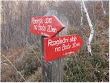 14
14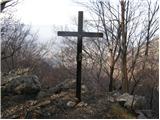 15
15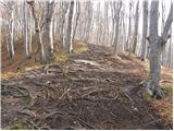 16
16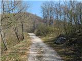 17
17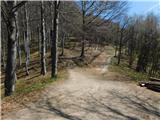 18
18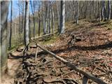 19
19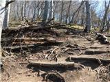 20
20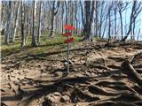 21
21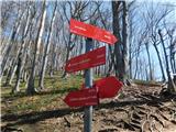 22
22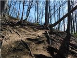 23
23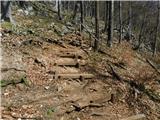 24
24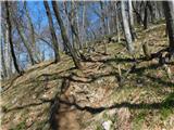 25
25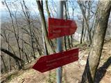 26
26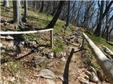 27
27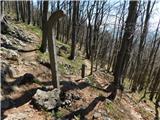 28
28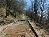 29
29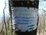 30
30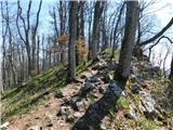 31
31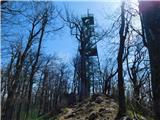 32
32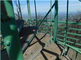 33
33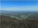 34
34
Discussion about the trip Zgornje Poljčane - Boč
To post a comment you must log in:
If you do not yet have a username, you must first
register.