Zgornje Poljčane - Planinska koča Velikonočnica (by road)
Starting point: Zgornje Poljčane (360 m)
| Latitude/Longitude: | 46,29710°N 15,58340°E |
| |
Route name: by road
Walking time: 1 h 10 min
Difficulty: easy marked way
Elevation gain: 190 m
Elevation difference along the route: 285 m
Map: Posavsko hribovje Boč - Bohor 1:50.000
Recommended equipment (summer):
Recommended equipment (winter):
Views: 2.085
 | 2 people like this post |
Access to starting point:
A) From the direction of Ljubljana we leave the highway in Slovenske Konjice and through Žiče, Loče and Zbelovo we get to Poljčane. At the intersection, we continue right in the direction of Zgornje Poljčane, where at the marked intersection we turn left upwards and drive to the parking lot - starting point for mountain paths on Boč.
B) From the direction of Maribor we leave the highway in Slovenska Bistrica, where traffic signs direct us to Poljčane. Through the center of the settlement Poljčane we continue in the direction of Zgornje Poljčane, where at the marked intersection we turn left upwards and drive to the parking lot - starting point for mountain paths on Boč.
Route description:
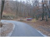
From the parking lot, we continue on the asphalt road upwards. A few hundred meters along the road there are meadows, pastures, vineyards and three or four houses or homesteads. At the end of the settlement Zgornje Poljčane the road passes into the forest, and we follow the asphalt surface higher all the way to a junction on Boč. To the left the road continues towards the mountain hut, while we continue right on the macadam connection. From the right side joins a mountain path over Galka and on the left we reach the site of the greater pasque flower on Boč, altitude 642 meters and also the highest point of the described path.
After a short visit to the site, which is most interesting of course in springtime (in the time of blooming), we continue straight ahead with the help of the directional signpost. We walk below the 782 meters high Dreveniška gora. On a pleasant forest road we continue twice a little to the right. There is also a pleasant clearing with some weekend cottages and left above the path the water reservoir Drevenik. This is followed by a short continuation on a somewhat narrower road and we soon reach the Planinska koča Velikonočnica mountain hut at an altitude of 550 meters.
The length of the described path is around 4000 meters, 285 positive elevation meters and 95 negative elevation meters.

The trip can be extended to the following destinations: Boč
Photos:
 1
1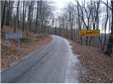 2
2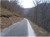 3
3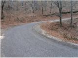 4
4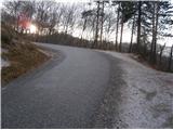 5
5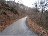 6
6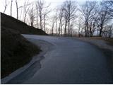 7
7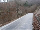 8
8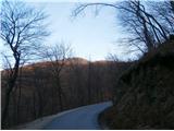 9
9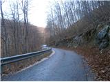 10
10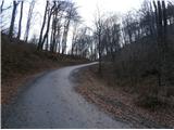 11
11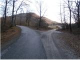 12
12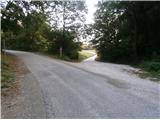 13
13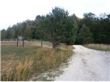 14
14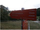 15
15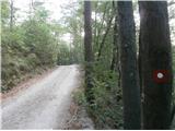 16
16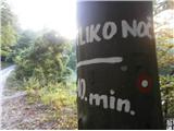 17
17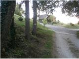 18
18 19
19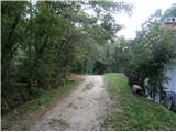 20
20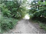 21
21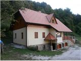 22
22
Discussion about the trip Zgornje Poljčane - Planinska koča Velikonočnica (by road)
To post a comment you must log in:
If you do not yet have a username, you must first
register.