Žiri - Loncmanova Sivka (Mrzli Vrh) (via Vrsnik)
Starting point: Žiri (487 m)
| Latitude/Longitude: | 46,04160°N 14,10410°E |
| |
Route name: via Vrsnik
Walking time: 2 h 40 min
Difficulty: easy marked way
Elevation gain: 500 m
Elevation difference along the route: 635 m
Map: Škofjeloško in Cerkljansko hribovje 1:50.000
Recommended equipment (summer):
Recommended equipment (winter):
Views: 3.312
 | 2 people like this post |
Access to starting point:
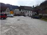
A) From Železniki, Kranj or Medvode we drive to Škofja Loka, and from there we continue driving in the direction of Gorenja vas in Poljanska dolina and Žiri. From Žiri we continue towards Logatec, and then still before the end of the settlement, we get to the inn Gostilna Lenger and a few tens of meters further also to the crossroad, where the main road towards Logatec turns left, and straight ahead the road continues towards Idrija. We park on an appropriate place by the crossroad. A large parking lot is by the inn Gostilna Lenger, but it is polite to ask the employees beforehand whether we may park on the mentioned parking lot.
B) From Horjul or Polhov Gradec we drive to Šentjošt above Horjul, and from there we continue driving towards Smrečje. When we reach the main road Podlipa - Žiri, we follow it to the right, and we drive along it to Žiri. When in Žiri, we reach the main road Škofja Loka - Logatec, we follow it to the left, and we drive along it past the parish church and inn and pizzeria Lenger, to the crossroad, where the main road towards Logatec turns left, and straight ahead the road continues towards Idrija. We park on an appropriate place by the crossroad. A large parking lot is by the inn Gostilna Lenger, but it is polite to ask the employees beforehand whether we may park on the mentioned parking lot.
C) From the highway Ljubljana - Koper we take the exit Vrhnika, and when we reach the old road Ljubljana - Logatec, we continue in the direction of Logatec, but only for a short time, since already at the next crossroad we continue right in the direction of Horjul. The road ahead leads us for a short time still through Vrhnika, later through the outskirts of Stara Vrhnika, and then we soon leave the road towards Horjul and continue driving slightly left in the direction of Smrečje. After Smrečje the road starts descending towards Račeva and Žiri. When in Žiri, we reach the main road Škofja Loka - Logatec, we follow it to the left, and we drive along it past the parish church and inn and pizzeria Lenger, to the crossroad, where the main road towards Logatec turns left, and straight ahead the road continues towards Idrija. We park on an appropriate place by the crossroad. A large parking lot is by the inn Gostilna Lenger, but it is polite to ask the employees beforehand whether we may park on the mentioned parking lot.
D) From the highway Koper - Ljubljana we take the exit Logatec, and when we reach the old road Logatec - Vrhnika we follow it to the right (first exit from the roundabout), and we drive along it only for a short time, since then signs for Rovte and Žiri direct us to the left. After Rovte the road starts descending towards Žiri, and when we reach the mentioned settlement, a road towards Idrija branches off to the left. We park on an appropriate place by the crossroad. A large parking lot is by the inn Gostilna Lenger (the inn is located a few tens of meters ahead from the crossroad in the direction of the center of Žiri), but it is polite to ask the employees beforehand whether we may park on the mentioned parking lot.
E) From the road Idrija - Spodnja Idrija, immediately after the end of Idrija we turn right (if coming from the direction of Spodnja Idrija, still before Idrija we turn left) across the bridge over the river Idrijca towards the store Eurospin. On the other side of the bridge we arrive in the settlement Mokraška vas, and we stick to the main road which leads towards Ledinsko Razpotje and Žiri. Higher up the road leads us through a few hairpin turns, and then we arrive in the settlement Ledinsko razpotje, where the road gradually flattens. After the neighboring settlement Govejk, the road starts descending towards Žiri, after a few kilometers of descent we arrive in Žiri and a little further to the crossroad, where we reach the main road Žiri - Logatec. We park on an appropriate place by the crossroad. A large parking lot is by the inn Gostilna Lenger (the inn is located a few tens of meters ahead from the crossroad in the direction of the center of Žiri), but it is polite to ask the employees beforehand whether we may park on the mentioned parking lot.
Route description:
If we have parked at the inn Gostilna Lenger, we first walk to the crossroad, where the road towards Idrija branches off from the main road. From the mentioned crossroad, we continue left towards Logatec and continue along the main road, where the path first leads past a religious symbol (cross), and then also across the stream Osojnica. Along the main road we walk for a few minutes, and then on the house with the address Logaška cesta 46 we notice signs for Vrsnik pri Vidicu, which direct us right onto a somewhat narrower asphalt road, which starts ascending initially still among some houses. After the nearby old bunker the compact settlement ends, and the road gradually turns left, where it then crosses the slopes to the left. The asphalt ends quickly, and the road then leads us below an old quarry, along it a few minutes higher we arrive at the farm Plesk.
After the farm we continue on a grassy cart track, onto which the blazes direct us, along it we walk only about 30 m, then at a smaller right bend we continue left onto an initially worse cart track, which quickly turns into a footpath. We continue on a fairly steep path, which soon crosses another cart track, and in summer also a quite overgrown path, with a view of the surrounding hills, brings us to the next crossing of a cart track, after which through a strip of forest we reach the macadam road. We ascend slightly along the road, which on a smaller leveling turns slightly left. From there along the road we walk only a short time longer, since then the blazes lead us right onto a path, which quickly widens into an old forested cart track. After the well-preserved border stone of the old Rapallo border from the year 1920, we also leave the cart track and continue a bit more to the right onto a well-marked footpath, which continues along an indistinct ridge. Higher we reach the summit, on which stands an old enclosure, and inside it a newly built structure (on maps the name Vidicov dom appears). When we bypass the enclosure and house on the left side, we step onto the road, and on the trunk of the nearby tree we notice a logbook box.
When we step onto the road, we continue the path in the direction of Ledine. After crossing a strip of forest, on the right we will notice an old Italian structure from the time of the Rapallo border, ahead of us we see the surrounding hills and soon also the church of sv. Tomaž, which is located on a panoramic elevation between Spodnji and Gornji Vrsnik. When somewhat lower the road turns right, we can go straight ahead in a few minutes across pathless terrain or hay meadow to the church of sv. Tomaž, but the mentioned approach is not desired, especially during the grass growth period, as we would thereby cause some damage to the farmer (the arranged path to the church leads from the village Gornji Vrsnik). The road ahead leads us also past a watering place for animals, then gradually we arrive at the first or last houses in the village. At the first crossroad we continue right (left sv. Tomaž 10 minutes) and continue along the asphalt road through the village. At a few smaller crossroads we follow the marked road, at a somewhat larger crossroad, already on the other side of the village, we continue slightly right in the direction of the marked path towards the village Ledine. A light gradual descent follows and a fairly panoramic road brings us to the place where we join the main road Idrija - Žiri.
We follow the mentioned road to the right, and along it we walk only some 10 m, or to the marked junction at Govejk, from where we continue left in the direction of Ledine, to which we have almost an hour of walking left. The path ahead leads us past some houses and a larger enclosure, then after a short ascent it flattens completely. At the next crossroad, where we notice signs for Ledine, we continue right, some 10 m further, near the "last" house also right onto a cart track. We continue along the cart track, which after a few minutes from the meadows enters the forest. When after a few minutes we arrive out of the forest the path widens into a drivable cart track, a bit further we also join a somewhat wider road. Along the macadam road in a few minutes we reach an asphalt road, along it we quickly arrive at the marked crossroad, where from the left a marked path from Ledinsko Razpotje joins us.
We continue in the direction of Sivka, along a level road, which gradually brings us to the village Ledine, where on the right we notice Jurečeva šupa (museum collection), on the left on the bus stop shelter attached a logbook box, in which there is a stamp and logbook.
The path ahead leads us through the village, after the sign end of settlement Ledine, we continue right, where the blazes also direct us. The path then quickly ascends above the village, from where there is a nice view over part of the plateau, on the left, along the path, we also notice a smaller park or NOB monument.
The asphalt road then moderately ascends across initially still quite panoramic slopes, from which a nice view opens up to us, reaching all the way to Trnovski gozd. Higher the road enters the forest, where it leads us past a smaller religious symbol, which we notice somewhat to the right from the path. A crossing of a meadow follows, then we ascend for a few more minutes through the forest. The main road higher brings us out of the forest, where in a few steps we arrive at the marked junction by the chapel.
From the mentioned junction we continue right in the direction of Ermanovec (left summit Sivka 10 minutes) and along the asphalt road we begin to descend moderately. When the descent ends, at the first crossroad, immediately after the farm building we continue right in the direction of Ledinica, Breznice and Žiri. The path for a short time continues along the increasingly panoramic road, then at the right bend we notice signs for Mrzli vrh and the information board of the Path along the Rapallo border. We continue along the panoramic cart track, which leads us across the grassy slope of Mrzli vrh or Loncmanova Sivka. Higher we cross a pasture fence and behind it continue right to the summit some 10 m away, from which a nice view opens up to all sides.
Description and pictures refer to the condition in 2015 (January).

Along the route: Vidicov dom (764m), Gornji Vrsnik (715m), Govejk (710m), Ledine (790m)
Photos:
 1
1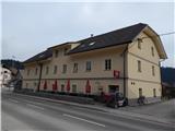 2
2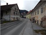 3
3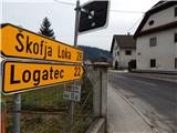 4
4 5
5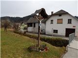 6
6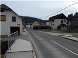 7
7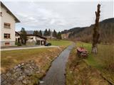 8
8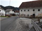 9
9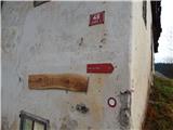 10
10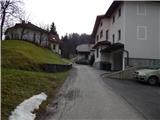 11
11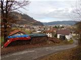 12
12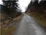 13
13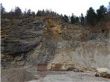 14
14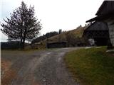 15
15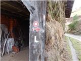 16
16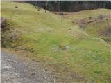 17
17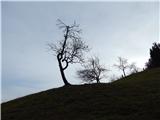 18
18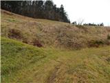 19
19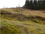 20
20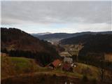 21
21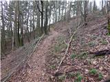 22
22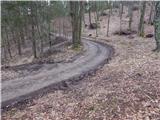 23
23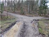 24
24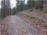 25
25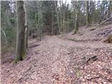 26
26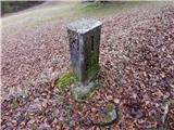 27
27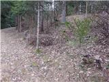 28
28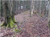 29
29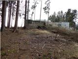 30
30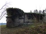 31
31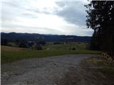 32
32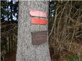 33
33 34
34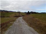 35
35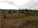 36
36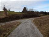 37
37 38
38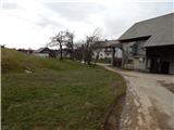 39
39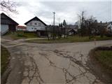 40
40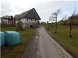 41
41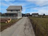 42
42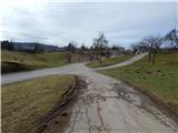 43
43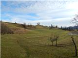 44
44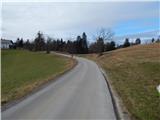 45
45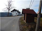 46
46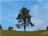 47
47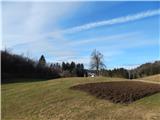 48
48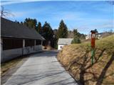 49
49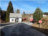 50
50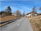 51
51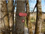 52
52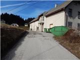 53
53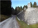 54
54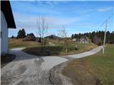 55
55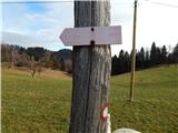 56
56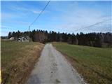 57
57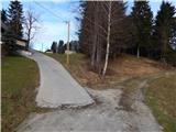 58
58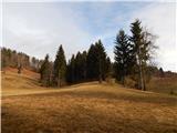 59
59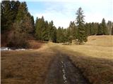 60
60 61
61 62
62 63
63 64
64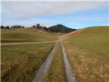 65
65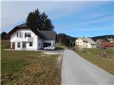 66
66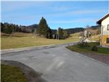 67
67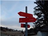 68
68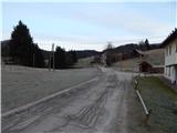 69
69 70
70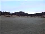 71
71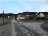 72
72 73
73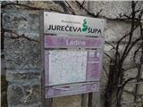 74
74 75
75 76
76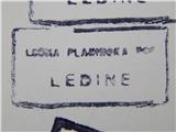 77
77 78
78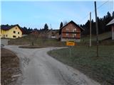 79
79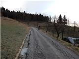 80
80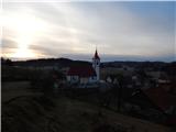 81
81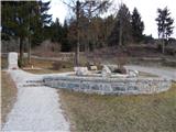 82
82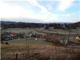 83
83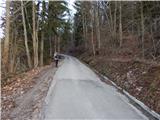 84
84 85
85 86
86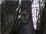 87
87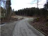 88
88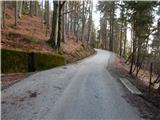 89
89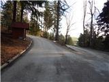 90
90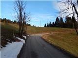 91
91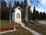 92
92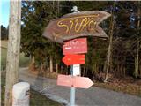 93
93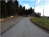 94
94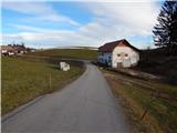 95
95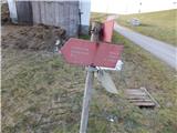 96
96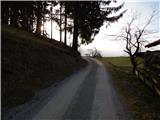 97
97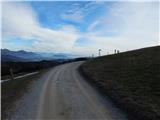 98
98 99
99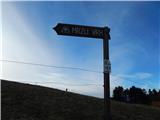 100
100 101
101 102
102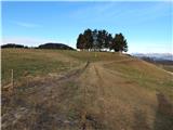 103
103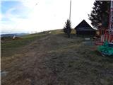 104
104 105
105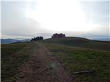 106
106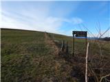 107
107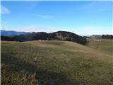 108
108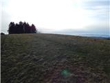 109
109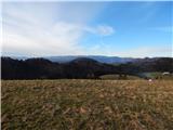 110
110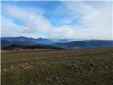 111
111 112
112
Discussion about the trip Žiri - Loncmanova Sivka (Mrzli Vrh) (via Vrsnik)
To post a comment you must log in:
If you do not yet have a username, you must first
register.