Zvodno - Hotel Celjska koča (via Hudičev graben)
Starting point: Zvodno (300 m)
| Latitude/Longitude: | 46,20790°N 15,28770°E |
| |
Route name: via Hudičev graben
Walking time: 1 h 25 min
Difficulty: difficult marked way
Elevation gain: 352 m
Elevation difference along the route: 375 m
Map:
Recommended equipment (summer): helmet
Recommended equipment (winter): helmet, self belay set, ice axe, crampons
Views: 33.450
 | 2 people like this post |
Access to starting point:
From the highway Ljubljana - Maribor, we take the exit Celje - center and continue driving in the direction of Laško and Zidani Most. The road leads through the center of Celje, then brings us to a roundabout with a fountain. Here we continue "straight" (direction Laško and Zidani Most) and follow the road to the next traffic-light intersection, where we continue left, drive over the river Savinja and then at the intersection behind the bridge continue right. Further, we reach the underpass under the railway track and only a few meters further to the fire station in Zagrad. We continue straight and follow the road through the village, which higher brings us to a smaller intersection, where we notice signs for Suhi potok right, Hudičev graben straight. We continue straight and after a short ascent we reach the NOB monument, after which the road gradually flattens. Here we pay attention, because we will soon reach the beginning of the marked path that leads through Hudičev graben. We park a few tens of meters lower, on one of the parking spaces by the road (there aren't many).
To the starting point we can also come from Dolenjska and Zasavje. In this case, we first drive to Rimske Toplice and then through Laško to the starting point.
Route description:
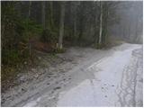
From the starting point, we continue along the road for a few more tens of meters, then signs for Hudičev graben direct us right onto a footpath, which first ascends gently along the fence. A little further, we come to a larger meadow, where the path gets lost a bit, but since we continue in the same direction, there are no major orientation problems. At the end of the meadow we step onto a wide cart track, which after a few steps brings us to Hudičev potok, where there is a marked junction.
We continue in the direction of Hudičev graben (left Srebotnik) and continue the ascent along the path that runs in and along the bed of Hudičev potok. The gorge soon narrows and pegs, staples and steel cables help us. Further, with the help of numerous safety features we ascend right above the stream bed, on which we can observe numerous waterfalls.
Higher, the gorge widens, and the path turns somewhat to the right, where it begins to ascend more steeply through the forest. If we set out on the path in the spring months, we can notice numerous wild garlic patches during the ascent through the forest. After a few minutes of ascent, the path flattens and brings us to a wide cart track, which we follow. The path ahead, which runs along an ever-widening cart track, bypasses the little-known Bavč on the south side and a little further brings us to a junction, where the path through Suhi potok joins from the right.
We continue in the direction of Celjska koča and continue the ascent along a wide macadam road, from which soon to the left branches the path to Tolsti vrh and Svetina. We continue along the road and follow it all the way to Celjska koča, which we reach after a few minutes of further walking.

Photos:
 1
1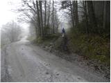 2
2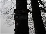 3
3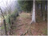 4
4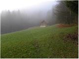 5
5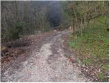 6
6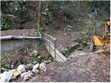 7
7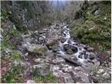 8
8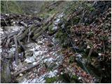 9
9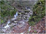 10
10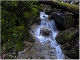 11
11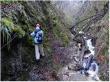 12
12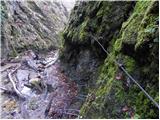 13
13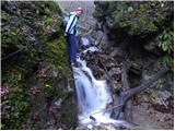 14
14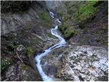 15
15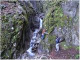 16
16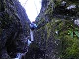 17
17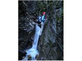 18
18 19
19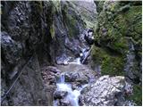 20
20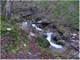 21
21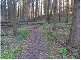 22
22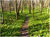 23
23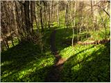 24
24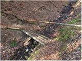 25
25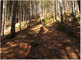 26
26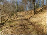 27
27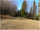 28
28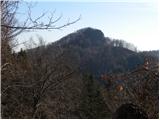 29
29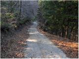 30
30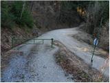 31
31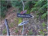 32
32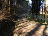 33
33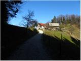 34
34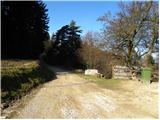 35
35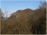 36
36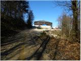 37
37 38
38
Discussion about the trip Zvodno - Hotel Celjska koča (via Hudičev graben)
|
| seinfeld4. 08. 2013 |
We did the trip today. Despite the unbearable heat, it's pleasant in Hudičev graben, plenty of water, the whole path is in the shade. However, caution is needed, the intersection on photo 28 is unmarked, you need to turn right and the path goes about 200m downhill to the barrage. There are signposts. Recommended, interesting for slightly older children (10+).
|
|
|
|
| Gdu bo meni reku svinja18. 10. 2014 |
Is the path suitable for a medium-sized dog?
From some photos it seems probably not, or am I wrong?
|
|
|
|
| sirt118. 10. 2014 |
I'll tell you pig - if you thought of going on this path with a dog!
|
|
|
|
| vespuci18. 10. 2014 |
Not for any dog; even though there's a lot of water, even two-legged ones need neoprene.
|
|
|
|
| Mira.k9. 05. 2018 |
I'm interested in the condition of the path, is it passable given the water level.
|
|
|
|
| 30610. 05. 2018 |
The path is passable, safety gear good, water low. Straight to the path.
Regards
|
|
|
|
| Mira.k14. 05. 2018 |
Thanks for the info 306, this Thursday the weather will be good.
|
|
|
|
| 30615. 05. 2018 |
Hi. There has been quite a bit of rain these days but I think it will still be OK. The gully is more of a torrent nature and the water will drain quickly. Still, take caution on the path 
|
|
|
|
| edelweiss9620. 10. 2019 |
Very nice and interesting trail that slightly reminds of more demanding high mountain paths, and at the same time not too far for us Styrians. We'll come again! 
|
|
|
|
| KSG9. 07. 2021 23:00:54 |
Interesting trail, not too difficult, just a bit of caution is advisable. We can extend it to Grmada and other hills, below Grmada summit we refresh at Pečovnik hut. Impressions from July 2021: https://bit.ly/2SSvEVC
|
|
|
To post a comment you must log in:
If you do not yet have a username, you must first
register.