Zvodno - Srebotnik (via Hudičev graben)
Starting point: Zvodno (300 m)
| Latitude/Longitude: | 46,20666°N 15,29126°E |
| |
Route name: via Hudičev graben
Walking time: 1 h
Difficulty: difficult marked way
Elevation gain: 400 m
Elevation difference along the route: 400 m
Map: Celjska kotlina, 1:50000
Recommended equipment (summer): helmet, self belay set
Recommended equipment (winter): helmet, self belay set
Views: 8.260
 | 1 person like this post |
Access to starting point:
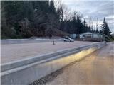
From the Ljubljana - Maribor highway, take the Celje - center exit and continue driving in the direction of Laško and Zidani Most. The road leads us through the center of Celje, then before the Savinja brings us to a roundabout with a fountain. Here we continue "straight" over the first bridge (direction Laško and Zidani Most) and follow the road to the next traffic-light intersection, where we continue left over the second bridge over the Savinja. Immediately behind the bridge at the intersection we continue right. After approx. 500 meters we arrive at the underpass under the railway track (on the right side a large parking lot and the starting point in Zagrad), drive through it and continue straight past the fire station in Zagrad. We follow the road through the village, and higher in Zvodno it brings us to a smaller intersection at the bus stop, where we notice signs for Grmada right, Hudičev graben straight, parking lot 1.2 km straight. We continue straight towards the new parking lot (2020), and the road gradually flattens and narrows. New parking lot - our starting point is located just by the road before the fish farm. Here we can park and head out on paths that lead either past Marija, or through Hudičev graben, or through Suhi potok. The starting point can also be reached from Dolenjska and Zasavje. In this case, we first drive to Rimske Toplice and then through Laško to the above-described second bridge, from where we continue according to the description.
Route description:
From the starting point, signs for Hudičev graben direct us first a few steps along the road back toward Celje, then sharply left toward the south onto a cart track into the forest, which ascends gently. The cart track brings us after a few steps to the start of Hudičev graben, where the first junction is marked. We continue straight today toward Hudičev graben (left to Srebotnik via the village Pečovje) and continue the ascent along the path that runs through and beside the bed of Hudičev potok stream. The path is marked throughout. The gorge soon narrows, and pegs, staples, and steel cables assist us. Further on, with the aid of numerous fixed protections, we ascend right above the streambed, where we can observe numerous small waterfalls. Higher up, where the gorge widens and the protections end, we reach the next junction. If we turn slightly right, we can reach Bavč, Grmada, Pečovniška koča hut, etc.; today, however, we head left steeply upward toward the western ridge of Srebotnik. After the initial steep section, we reach a path junction on a panoramic ridge, offering a view of Stari grad castle. If we continued straight on the unmarked path, we could bypass Srebotnik on its northern side, but we continue on the marked path right along the western ridge of Srebotnik steeply upward toward the east. After the initially steep section, the path flattens slightly after a while, then we encounter a new junction where the path from the southern approach to Srebotnik joins from the right. The latter path is also part of the Celje mountain path. We continue straight upward along the ridge. Only about 200 meters remain to the summit; in the final section, the gradient steepens again considerably, and the path below the summit is secured with a steel cable. At the summit, a magnificent panorama awaits in practically all directions, along with the Slovenian flag, summit logbook, bench, and stamp. A few steps to the southwest, it is possible to approach the exposed section of the panoramic cliff.

Photos:
 1
1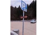 2
2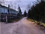 3
3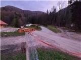 4
4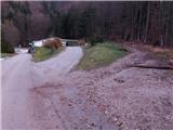 5
5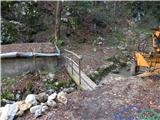 6
6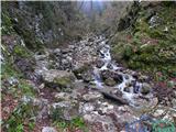 7
7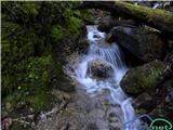 8
8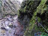 9
9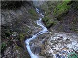 10
10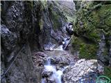 11
11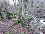 12
12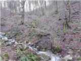 13
13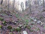 14
14 15
15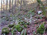 16
16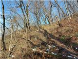 17
17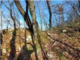 18
18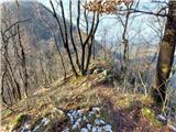 19
19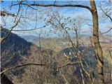 20
20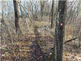 21
21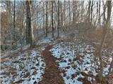 22
22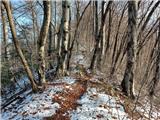 23
23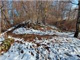 24
24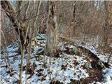 25
25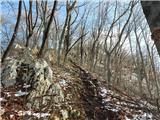 26
26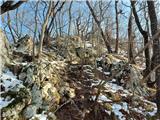 27
27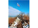 28
28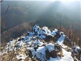 29
29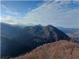 30
30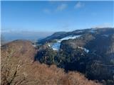 31
31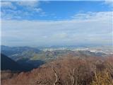 32
32
Discussion about the trip Zvodno - Srebotnik (via Hudičev graben)
To post a comment you must log in:
If you do not yet have a username, you must first
register.