Zvodno - Tolsti vrh above Celjska koča (via Hudičev graben)
Starting point: Zvodno (300 m)
| Latitude/Longitude: | 46,20790°N 15,28770°E |
| |
Route name: via Hudičev graben
Walking time: 1 h 45 min
Difficulty: difficult marked way
Elevation gain: 534 m
Elevation difference along the route: 550 m
Map:
Recommended equipment (summer): helmet
Recommended equipment (winter): helmet, self belay set, ice axe, crampons
Views: 8.005
 | 1 person like this post |
Access to starting point:
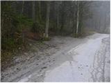
From the Ljubljana–Maribor motorway, take the Celje-center exit and continue driving in the direction of Laško and Zidani Most. The road leads through the center of Celje, then brings us to a roundabout with a fountain. Here we continue "straight" (direction Laško and Zidani Most) and follow the road to the next traffic-light intersection, where we continue left, drive over the Savinja River and then at the intersection behind the bridge continue right. Further, we reach the underpass under the railway track and only a few meters further to the fire station in Zagrad. We continue straight and follow the road through the village, which higher brings us to a smaller intersection, where we notice signs for Suhi potok right, Hudičev graben straight. We continue straight and after a short ascent we reach the NOB monument, after which the road gradually flattens. Here we need to pay attention, because we will soon reach the beginning of the marked path which leads through Hudičev graben. We park a few tens of meters lower, on one of the parking spots by the road (there aren't many).
To the starting point we can also come from Dolenjska and Zasavje. In this case, we first drive to Rimske Toplice and then through Laško to the starting point.
Route description:
From the starting point, we continue along the road for a few more tens of meters, then signs for Hudičev graben direct us right onto a footpath, which first ascends gently along the fence. A little further, we come to a larger meadow, where the path gets lost somewhat, but since we continue in the same direction there are no major orientation problems. At the end of the meadow we step onto a wide cart track, which after a few steps brings us to Hudičev potok, where there is a marked junction.
We continue in the direction of Hudičev graben (left Srebotnik) and continue the ascent along the path that runs in and along the bed of Hudičev potok. The gorge soon narrows and aids are pegs, staples and steel cables. Further ahead we ascend with the help of numerous fixed protections right above the stream bed, on which we can observe numerous small waterfalls.
Higher the gorge widens, the path turns somewhat to the right, where it begins to ascend more steeply through the forest. If we set out on the path in the spring months, during the ascent through the forest we can observe numerous wild garlic patches. After a few minutes' ascent, the path levels out and brings us to a wide cart track along which we continue. The path ahead, which runs along an ever-widening cart track on the south side, bypasses the little-known Bavč and brings us just a little further to a junction, where the path through Suhi potok joins from the right.
We continue in the direction of Celjska koča and continue the ascent along a wide gravel road, from which soon to the left branches the path to Tolsti vrh and Svetina. Here we continue left and continue the ascent along the path, which ascends transversely through the forest. Higher we step onto a gravel road, which we only cross, as signs for Tolsti vrh direct us onto a somewhat steeper path. From the hut we continue along the left road in the direction of Svetina, which after 15 minutes of walking brings us to a path junction, where the path to Tolsti vrh branches sharply right upwards. The path ahead ascends through the forest and brings us in a few minutes above the quarry, which we bypass on the right side. A little further the path from Svetina joins from the left, and we continue slightly right along a moderately steep path, along which in a few minutes of further walking we ascend to Tolsti vrh.
From the summit we can also continue to the nearby viewpoint, which is only 1 minute away.

Photos:
 1
1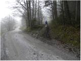 2
2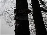 3
3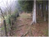 4
4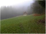 5
5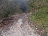 6
6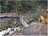 7
7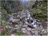 8
8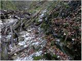 9
9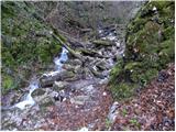 10
10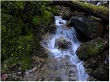 11
11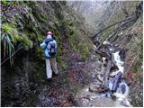 12
12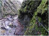 13
13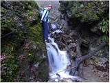 14
14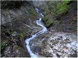 15
15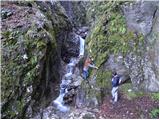 16
16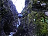 17
17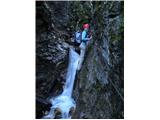 18
18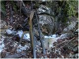 19
19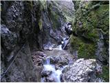 20
20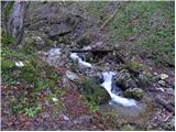 21
21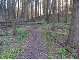 22
22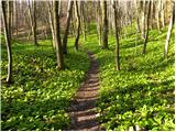 23
23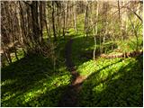 24
24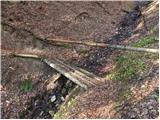 25
25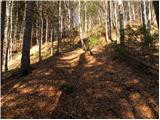 26
26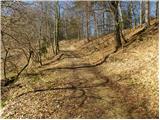 27
27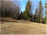 28
28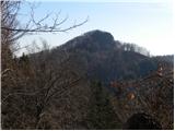 29
29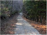 30
30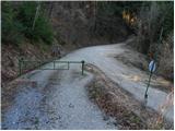 31
31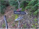 32
32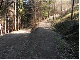 33
33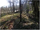 34
34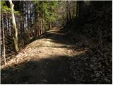 35
35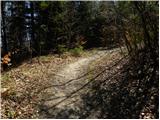 36
36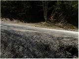 37
37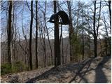 38
38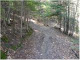 39
39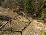 40
40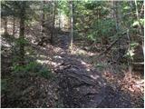 41
41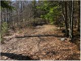 42
42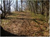 43
43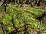 44
44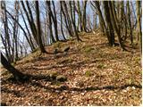 45
45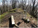 46
46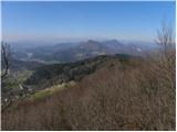 47
47
Discussion about the trip Zvodno - Tolsti vrh above Celjska koča (via Hudičev graben)
To post a comment you must log in:
If you do not yet have a username, you must first
register.