PZS Presents Editions of PZS Mountaineering Publishing House 2013
16.10.2013
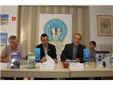
Today, October 16, a press conference took place at the Alpine Association of Slovenia, where PZS General Secretary Matej Planko, alpinist and writer Viki Grošelj, and editor of the Šaleška Valley with Surroundings map Milan Domitrovič presented the editions of the PZS Mountaineering Publishing House that PZS issued this year. Among them, Grošelj's book Giants of the Himalayas undoubtedly stands out the most, presenting the first complete overview of the achievements of Slovenian alpinists on the fourteen highest peaks in the world.
An important part of the Alpine Association of Slovenia is raising awareness, education, and informing mountaineers, mountain lovers, and the entire public about mountains and safer mountain visiting ... also through the publication of mountaineering literature, guidebooks, maps. At the same time, PZS wishes to offer mountaineers and others something more through the publication of fiction books and other products. In the introduction, PZS General Secretary Matej Planko emphasized important steps in cooperation between RTV Slovenija and the Alpine Association of Slovenia. The high viewership of programs with mountaineering content and especially films from the TV series Giants of the Himalayas by Viki Grošelj, which are the result of cooperation between RTV and PZS, shows that mountaineering and mountains are what connect, inspire, and unite people.
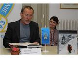
The book GIANTS OF THE HIMALAYAS. This is already the fourteenth book by the top alpinist, Himalayan climber, mountain rescuer, and mountain guide Viki Grošelj. In it, he presents all fourteen highest peaks in the world, the 14 eight-thousanders, and outlines the history of ascents on them with special emphasis on the activities of Slovenian alpinists who, with exceptional achievements in the Himalayas, rose to the world top. This year, eight years after the first film about Makalu (the first eight-thousander for Slovenia), the eponymous TV series about all 14 eight-thousanders is also concluding. The team with Viki Grošelj at the helm is departing to the Himalayas this Friday, October 18, 2013, to shoot the last scenes of the last of the 14 films. The last scenes of the Annapurna film (which was also the last of the 14 eight-thousanders for Slovenia) will be shot in the Manang area, where in 1979 PZS established the Slovenian Mountaineering School. Upon the release and presentation of the book, author Viki Grošelj thanked, among others, all collaborators who contributed photographs, some of whom were also present at the press conference. The author dedicated the book to Slovenians who passed away in the Himalayas, as well as to three friends from abroad who also remained under the world's highest mountains. Grošelj wishes to conclude the book Giants of the Himalayas, the eponymous exhibition in the lobby of RTV Slovenija, and the TV series this year, as 2013 is full of special anniversaries, among the most important of which the author highlighted the 120th anniversary of organized mountaineering in Slovenia and thus PZS, and the 50th anniversary of the PZS Commission for Expeditions to Foreign Mountains, under whose auspices practically all expeditions operated. Viki Grošelj invited all those gathered to the pre-premiere of the 13th and 14th films from the TV series Giants of the Himalayas, which will take place on December 20, 2013, in the Slovenian Alpine Museum in Mojstrana.
The MOUNTAINEERING MAP POLHOGRAJSKO HRIBOVJE 1:25,000 was issued by the Alpine Association of Slovenia at the beginning of the year. We awaited it with joy, as the previous one was sold out. It covers the entire area of Polhograjsko hribovje; to the north it extends to Škofja Loka, to the south to Smrečje and Lesno Brdo, to the east to Dvor, and to the west to Žirovski vrh. The area is divided into eight major relief units: Central Polhograjsko hribovje, Western Polhograjsko hribovje, Northern Polhograjsko hribovje, Butajnovsko-Samotorška karst plateau, Karst plain at Toško Čelo, Low hills to the south, Žlebsko gričevje, Extended parts of the valleys of Gradaščica, Horjulščica, and Šujica. The map editor is Bogdan Seliger, and the map was presented by PZS General Secretary Matej Planko. The mountaineering map is complemented by the PZS guidebook Polhograjsko hribovje by author Božidar Lavrič, and it also marks circular routes (circular and connecting mountaineering trails), which are also marked on the terrain. The routes of all mountaineering trails are arranged based on GPS recordings. Katarina Kotnik, editor of mountaineering trail data for the Mountaineering Trails Committee of the Inter-Association Committee of Ljubljana Mountaineering Associations, Božidar Lavrič, and members of mountaineering associations: Gorenja vas, Medvode, Blagajana - Polhov Gradec, Škofja Loka, Pošta Telekom, Horjul also collaborated on the project.
The MOUNTAINEERING MAP ŠALEŠKA DOLINA WITH SURROUNDINGS 1:50,000 was released this summer. Previous mountaineering maps of the PZS Mountaineering Publishing House did not cover the entire area where the Šaleška dolina with surroundings map is placed. Therefore, at the initiative of local mountaineering associations, the Alpine Association of Slovenia decided to produce the map, which was presented by its editor Milan Domitrovič. The new mountaineering map extends from Vransko to Celje (lower Savinja Valley) in the south and from Prevalje to Vuzenica (up to the Austrian border) in the north. The map includes mountaineering highlights such as Dobrovlje, Mozirske planine (Golte), Smrekovec, Uršlja gora, Košenjak, western part of Kozjak across the Drava, western Pohorje, Paški Kozjak, and the hills of Ponikvanska planota with karst features. In the central part of the map is Šaleška dolina with Velenje and Šoštanj, to the north Slovenj Gradec, Ravne na Koroškem, and to the south Žalec and Celje. The map features numerous mountaineering circular routes and transverse paths: Slovenian Mountaineering Trail, E6, Šaleška pot, Koroška pot, Savinjska pot, Vinskogorska pot, Andraška pot, Martinova pot, Pot okoli Mute, and others. "The novelties of the map are: it was made from electronic data of the mountaineering trails cadastre database, where all trails are measured with geo-positioning devices. In addition to mountaineering huts and trails, climbing areas and climbing polygons, i.e., mountaineering infrastructure objects, have been added to the map. A significant part of the back of the map is dedicated to presenting municipalities from the map's area that contributed to co-financing the map. Some descriptions on the back of the map are also in English, German, and Italian," said editor Domitrovič.
At the end, PZS General Secretary also presented the MOUNTAINEERING CALENDAR for 2014, the MOUNTAINEERING EXPERIENCES calendar, which features the most beautiful photographs selected in this year's call by the Alpine Association of Slovenia, representing parts of mountain nature in different seasons.
This year, the release of another book within the PZS Mountaineering Publishing House is planned, but we will inform you about it in due time.