Snow conditions 10. 3. 2026
10.03.2026
Avalanche forecast
Tuesday, 10. 3. 2026
Danger level Tuesday, 10. 3. 2026 at
Danger level 2 – moderate
Southern Julian Alps, Central Julian Alps, Eastern Julian Alps, Western Julian Alps, Kamnik-Savinja Alps and Carinthia, Western Karawanks, Central Karawanks
Weak layers still persist deep in the snowpack
Weak layers deep in the snowpack represent the problem, located deeper in the snowpack. If the load exceeds the load-bearing capacity of the deeper weak layers, a deep and large avalanche can be triggered. There are many such weak layers especially on slopes above the forest.
Snowpack
Danger patterns
dp.1: deep hard slab weak layer
The snowpack freezes at night, during the day it softens mainly in the mid-mountains on sun-exposed slopes. At the same time, the crust strengthens and becomes thicker. This process will be less pronounced today. The snow has settled and has already reformed quite well especially on sun-facing sides. The snow layers have bonded together. In the old snowpack, several weak layers of facets and rounded grains appear deep below the surface.
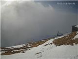
Weather
Moderately to mostly cloudy, summits will often be in fog. Less cloudiness in the eastern Karawanks. Especially in the Julian Alps, local showers will be possible midday and in the afternoon. A weak to moderate southwesterly will blow. At midday, the temperature at 1500 m will be around 2 °C, at 2500 m around -5 °C.
Outlook
Weather and avalanche conditions will be similar in the coming days.
https://www.hribi.net/snezne_razmere_v_gorah Source: ARSO