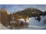
Snow conditions 12. 3. 2026
12.03.2026
Avalanche forecast
Thursday, 12. 3. 2026
Danger level Thursday, 12. 3. 2026
Danger level 2 – moderate
Southern Julian Alps, Central Julian Alps, Eastern Julian Alps, Western Julian Alps, Kamnik Alps, Savinja Alps and Carinthia, Western Karawanks, Central Karawanks
Weak layers persist deep in the snowpack
The problem consists of weak layers in the snowpack located deeper in the snowpack. If the load exceeds the load-bearing capacity of the deeper weak layers, a deep and large avalanche can be triggered. There are many such weak layers especially on slopes above the forest.
Snowpack
Danger signs
dp.1: deep hard slab weak layer
The snow has settled and especially on sun-exposed aspects has already reformed quite well. The snow layers have bonded together, the surface is crusty in many places. Deep below the surface in the old snowpack, several weak layers of facets and rounded grains occur.
Weather
Mostly cloudy, summits often in clouds. Especially midday and in the afternoon, local showers will form, above around 1700 m snowy. A weak wind from easterly directions will blow. Midday temperature at 1500 m around 3, at 2500 m around -4 °C.
Outlook
Weather and avalanche conditions will be similar in the coming days.
https://www.hribi.net/snezne_razmere_v_gorah Source: ARSO