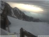
Snow conditions 12. 4. 2026
12.04.2026
Avalanche forecast
Sunday, 12 April 2026
Danger level Sunday, 12 April 2026
Danger level 1 – low
Southern Julian Alps, Central Julian Alps, Eastern Julian Alps, Western Julian Alps, Kamnik-Savinja Alps, Savinja Alps and Carinthia, Western Karawanks, Central Karawanks
Wet snow avalanches not excluded
The snowpack is mostly well bonded and generally stable. During the day, wet snow avalanches may occur in some places.
Smaller danger also from weak layers in old snow located deeper in the snowpack. Such weak layers are more frequent on shady slopes above the forest. Under heavy load exceeding the carrying capacity of these layers, a small to medium-sized avalanche can be triggered.
Snowpack
Danger patterns
dp.10: spring conditions
The snowpack will mostly freeze overnight, but less than in previous days due to a warmer night. During the day, the snow will thaw and may become unstable in places.
In the old snowpack, snow layers are mostly well bonded together. More or less deep below the surface, several weak layers of facets and rounded grains occur, more frequent on shady slopes.
Weather
On Sunday, some low cloud in the mid-mountains initially, clearing during the day. Patchy clouds here and there. Only in places in the high mountains will a moderate northwesterly wind blow initially, weakening during the day. Midday temperature at 1500 m around 8, at 2500 m around 3 °C.
Outlook
On Monday, transient cloudiness. Avalanche danger will remain relatively low.
https://www.hribi.net/snezne_razmere_v_gorah Source: ARSO