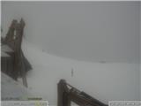
Snow conditions 13. 3. 2026
13.03.2026
Avalanche forecast
Friday, 13. 3. 2026
Danger level Friday, 13. 3. 2026 at
Danger level 2 – moderate
Southern Julian Alps, Central Julian Alps, Eastern Julian Alps, Western Julian Alps, Kamnik Alps, Savinja Alps and Koroška, Western Karawanks, Central Karawanks
Weak layers persist deep in the snowpack
Weak layers in the snowpack located deeper pose a problem. If the load exceeds the carrying capacity of the deeper weak layers, a deep and large avalanche can be triggered. There are many such weak layers especially on slopes above the forest. During the day, smaller wet snow avalanches are possible on sun-exposed slopes.
Snowpack
Danger patterns
dp.1: deep hard weak layer
The snow has settled and has already reformed quite well especially on sun-exposed slopes. The snow layers have bonded together. In the mid-mountains, more and more bare areas are appearing on sun-exposed slopes. In the old snowpack, several weak layers of facets and rounded grains appear deep below the surface.
Weather
Partly clear with occasional increased cloudiness, summits may occasionally be in fog. The probability of any shower will be quite low. A weak southwesterly wind will blow. At midday, temperature at 1500 m around 3 °C, at 2500 m around -3 °C.
Outlook
Weather and avalanche conditions will be similar in the coming days.
https://www.hribi.net/snezne_razmere_v_gorahSource: ARSO