Snow conditions 14. 3. 2026
14.03.2026
Avalanche forecast
Saturday, 14. 3. 2026
Danger level Saturday, 14. 3. 2026 at
Danger level 2 – moderate
Southern Julian Alps, Central Julian Alps, Eastern Julian Alps, Western Julian Alps, Kamnik Alps, Savinja Alps and Carinthia, Western Karawanks, Central Karawanks
Weak layers persist deep in the snowpack
The problem is weak layers in the snowpack located deeper in the snowpack. There are more such weak layers on slopes above the forest. Under a large load exceeding the carrying capacity of these layers, a larger avalanche can also be triggered. During the day, smaller avalanches or wet snow sluffs may occur on sun-exposed slopes.
Snowpack
Danger signs
dp.1: deep hard persistent weak layer
On the surface in the high mountains there is a crust present, snow layers are mostly well bonded together. The crust holds a skier's weight and may be frozen in the morning. In the mid-mountains, more bare areas are appearing on sun-exposed slopes. In the old snowpack, several weak layers of facets and rounded grains appear deep below the surface.
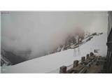
Weather
Variable to mostly cloudy, peaks in the west will often be in fog, while it will initially be partly clear towards the east. Local precipitation, partly showers, will form in the west and spread towards the east during the day. The southwest wind will strengthen further. At noon, temperature at 1500 m around 2 °C, at 2500 m around -4 °C.
Outlook
Weather and avalanche conditions will be similar in the coming days.
https://www.hribi.net/snezne_razmere_v_gorah Source: ARSO