Snow conditions 25.11.2016
25.11.2016
General avalanche danger - Friday, 25 November 2016
Danger level 2 on the European 5-level scale - MODERATE.
Main problem: wind slab, new snow, drifted snow
Danger pattern: vn4 Cooling after warm weather / warming after cold
Risk assessment
Avalanche risk in the high mountains, above about 2200 m a.s.l., is MODERATE, level 2. Elsewhere LOW. Particularly dangerous are places with drifted snow and steep slopes where an avalanche can be triggered. In places the surface is icy, so risk of slipping there. Lower down almost no snow left.
Snow conditions
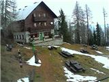
In the mountains, rather warm weather for the time of year continues. Occasional precipitation in hills of western Slovenia, no significant snow amounts. Snowfall line between 2200 and 2500 m a.s.l. Snowpack mostly crusted, does not bear human weight, icy in places. Some wind slab mainly on northern sides of ridges.
Forecast weather development
Today and tomorrow cloudy. Occasional precipitation, stopping gradually tomorrow morning. Mostly dry on Pohorje and perhaps extreme eastern Karawanks. Snow line today around 2100 m a.s.l., tomorrow may drop to around 1700 m especially northwest. Freezing level around 2500 m a.s.l. Sunday partly clear in high mountains with occasional increased cloudiness, below about 1700 m a.s.l. cloudy and foggy. Daytime slight further cooling, afternoon freezing level around 2200 m. Monday night strong north or northeast wind, significant cooling.
Snow conditions tendency
Until tomorrow morning around 20 cm snow in Julian Alps and western Karawanks, locally more, further east 5-10 cm. New snow above ~2500 m dry, poor bonding to crusty base. Lower wetter, better bond with old snow except icy surfaces. South wind not strong, no major new drifts expected. Only strong north wind Monday night will transport snow, new slabs on southern ridge sides. New snow settling slowly Sat-Sun, then in cold dry polar air mass little transformation for days. Due to new snow avalanche danger above ~2300 m increases to 3 mainly western areas. Especially drifted snow spots and steep slopes, new snow may release with minor load. Further east less new snow, danger remains 2. Early week cold windy weather forming slabs, main hazard next week.
General avalanche danger level 2 on European 5-level scale.
Next bulletin: Monday, 28 November 2016
Source: ARSO