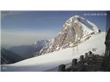
Snow conditions 9. 3. 2026
9.03.2026
Avalanche forecast
Monday, 9. 3. 2026
Danger level Monday, 9. 3. 2026 at
Danger level 2 – moderate
Southern Julian Alps, Central Julian Alps, Eastern Julian Alps, Western Julian Alps, Kamnik Alps, Savinja Alps and Carinthia, Western Karawanks, Central Karawanks
Weak layers persist deep in the snowpack
The problem consists of weak layers in the snowpack located deeper within the snowpack. If loading exceeds the strength of deeper weak layers, a deep and large avalanche may be triggered. There are many such weak layers especially on slopes above the treeline.
Snowpack
Danger patterns
dp.1: deep persistent weak slab
The snowpack freezes overnight, during the day it mainly ripens on sun-exposed slopes. During this the crust strengthens and becomes thicker. This process will be less pronounced today than on previous days. The snow has settled and especially on sun-exposed aspects has already reformed quite well. Snow layers have bonded together. In the old snowpack multiple weak layers of facets and rounded grains occur deep below the surface.
Weather
Partly clear with occasional increased cloudiness, especially in the Julian Alps summits may occasionally be in fog. There will also be considerable high cloudiness. A light south to southeast wind will blow, towards evening turning southwest. At midday temperature at 1500 m around 2 °C, at 2500 m around -4 °C.
Outlook
Weather and avalanche conditions will be similar in the coming days.
https://www.hribi.net/snezne_razmere_v_gorah Source: ARSO