Snow conditions in the area of the Municipality of Tržič 13.1.2023
13.01.2023
General avalanche danger in the Municipality of Tržič area above 1500 meters is 2nd degree, below 1500 it is 1st degree on the five-level European scale.
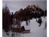
In the high mountains of the Municipality of Tržič area, 30 to 50 cm of snow has fallen in the last few days. Lower down, below 1500 meters, there is less snow. Snowfall was accompanied by strong south and north winds. Wind transported snow during snowfall and also afterwards. It built cornices and drifts on all slopes. There is a huge amount of wind-blown snow in depressions and narrow gullies below ridges. The snow cover is unstable in these areas. Weak layers are present under the new snow cover.
Tomorrow morning it will be clear in the hills. Air temperature at 1500 meters will be around 0°C, weak SW wind blowing. At 2000 meters around -4°C, SW to W wind up to 40 km/h. In the afternoon it will become cloudy. On Sunday the SW wind will strengthen and air humidity will rise. Air temperature at 1500 meters around 0°C. On the night to Monday, precipitation will arrive. Heavy snow will start. Up to 30 cm of snow can fall by morning at around 1000 meters. More snow in the high mountains. Avalanche danger will INCREASE SIGNIFICANTLY!
The snow cover will remain unchanged until Sunday afternoon. In the high mountains it will slowly settle and metamorphose. The SW wind will transport snow in smaller quantities and deposit it in leeward positions. On all slopes of the high mountains, especially below ridges, there are areas with wind-blown snow. There are many cornices and drifts. In these areas you can trigger an avalanche already with additional minor loading.
Below 1500 meters there is less snow, but there are also areas with wind-blown snow! Caution!
On the night to Monday heavy snow will start. Avalanche danger will increase!
Source:
https://www.zvsp.si