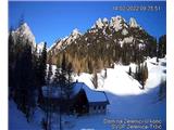
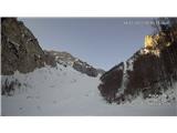
Snow conditions in the area of the Municipality of Tržič 14.2.2022
14.02.2022
Avalanche Bulletin 36, Monday 14.2.2022 at 6:00 for the area of the Municipality of Tržič.
General avalanche danger in the area of the Municipality of Tržič is level 1 on the five-level European scale.
New snow that fell a week ago has mostly well bonded with the old snow surface, especially on sun-exposed slopes. On shaded slopes, this snow remained dry. In narrow gullies and some areas, there are still areas with wind-blown snow, but the areas are few or small. Elsewhere, the snow surface is stable and hard. The wind that blew over the weekend did not significantly affect the snow cover. The air temperature, which was low on Saturday and yesterday, had a somewhat greater impact. This impact was greater on shaded slopes.
On sun-exposed slopes, the snow crusted during the day and froze at night. Along ridges, the surface also crusted or softened during the day and froze at night.
Today it will be clear in the Tržič high mountains. In the late afternoon, it will gradually cloud over. Today's daytime temperature at 1500 meters will be around -2°C, moderate SW wind blowing. At 2000 meters, midday will be around -5°C, wind from W to SW direction up to 40 km/h. Tonight and into Tuesday night, expect some precipitation. Snow line around 800 meters.
Today's solar radiation will still affect the snow surface on sun-exposed slopes. During the day, it will soften or crust. In the afternoon, it will refreeze. On shaded slopes, there will be no major change in the snow cover. The snow cover will REMAIN STABLE TODAY. Ridges are icy, be careful not to slip.
From tonight to tomorrow afternoon, expect some precipitation. New snow will bond very poorly with the old icy or hard snow surface. A critical layer will form. Avalanche danger will INCREASE tomorrow on all slopes and elevations.
Source:
https://www.zvsp.si