Snow conditions in the area of the Municipality of Tržič 24.3.2023
24.03.2023
The general avalanche danger in the area of the Municipality of Tržič is above 1800 m level 2 on the five-level European scale. Below 1800 m it is level 1.
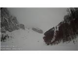
The snowpack is softened due to high temperatures and solar radiation up to the highest peaks on all slopes. Even in shady areas it is wet throughout its depth up to about 1700 m. On sunny grassy slopes in the high mountains, traces of glide-snow avalanches are visible. Wet slab avalanches have also occurred in shady or lee aspects, but they were small.
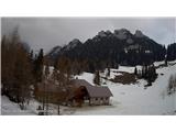
Snow has frozen only superficially above 1500 m locally during the night. Ridges are partially bare in places. Below 1300 m there is very little snow left, sometimes none at all.
Today it will be cloudy. Air temperature at 1500 m will be around +7°C, at 2000 m around +4°C. In the high mountains, SW to W wind with gusts up to 50 km/h will blow. Tonight into Saturday it will start raining. The snow line will be between 1500 and 1700 m. Above 1800 m up to 10 cm of snow may fall, which will bond relatively well with the old wet snow base. Tomorrow, Saturday, it will be cloudy, with new precipitation expected already in the morning. Air temperature at 1500 m around +3°C, at 2000 m around -1°C. W to S wind will blow. The snow line will be around 1600 m. On Sunday morning it will partly clear, but in the afternoon it will cloud over again from the west. Some precipitation is expected, which will taper off on Monday night. The snow line will be somewhere between 1100 and 1200 m.
The snowpack will remain soft, even at night. Tonight into Saturday rain will start up to an altitude of about 1700 m. Higher up, rain will gradually turn to snow. The new snow will bond relatively well with the old snow base. In the high mountains, W to S wind will transport snow into wind slabs and cornices. On Saturday the weather will cool somewhat. The new snow will start to transform and bond faster.
Some new precipitation is expected on Sunday night into Monday. The snow line will be a bit lower. At 1500 m up to 5 cm of snow may fall, somewhat more higher in the high mountains. This snow will not significantly change the avalanche conditions.
Thus, the general avalanche danger will be above 1800 m level 2. On Sunday and Sunday night into Monday the avalanche danger will be slightly higher in the high mountains, where wind will blow and transport snow, building wind slab areas. Below 1800 m it will be level 1.
Source:
https://www.zvsp.si