Snow conditions in the area of the Municipality of Tržič 28.4.2023
28.04.2023
General avalanche danger in the area of the Municipality of Tržič above 1500 m is MODERATE, level 2 on the five-level European scale. Below 1500 m it will be LOW, level 1.
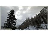
In recent days, the snow cover in the mid-mountains has consolidated significantly. It was also moist in the high mountains. The zero isotherm height was above 1700 m. Above 1800 m there are areas with wind-packed snow. There are many of these especially below rock faces and in narrow gullies of northern slopes. Today, the snow has also moistened on these parts during the day.
Spontaneously, small to medium-sized wet snow avalanches have released on all slopes. Some avalanches were close to their maximum reach. With decreasing elevation, there is also less snow and it melts quickly.
Tomorrow, Friday, it will be cloudy. In the afternoon, some precipitation can be expected. Air temperature at 1500 m will be around +7°C, at 2000 m around +3°C. In the high mountains, SW to W wind up to 30 km/h will blow. It will be warm. Zero isotherm height will be above 2700 m. On Saturday, similar weather with slightly higher temperatures also at elevations. Wind will calm down. On Sunday, cloudy with precipitation.
The snow cover will moisten all the way to the highest peaks in the Municipality of Tržič. Precipitation in the form of rain will additionally burden the snow and it will become heavy. Wet snow avalanches are expected to release on all slopes. Choose appropriate objectives and do not linger under slopes with frequent avalanches. Even at night, the snow cover will not refreeze.
In the mid-mountains and lower, snow melts quickly. Below 1300 m there is very little snow.
Avalanche danger will be level 2 above 1500 m, level 1 below 1500 m. We warn you that snow avalanches can reach the valley bottoms, so be extremely careful!
Source:
https://www.zvsp.si