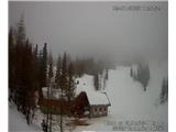
Snow conditions in the area of the Municipality of Tržič 5.1.2022
5.01.2022
Avalanche bulletin 18, Wednesday 5.1.2022 at 5:45 for the area of the Municipality of Tržič.
The general avalanche danger in the area of the Municipality of Tržič will rise to 3rd level on the five-level European scale by late afternoon today!
Yesterday, the snowpack settled somewhat up to an altitude of approximately 1500 meters. Northern slopes of the high mountains are hard, icy in places. Yesterday, a strong SE wind began blowing, bringing more moisture and strongly affecting the snow surface. A few more slab avalanches occurred on sun-exposed slopes. On some grassy slopes, cracks in the snow can still be observed. The snowpack is very unstable in these areas.
Today, it will be cloudy in the mountains above Tržič. In the morning, very cold air will start flowing from the north. The snow line will drop rapidly and reach Tržič in the afternoon. We expect up to 40 cm of new snow at 1500 meters today during the day and overnight to Thursday. Air temperature will be around +2°C until about noon, then around -3°C in the afternoon. A strong SW wind will blow, turning in the afternoon to blow from the north. Lower down, around 1000 meters, there will be slightly less snowfall as it will start snowing later. Afternoon air temperature will be around -2°C with a north wind blowing. Precipitation will cease overnight to Thursday.
Today during the day, up to 40 cm of snow will fall around 1500 meters, more higher up! Above 1500 meters, snow will fall on a hard, icy base and bond very poorly with the old snow surface. Snowfall will be accompanied by a strengthening north wind that will transport snow and form wind slabs, cornices and overhangs. On these parts, you can trigger a snow avalanche with minimal additional load. We expect dry unbonded snow avalanches to release spontaneously as well, especially from the highest peaks. Due to low temperatures in the coming days, the snowpack will transform and settle very slowly. A critical layer will form between the old and new snowpack. The strengthening wind will also create problems, further deteriorating snowpack stability. Below 1500 meters, at the start of snowfall, snow will fall on settled snow. Here it will bond somewhat better with the old base. Locally above 1800 meters, avalanche danger may reach 4th level due to greater amounts of new snow, wind and the critical layer forming between old and new snowpack.
We strongly advise against visiting the mountains in the coming days as conditions will be very demanding and dangerous!! Avalanche danger in the area of the Municipality of Tržič above 1000 meters will remain at 3rd level tomorrow as well!!
Source:
https://www.zvsp.si