Hike.uno
Hike.uno
Login
Login
Username:
Password:
Login
Not registered yet? Registration.
Forgot password?
Hrastnik

Hrastnik

Country: Slovenia
Latitude/Longitude: 46,1456196°N 15,0817358°E
Altitude: 296 m
Type: Town
Weather forecast:
Th
Fr
Sa
Su
Mo
Description:
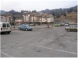
Hrastnik is a town located at an elevation of 296 meters. The town is located in country Slovenia 0. 7 km south from the center of Studence and 0. 8 km northeast from the center of Prapretno pri Hrastniku Hrastnik has 5. 700 inhabitants.
Images:
Hrastnik
Show map
Points in the vicinity:
Detailed descriptions
Klobuk (890m)
2,5 km northeasterly
Planinski dom na Kalu (946m)
3,8 km north-northeasterly
Špicberg (490m)
3,8 km westerly
Ostri vrh (855m)
4 km east-northeasterly
Webcams
Trbovlje
2,4 km west-northwesterly
Marno
4,6 km easterly
Mrzlica
5,1 km north-northeasterly
Kum
6,4 km southerly
Ribnik Vrbje
11,4 km north-northeasterly
Panoramas
Ostri vrh (855m)
4 km east-northeasterly
Baba (above Rečica) (789m)
5,0 km east-northeasterly
Mrzlica (1122m)
5,1 km north-northeasterly
Dom v Gorah (762m)
5,6 km southeasterly
GPS tracks
G. Trbovlje - St. Mary on Partizanski Peak
Posavsko hribovje and Dolenjska
Laško - Narks
Posavsko hribovje and Dolenjska
Dol pri Hrastniku - Spodnji Kal
Posavsko hribovje and Dolenjska
Hrastnik ž.p. - Dom na Kalu
Posavsko hribovje and Dolenjska
Hrastnik - Kal Hut
Posavsko hribovje and Dolenjska
Starting points
Hrastnik
2,7 km south-southeasterly
Dol pri Hrastniku
2,7 km easterly
Hrastnik (Podkraj)
2,8 km south-southeasterly
Krnice
3,6 km south-southeasterly
Trbovlje
4,1 km west-southwesterly
         
Copyright © 2026 Hike.uno, Terms of use, Privacy and cookies