Hike.uno
Hike.uno
Login
Login
Username:
Password:
Login
Not registered yet? Registration.
Forgot password?
Sveti Jurij

Sveti Jurij

Country: Slovenia
Latitude/Longitude: 46,7985851°N 16,0352265°E
Altitude: 234 m
Type: Village
Weather forecast:
Fr
Sa
Su
Mo
Tu
Description:
Sveti Jurij is a village located at an elevation of 234 meters. The village is located in country Slovenia 0. 8 km south from the center of Rogašovci and 1. 6 km southeast from the center of Nuskova Sveti Jurij has 478 inhabitants.
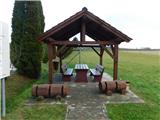
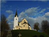
Images:
Sveti Jurij Sveti Jurij
Show map
Points in the vicinity:
Detailed descriptions
Mineral water spring Nuskova (239m)
1,5 km north-northwesterly
Sveta Helena (Pertoča) (298m)
2,4 km south-southwesterly
Beli breg (346m)
2,7 km northwesterly
Planinska koča Rak (290m)
2,8 km northeasterly
Webcams
Kuzma
5,3 km northeasterly
Klöchberg
7,3 km west-southwesterly
Mačkovci
10,0 km easterly
Straden - Saziani
12,9 km westerly
Gederovci
13,4 km southerly
Panoramas
Serdiški breg (Rdeči breg) (416m)
3,9 km north-northwesterly
Rotunda of St. Nikolaj (Selo) (251m)
19,9 km east-southeasterly
Bukovniško jezero (189m)
26,9 km east-southeasterly
Zavrh v Slovenskih goricah (370m)
33 km south-southwesterly
Starting points
Sveti Jurij
0,3 km southerly
Nuskova
1,4 km north-northwesterly
Mineral water spring Nuskova
1,5 km north-northwesterly
Serdica
2,0 km north-northwesterly
Gornji Slaveči (cemetery)
2,5 km northeasterly
         
Copyright © 2026 Hike.uno, Terms of use, Privacy and cookies