Hike.uno
Hike.uno
Login
Login
Username:
Password:
Login
Not registered yet? Registration.
Forgot password?
Rosenberg

Rosenberg

Country: Austria
Latitude/Longitude: 46,8154063°N 15,9231275°E
Altitude: 458 m
Type: Summit
Weather forecast:
Th
Fr
Sa
Su
Mo
Description:
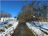
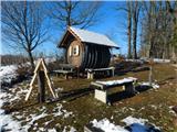
Rosenberg is 458 meter high peak. The peak is located 3 km south of peak Stradner Kogel. And bivouac Abzweigung Merkendorf is also close by.
Images:
Rosenberg Rosenberg
Show map
Points in the vicinity:
Detailed descriptions

3,4 km northerly

4,2 km east-northeasterly

4,5 km southeasterly

5,6 km east-northeasterly

6 km east-northeasterly
Webcams

4,3 km westerly

6,0 km south-southeasterly

12,2 km easterly

15,4 km south-southeasterly

16,0 km southwesterly
Panoramas

7,1 km east-northeasterly

8,5 km east-northeasterly

28,6 km east-southeasterly

31,6 km south-southwesterly

35,3 km east-southeasterly
GPS tracks


Video


Starting points

3,8 km southeasterly

3,9 km north-northwesterly

5,4 km northerly

5,5 km southeasterly

5,8 km easterly
         
Copyright © 2026 Hike.uno, Terms of use, Privacy and cookies