Bavšica - Planina Bukovec
Starting point: Bavšica (698 m)
| Latitude/Longitude: | 46,36990°N 13,62990°E |
| |
Walking time: 2 h
Difficulty: easy marked way
Elevation gain: 648 m
Elevation difference along the route: 660 m
Map: Julijske Alpe - zahodni del 1:50.000
Recommended equipment (summer):
Recommended equipment (winter): ice axe, crampons
Views: 112
 | 3 people like this post |
Access to starting point:
From the Bovec - Predel road, at the Kluže fortress, an asphalt road branches off to the right into the Bavšica valley. We take the mentioned road, which we follow in a moderate ascent to the parking lot in Bavšica (the parking lot is located next to mountain signposts and an information board).
Route description:
From the parking lot we continue along the right road, which quickly takes us to the Planinsko učno središče Bavšica. We continue straight, initially still on the cart track towards Planina Bukovec and Bavški Grintavec. At the benches with a table the cart track ends and the markings direct us slightly to the right onto a footpath. The path crosses the stream Kopica, along which it then ascends. Soon we cross the streambed to the left side and subsequently ascend relatively steeply for some time, mostly above the mentioned stream. The path leads us occasionally through forest and occasionally beside shrubbery. Higher up the valley we are ascending narrows and the path leads us under steep walls. Here the path comes very close to the stream and later also crosses it. After crossing, the path ascends a steeper slope where a piton is also helpful at one short section. There follows a further ascent mostly through forest, after which the path takes us to the hunting hut on Planina Bukovec.

Along the route: Planinsko učno središče (713m)
Photos:
 1
1 2
2 3
3 4
4 5
5 6
6 7
7 8
8 9
9 10
10 11
11 12
12 13
13 14
14 15
15 16
16 17
17 18
18 19
19 20
20 21
21 22
22 23
23 24
24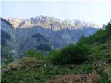 25
25
Discussion about the trip Bavšica - Planina Bukovec
To post a comment you must log in:
If you do not yet have a username, you must first
register.