Starting point: Zgornji Gabernik (301 m)
| Latitude/Longitude: | 46,27150°N 15,57350°E |
| |
Walking time: 1 h 10 min
Difficulty: easy unmarked way
Elevation gain: 383 m
Elevation difference along the route: 390 m
Map: Posavsko hribovje Boč - Bohor 1:50.000
Recommended equipment (summer):
Recommended equipment (winter): ice axe, crampons
Views: 33
 | 1 person like this post |
Access to starting point:
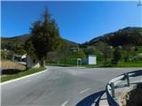
a) From the Celje - Rogaška Slatina road, we drive to the Podplat settlement, where from the traffic-light intersection next to the Petrol gas station we turn in the direction of Maribor, Slovenska Bistrica and Poljčane. Already soon, or behind Tehnični pregledi Strašek, we turn right following the road signs for Gabernik, then we drive through the centre of Spodnji Gabernik to Zgornji Gabernik, where the described trail begins at the water filling station. At the starting point there is the Zgornji Gabernik bus stop and hiking direction signs. There are no suitable parking spots at the beginning of the described trail.
b) We drive to Poljčane, then continue driving in the direction of Rogaška Slatina and Podčetrtek. The route further leads us over the Pečice pass; once we descend into the valley on the other side, we turn left onto the side road before the Tehnični pregledi Strašek building, next to which there are road signs for Gabernik. We then drive through the centre of Spodnji Gabernik to Zgornji Gabernik, where the described trail begins at the water filling station. At the starting point there is the Zgornji Gabernik bus stop and hiking direction signs. There are no suitable parking spots at the beginning of the described trail.
Route description:
From the starting point we continue along the asphalt road, next to which there are signs for Boč and Dom na Boču. At first we walk northwards, soon the road turns right and gradually climbs to a quarry, where we turn left onto a steep gravel road, ascending transversely above the fenced pasture.
When a little higher we reach the weekend cottage among the vineyards we turn right and climb along the vineyard to another, smaller cottage, where we cross the access track.
The path ahead begins to climb steeply, first through the forest, then through sparse woodland along an occasionally quite steep ridge, where at some points, especially on the descent, extra caution is needed to avoid slipping. Higher up the ridge levels off somewhat and the path from Pečice joins us from the left.
We continue right towards Boč, while the marked path continues along the ridge for a short while longer, then turns right.
At the point where the marked path turns right, we leave it and continue straight ahead along the trodden but subsequently unmarked path, which first takes us to the sub-summit of Galke, from which we continue along a gentler path to the summit of Galke, where there is a bench and from which some views open up.
Starting point - Galke junction 0:50, Galke junction - junction off marked path 0:05, junction off marked path - Galke 0:15.
Description and photos refer to the conditions in April 2026.

Along the route: Razpotje Galke (600m), Odcep z markirane poti (625m)
Photos:
 1
1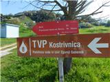 2
2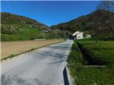 3
3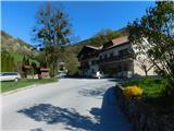 4
4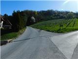 5
5 6
6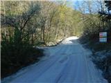 7
7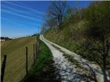 8
8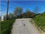 9
9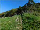 10
10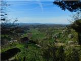 11
11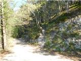 12
12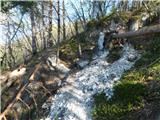 13
13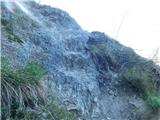 14
14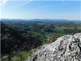 15
15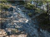 16
16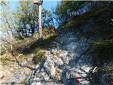 17
17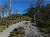 18
18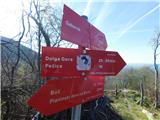 19
19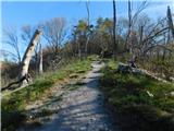 20
20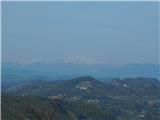 21
21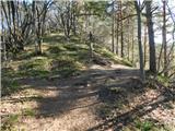 22
22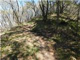 23
23 24
24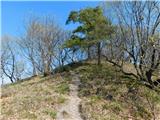 25
25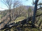 26
26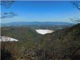 27
27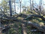 28
28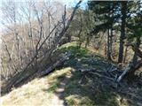 29
29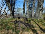 30
30
Discussion about the trip Zgornji Gabernik - Galke
To post a comment you must log in:
If you do not yet have a username, you must first
register.