Vrhovlje pri Kojskem - Dom na Sabotinu
Starting point: Vrhovlje pri Kojskem (385 m)
| Latitude/Longitude: | 46,02214°N 13,57644°E |
| |
Walking time: 2 h 5 min
Difficulty: easy marked way
Elevation gain: 175 m
Elevation difference along the route: 230 m
Map:
Recommended equipment (summer):
Recommended equipment (winter):
Views: 110
 | 1 person like this post |
Access to starting point:
From the Nova Gorica-Tolmin road we drive to the settlement Plave, from where we continue driving in the direction of the settlement Dobrovo. This is followed by some descent, after the bridge over the Soča river we turn left and start ascending again. Higher up we arrive at the settlement Vrhovlje pri Kojskem, where we gradually start descending, but we drive to the tourist information board, where there is a small asphalt parking lot at the intersection.
Route description:
From the starting point we follow the signs for the hiking trail towards Šmartno (not on the main road), where we initially walk east on a side asphalt road that turns into a cart track after the last house. The cart track soon leads us to a meadow, then turns into a forest where it forks. To the right branches off the hiking trail that leads further to Šmartno, but we continue straight and follow the Knafelč markings. A little further, at a small pass we reach a gravel road, which we reach exactly at the intersection, but we continue straight in the direction towards Sabotin.
In the continuation we walk for some time on the gravel road, which leads us past the hunting lodge and the NOB monument, and a few minutes further we gradually enter the forest on a forest path, where at several junctions we follow the Knafelč markings or signs for Sabotin or Solkan. This is followed by some gentle descent, then we start moderately ascending through the forest, and when the forest thins we reach a scenic ridge above the right bank of the Soča river. This is followed by quite a few gentle to moderate ascents along the mentioned ridge, with occasional exceptional views of the Soča river and surrounding mountains. Later the path moves slightly to the right of the ridge and leads us along old military trenches, where at junctions we follow the Knafelč markings. When the path widens we quickly leave the forest and arrive at the scenic part by the Koča na Sabotinu.
The description and pictures refer to the situation in October 2026.
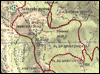
Along the route: Lovska koča (400m), Sv. Primož (405m)
Photos:
 1
 2
 3
 4
 5
 6
 7
 8
 9
 10
 11
 12
 13
 14
 15
 16
 17
 18
 19
 20
 21
 22
 23
 24
 25
 26
 27
 28
 29
 30
 31
 32
 33
 34
 35
Discussion about the trip Vrhovlje pri Kojskem - Dom na Sabotinu
To post a comment you must log in:
If you do not yet have a username, you must first
register.