Vrhovlje pri Kojskem - Korada
Starting point: Vrhovlje pri Kojskem (385 m)
| Latitude/Longitude: | 46,02214°N 13,57644°E |
| |
Walking time: 2 h
Difficulty: easy marked way
Elevation gain: 427 m
Elevation difference along the route: 470 m
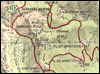
Map:
Recommended equipment (summer):
Recommended equipment (winter):
Views: 46
 | 1 person like this post |
Access to starting point:
From the Nova Gorica-Tolmin road we drive to the settlement of Plave, from where we continue driving in the direction of the settlement of Dobrovo. This is followed by some descent, after the bridge over the Soča river we turn left and start ascending again. Higher up we arrive at the settlement of Vrhovlje pri Kojskem, where we gradually start descending, but we drive to the tourist information board, where there is a small asphalt parking lot at the intersection.
Route description:
From the starting point we follow the signs for Korada and on the road by which we arrived at the starting point (if we came to the starting point from the direction of the settlement of Plave) we start returning towards Plave. At first we ascend lightly through the settlement, after the NOB monument we start descending. When we start descending, the path to the Church of the Virgin Mary at Kapela first branches off to the left, but we continue straight and continue on the main road, along which the Knafelč markings continue. Somewhat lower we turn slightly left onto a narrower asphalt road, along which there are signs for Korada and the settlements of Lig and Višnjevik. This is followed by some ascent and just before the next intersection another path joins from the left, leading past the Church of the Virgin Mary.
We continue straight, for some time still on the asphalt road, where we follow the markings at intersections, then we turn slightly right onto a marked footpath, which continues through the forest and then bypasses the hill Strmec on the right side. North of Strmec we return to the asphalt road, then from the nearby intersection we turn slightly left onto the road with signs for Bela and Nozno. A little further on, looking to the left side, a beautiful view opens in the direction of the Goriška Brda, and the view extends all the way to the sea. When we return to the forest the asphalt road soon turns slightly left, to the right a gravel road branches off, but we continue on the marked path, which continues between the two roads and a minute later returns to the asphalt road that we left lower down when we continued left towards Nozno at the intersection. This is followed by a short section of the path on the asphalt road, where looking to the right a beautiful view opens in the direction of the Trnovski gozd, then red mountain direction signs direct us slightly left onto a path that continues through the forest. Just a little further we cross the road we left, then we ascend for some time along the right edge of the pasture, higher up the path levels out and leads us across a meadow, where on the right we notice a kind of chapel or the remains of a military altar. Further on the path widens into a cart track, which bypasses a weekend house on the upper, right side. After the weekend house we step onto the asphalt road, when the road returns to the forest we turn left onto the road with signs for the settlement of Senik, and after a few steps right onto a poorer road, which after a minute returns to the wider gravel road. At the place where we return to the wider gravel road we immediately turn right onto a footpath with signs for the mountain hut. The path continues in a moderate ascent through the forest, higher up we also ascend across a meadow, after which we gradually return to the asphalt road. The asphalt road then branches once more, but we continue on the mountain path between the roads, soon the path leads us to the left road, which we also do not follow for long. When we leave the forest, we also leave the road leading to the nearby hunting lodge and continue right in the direction of Korada. Here the path returns to the forest once more, and a little further on the path branches. To the right an marked but unmarked path branches off towards the summit of Korada, but we keep to the left path, which a little further leads us to the Planinsko zavetišče na Koradi.
At the shelter we turn right in the direction of Plave and Kanal and in a few minutes with beautiful views we ascend to the summit of Korada.
Vrhovlje - zavetišče na Koradi 1:55, zavetišče na Koradi - Korada 0:05.
The description and pictures refer to the situation in October 2026.
Photos:
 1
 2
 3
 4
 5
 6
 7
 8
 9
 10
 11
 12
 13
 14
 15
 16
 17
 18
 19
 20
 21
 22
 23
 24
 25
 26
 27
 28
 29
 30
 31
 32
 33
 34
 35
 36
 37
 38
 39
 40
 41
 42
 43
 44
 45
 46
 47
 48
 49
 50
Discussion about the trip Vrhovlje pri Kojskem - Korada
To post a comment you must log in:
If you do not yet have a username, you must first
register.