Smučišče Koralpe (Koralpenparkplatz) - Steinschneider
Starting point: Smučišče Koralpe (Koralpenparkplatz) (1627 m)
| Latitude/Longitude: | 46,80770°N 14,94662°E |
| |
Walking time: 1 h 20 min
Difficulty: easy marked way
Elevation gain: 443 m
Elevation difference along the route: 443 m
Map: WK 237 Saualpe-Lavanttal-Koralpe 1:50.000
Recommended equipment (summer):
Recommended equipment (winter): ice axe, crampons
Views: 30
 | 1 person like this post |
Access to starting point:
a) Via Dravograd: We drive across the border crossing Vič and continue through Št. Andrež (St. Andrä) to the town of Volšperk (Wolfsberg). In the town, traffic signs for Koralpe direct us to the right. The ascending mountain road then takes us through the settlements of Št. Štefan (St. Stefan), Maildorf and Rieding to the large central parking lot below the ski resort – Smučišče Koralpe (Koralpenparkplatz).
Note: Parking at the central parking lot is subject to a charge. The daily parking fee amounts to 5 €, the payment machine is located at the entrance to the parking lot.
b) Via the motorway (A2): We exit the Gradec–Celovec motorway at the Wolfsberg Süd exit. At the intersection, we turn right towards the town center, then at the shopping center turn right again towards Koralpe. The ascending mountain road then takes us through the settlements of Št. Štefan (St. Stefan), Maildorf and Rieding to the large central parking lot below the ski resort – Smučišče Koralpe (Koralpenparkplatz).
Note: Parking at the central parking lot is subject to a charge. The daily parking fee amounts to 5 €, the payment machine is located at the entrance to the parking lot.
Route description:
At the beginning of the large parking lot we turn sharply right onto the road which quickly brings us to the left hairpin bend, where there is another, smaller parking lot. From here we continue on the asphalt road closed to public traffic in the direction of the Koralpenhaus hut and the Großer Speikkogel summit. The marked path a little higher crosses two hairpins, then we continue on the road to the point where it turns right.
At the point where the road turns right, we continue straight ahead and continue the ascent along the ski slope route. In summer there is an extensive grazing area here, so some caution is required when encountering livestock. On this section we ascend on a well-trodden path and the markings are rather sparse.
Higher up the path gradually transitions from the northern to the south-western slopes and approaches the road we left lower down. This is followed by a traversing ascent to the right with beautiful views of Austrian Carinthia. When near the Koralpenhaus hut we step onto the asphalt road, we simply cross it and are already at the renovated mountain hut.
We bypass the hut on the left side and continue for a short time on the asphalt road, next to which there are signs for Großes Kar and the Grillitschhütte hut, then we go left onto the footpath which ascends across the scenic grassy slope; higher up we return to the road or reach the gravel road which branched left from the asphalt. We follow the mentioned road to the left and on it we quickly reach the Steinschneider summit.
Starting point - Koralpenhaus 1:00, Koralpenhaus - Steinschneider 0:20.
The description and pictures refer to the situation in July 2023 and June 2026.

Photos:
 1
1 2
2 3
3 4
4 5
5 6
6 7
7 8
8 9
9 10
10 11
11 12
12 13
13 14
14 15
15 16
16 17
17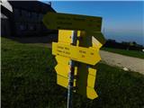 18
18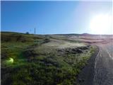 19
19 20
20 21
21 22
22
Discussion about the trip Smučišče Koralpe (Koralpenparkplatz) - Steinschneider
To post a comment you must log in:
If you do not yet have a username, you must first
register.