V Koncu - Bivouac in Kočna
Starting point: V Koncu (875 m)
| Latitude/Longitude: | 46,34200°N 14,56820°E |
| |
Walking time: 4 h 25 min
Difficulty: difficult marked way, partly demanding unmarked way
Elevation gain: 1077 m
Elevation difference along the route: 1250 m
Map: Kamniške in Savinjske Alpe 1:50.000
Recommended equipment (summer): helmet
Recommended equipment (winter): helmet, ice axe, crampons
Views: 112
 | 1 person like this post |
Access to starting point:
a) We drive to Kamnik, then follow the signs for Kamniška Bistrica and Črnivec Pass. In Stahovica at the traffic light intersection we turn left towards Kamniška Bistrica (straight ahead Črnivec Pass) and drive to Dom v Kamniški Bistrici. We bypass the mountain hut on the right side. The asphalt ends a little higher up, from there we continue on a gravel road that soon forks. We keep to the lower left road (right leads to a footpath towards Kokrsko sedlo), and at subsequent intersections we follow the signs for Grintovec. We park at the parking lot by the lower station of the freight cable car to Kokrsko sedlo. Driving and parking beyond the freight cable car is prohibited (there is no prohibition sign, but fines of €1,000 are regularly issued). In winter, driving from Koča v Kamniški Bistrici to the parking lot V Koncu is prohibited by a traffic sign, which extends the walk by almost an hour.
b) From the direction of Gornji Grad we drive to Črnivec Pass, then start descending towards Kamnik. When we reach Stahovica, at the traffic light intersection we turn right towards Kamniška Bistrica (straight ahead Kamnik) and drive to Dom v Kamniški Bistrici. We bypass the mountain hut on the right side. The asphalt ends a little higher up, from there we continue on a gravel road that soon forks. We keep to the lower left road (right leads to a footpath towards Kokrsko sedlo), and at subsequent intersections we follow the signs for Grintovec. We park at the parking lot by the lower station of the freight cable car to Kokrsko sedlo. Driving and parking beyond the freight cable car is prohibited (there is no prohibition sign, but fines of €1,000 are regularly issued). In winter, driving from Koča v Kamniški Bistrici to the parking lot V Koncu is prohibited by a traffic sign, which extends the walk by almost an hour.
c) From Luče we drive to Podvolovljek, then on a steep road we ascend to Volovljek Pass (the pass is also known as Kranjski Rak after the inn there). From there we start descending towards Kamnik. Lower down we join the road from Črnivec Pass, where we turn right downhill. When we reach Stahovica, at the traffic light intersection we turn right towards Kamniška Bistrica (straight ahead Kamnik) and drive to Dom v Kamniški Bistrici. We bypass the mountain hut on the right side. The asphalt ends a little higher up, from there we continue on a gravel road that soon forks. We keep to the lower left road (right leads to a footpath towards Kokrsko sedlo), and at subsequent intersections we follow the signs for Grintovec. We park at the parking lot by the lower station of the freight cable car to Kokrsko sedlo. Driving and parking beyond the freight cable car is prohibited (there is no prohibition sign, but fines of €1,000 are regularly issued). In winter, driving from Koča v Kamniški Bistrici to the parking lot V Koncu is prohibited by a traffic sign, which extends the walk by almost an hour.
Route description:
S parkirišča se usmerimo levo na markirano pešpot v smeri Cojzove koče na Kokrskem sedlu, Grintovca in Skute (naravnost neoznačeni poti čez Gamsov skret in Žmavčarje) . Pot nas sprva vodi po desni strani tovorne žičnice, a že takoj preide v gozd, skozi katerega se začne najprej zmerno, kmalu pa precej strmo vzpenjati. Lepo urejena pot nas višje pripelje do kratkega, strmejšega skokca. Tu sta bili včasih nameščeni dve krajši jeklenici, ki pa so ju odstranili. V suhem prehod ni zahteven, nekaj več previdnosti pa je potrebne predvsem pri sestopu in v mokrem.
Nad strmim delom prispemo do klopce, kjer si lahko privoščimo krajši počitek. Pot se nato še nekaj časa nadaljuje skozi gozd. Za prečenjem hudournika prispemo najprej v pas nizkega drevja, nato pa pod pečine Malega vrha (1915 m), kjer je predvsem spomladi in po dežju povečana nevarnost padajočega kamenja.
V nadaljevanju pot postane bolj gruščnata in strma, kar nam lahko vzame nekaj dodatne energije. Se nam pa zato odpirajo čudoviti pogledi na gore nad dolino Kamniške Bistrice, pri čemer izstopajo mogočna ostenja bližnje Kalške gore. Sledi še nekaj prečnega vzpona preko melišč, nato pa kamnita pot preide na razgledna travnata pobočja. Ob njih se nato vzpnemo do Kokrskega sedla, kjer na levi zagledamo planinski dom, v smeri naravnost pa se nam odpre lep pogled še v smeri doline reke Kokre.
S Kokrskega sedla nadaljujemo desno v smeri Grintovca, Skute in Kamniškega sedla čez Sleme (levo Kalška gora, Kalški greben in Krvavec, naravnost navzdol Kokra in Suhadolnik). Sprva se precej strmo vzpnemo po pobočjih, ki se dvigajo severno od sedla. Po desetih minutah strmina popusti in prispemo na označeno razpotje, kjer se usmerimo levo v smeri Grintovca in Kočne (desno vodi pot proti Kamniškemu sedlu in Skuti).
Pot naprej se kratek čas še lahkotno prečno vzpenja proti levi, nato pa sledi nekaj prečnega spusta do ravnice Spodnje Jame. Od tod se začnemo prečno vzpenjati po strmem pobočju, dokler ne dosežemo razpotja na Ovnovi čeri.
Nadaljujemo levo proti Kočni, desno pa vodi pot na vrh Grintovca. Pot nato preči strma travnata pobočja proti zahodu in se nato prične spuščati. Kasneje pot zavije v desno in se še naprej rahlo spušča ter preči rahlo izpostavljena pobočja vse do položnih travnatih pobočij (Srednji Dolci). Tu se priključimo poti, ki vodi čez Grdi graben, nekaj metrov pozneje pa smo ponovno na razpotju.
Usmerimo se levo proti bivaku in Kokrski Kočni, desno pa vodi pot proti Dolški škrbini in nato naprej proti Jezerski Kočni ali Grintovcu. Pot nato preči melišče v levo in se vzpne čez kratko grapo.
Malo nad grapo se levo odcepi neoznačena pot proti Bivaku pod Kočno katerega lahko že vidimo in je z markirane poti oddaljen samo nekaj minut hoje, do njega pa prispemo v rahlem spustu po travnatem pobočju.
Izhodišče - Kokrsko sedlo 2:30, Kokrsko sedlo - razpotje nad sedlom 0:10, razpotje nad sedlom - Ovnov čer 0:40, Ovnov čer - Spodnji Dolci 0:30, Spodnji Dolci - Srednji Dolci 0:05, Srednji Dolci - odcep k bivaku 0:20, odcep k bivaku - Bivak v Kočni 0:10.

Along the route: Pri debeli bukvi (1174m),
Cojzova koča na Kokrskem sedlu (1793m), Razpotje nad sedlom (1859m), Ovnov čer (2021m), Spodnji Dolci (1865m), Srednji Dolci (1900m), Odcep k Bivaku v Kočni (1992m)
Photos:
 1
1 2
2 3
3 4
4 5
5 6
6 7
7 8
8 9
9 10
10 11
11 12
12 13
13 14
14 15
15 16
16 17
17 18
18 19
19 20
20 21
21 22
22 23
23 24
24 25
25 26
26 27
27 28
28 29
29 30
30 31
31 32
32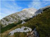 33
33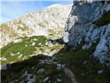 34
34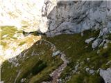 35
35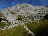 36
36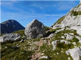 37
37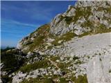 38
38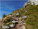 39
39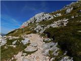 40
40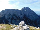 41
41 42
42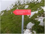 43
43 44
44 45
45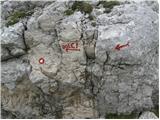 46
46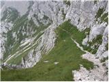 47
47 48
48 49
49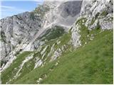 50
50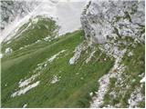 51
51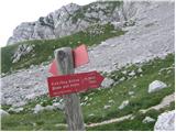 52
52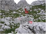 53
53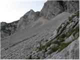 54
54 55
55 56
56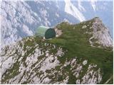 57
57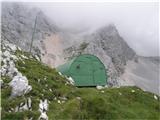 58
58
Discussion about the trip V Koncu - Bivouac in Kočna
To post a comment you must log in:
If you do not yet have a username, you must first
register.