Jama Pekel (parkirišče) - Jama Pekel (Forest and geological educational trail)
Starting point: Jama Pekel (parkirišče) (284 m)
| Latitude/Longitude: | 46,28610°N 15,13130°E |
| |
Route name: Forest and geological educational trail
Walking time: 40 min
Difficulty: easy marked way
Elevation gain: 16 m
Elevation difference along the route: 140 m
Map:
Recommended equipment (summer):
Recommended equipment (winter): ice axe, crampons
Views: 26
 | 1 person like this post |
Access to starting point:
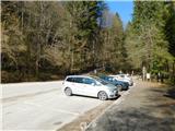
We leave the Styrian motorway at the Šempeter exit in the Savinja Valley and follow the signs for Šempeter. When we arrive in Šempeter, at the traffic-light intersection we follow the signpost for Jama Pekel and turn left. Immediately after crossing the railway line we turn right towards Podlog. In the settlement of Podlog in the Savinja Valley, at the roundabout we follow the signs for Jama Pekel and Zalog pri Podlogu. We continue through the underpass under the motorway and through the village Zalog pri Podlogu. Along the asphalt road we follow the signpost that directs us left and soon reach the well-arranged and spacious asphalt parking lot in front of the entrance to Jama Pekel, where we park.
Route description:
From the parking lot we continue on foot along the arranged, wide and compacted path leading north towards the cave entrance and to the right of the road. The path runs along the picturesque Peklenščica stream, which accompanies us on our left side. After a few minutes of walking we arrive at the information point (wooden hut), where there is a cash desk where we can buy a ticket for Jama Pekel before guided tours.
At the wooden hut we go sharply left onto the path along which the markings continue and which also leads the Forest and Geological Educational Trail Pekel. There follows some traverse ascent to the left, then the path turns right and climbs over a wooden footbridge, behind it turns left again and a bit further joins a cart track which we follow to the right (left unmarked shortcut towards the top of Apno). There follows a traverse ascent to the right, higher up we also cross a steep path, i.e. the route of the return educational trail. Only a short easy ascent remains and we arrive at the logbook box at Pogorišče.
After the logbook box we go left, passing some information boards, then we begin to descend and soon cross the cart track that we ascended a few minutes ago. A short somewhat steeper descent follows along the forest path through the forest, then at the exit from Jama Pekel the path widens and along the wide and fenced path we descend to the cave entrance, from there back to the parking lot along the already known path.
Starting point - Jama Pekel 0:05, Jama Pekel - Pogorišče 0:20, Pogorišče - Jama Pekel 0:10, Jama Pekel - parking lot 0:05.
Description and photos refer to the status in February 2026.

Photos:
 1
1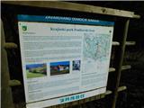 2
2 3
3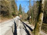 4
4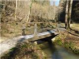 5
5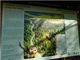 6
6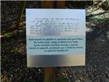 7
7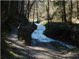 8
8 9
9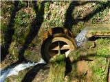 10
10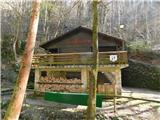 11
11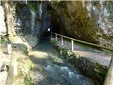 12
12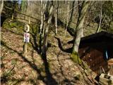 13
13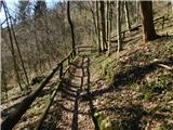 14
14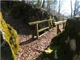 15
15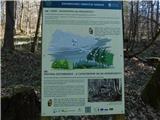 16
16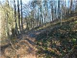 17
17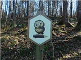 18
18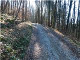 19
19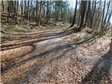 20
20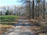 21
21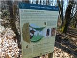 22
22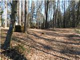 23
23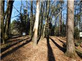 24
24 25
25 26
26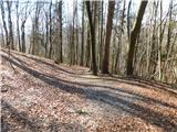 27
27 28
28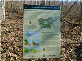 29
29 30
30 31
31 32
32 33
33 34
34 35
35 36
36
Discussion about the trip Jama Pekel (parkirišče) - Jama Pekel (Forest and geological educational trail)
To post a comment you must log in:
If you do not yet have a username, you must first
register.