Ljubnica - Golek (zgornja pot)
Starting point: Ljubnica (515 m)
| Latitude/Longitude: | 46,38357°N 15,34629°E |
| |
Route name: zgornja pot
Walking time: 45 min
Difficulty: easy marked way
Elevation gain: 254 m
Elevation difference along the route: 260 m
Map:
Recommended equipment (summer):
Recommended equipment (winter): ice axe, crampons
Views: 30
 | 1 person like this post |
Access to starting point:
From the road Vojnik - Slovenske Konjice, at the roundabout in the settlement Stranice, we take the exit for Zgornji Dolič and Vitanje.
Then in the settlement Lipa, more precisely opposite the bus stop, we turn sharply right onto a side road that quickly ascends above the village.
On this road we drive approximately 2 kilometers, until the valley narrows into a gorge. Here, at the entrance to the forest, on the right side we notice a cart track that leads left from the nearby house and along which the marked path begins.
Warning: There are no suitable parking spaces at the starting point itself.
Instruction: There are no arranged parking areas even in the immediate vicinity, so the vehicle must be parked lower in the settlement at a suitable place where we do not obstruct traffic, or we proceed to the starting point on foot, which lengthens the route.
Route description:
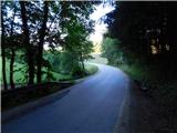
From the asphalt road we turn onto the cart track that branches off to the east and in a few steps leads us along the edge of the meadow into the forest, through which it begins to ascend transversely. We bypass the house on the right mostly on the left side, then carefully follow the branch of the steep and less visible marked path that branches sharply to the right from the cart track (the branch is not specially marked). Along the trail we cross the slopes to the right for a short time, but when we are somewhat above the house, the trail turns slightly left and ascends transversely across the steep and especially in wet conditions slippery slope.
Later the path passes onto the ridge, which is precipitous on the left side in several places, but is constantly overgrown with forest. The marked path mainly runs a few steps to the right of the ridge, so there is no greater danger of slipping. Higher up we reach an arranged viewpoint, which is increasingly overgrown by forest, but from there we still have a beautiful view towards the Carinthian beauties – Peca and Uršlja gora.
In the continuation we also ascend along the ridge for some time, but the steepness of the path gradually eases and the ridge also widens. Later there follow several successive junctions, where we even descend for a few steps temporarily. When we start ascending again, we continue the path on the left side of the pasture, and along it we walk all the way to the summit of Golek. From the summit we have a beautiful view towards the southwest, while on the other sides the view is obstructed by forest.
The description and pictures refer to the situation in June 2026.

Photos:
 1
1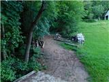 2
2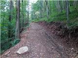 3
3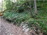 4
4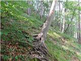 5
5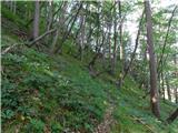 6
6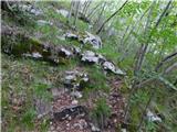 7
7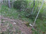 8
8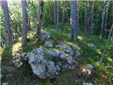 9
9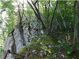 10
10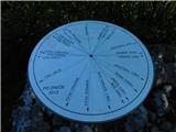 11
11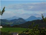 12
12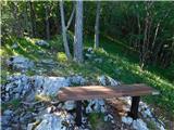 13
13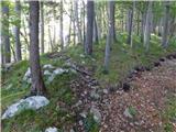 14
14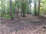 15
15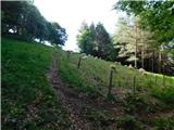 16
16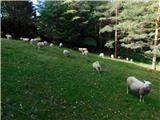 17
17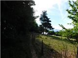 18
18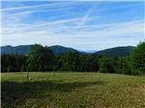 19
19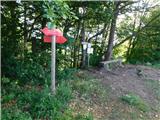 20
20
Discussion about the trip Ljubnica - Golek (zgornja pot)
To post a comment you must log in:
If you do not yet have a username, you must first
register.