|
| IgorZlodej13. 10. 2012 20:50:35 |
Since it belongs to this area and so as not to open a new topic, I'll describe the approach to Bivacco Bianchi here. I park before the roadblock, then go along an almost flat path for about 15 minutes and at the junction turn right, cross the Alba stream and go to casera Crostis. Twice in between you have to descend a bit. When I leave the former alpine pasture
Crostis, I reach another junction, right goes the path to škrbina Vidus, which ends somewhere between Pisimon and Crostis, but I choose škrbina Fonderis. From škrbina Fonderis I descend below the southern walls of Zuc dal Bora and go to bivouac G. Bianchi, which is located on a scenic flat area below Chivals. From there I go to the unserviced hut Vulat and back to the parking lot. Nice loop above the Alba valley, which would be even nicer if there was some sun.
| (+7) |  | |
|
|
|
|
| svicr18. 11. 2012 11:48:16 |
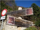
From Tabla (Pontebba) to Mužac (Moggio Udinese) into the Aupa valley, through the village Pradis, high above the Alba valley, where we left the car at the arranged parking lot under the ramp. Along a nice road to rifugio Vualt, from there along a modest trail to the abandoned alpine pasture Forchiettis. From here on along the arranged path 425 to three notches that bite sharply into Crete di Gleris. Forc. Forchiadice, Forc. Vacca (Cow notch) and Forc. Pecora (Sheep notch) are the notches that follow each other, connected by the Alta Via C.A.I. Moggio path, which in this section is a comfortable mule track. Soon after the last - Sheep notch, we arrive below Monte Chiavals, which we climb via the frozen western ridge. Views from the top excellent. We descend via the southern variant to bivacco Bianchi, via path 428 we complete the nice loop tour.
 1 1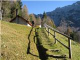 2 2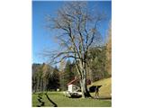 3 3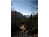 4 4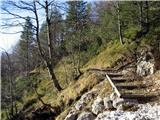 5 5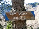 6 6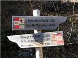 7 7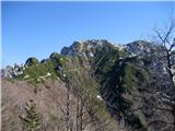 8 8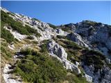 9 9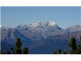 10 10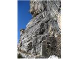 11 11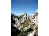 12 12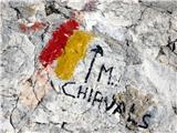 13 13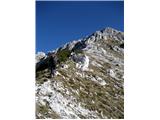 14 14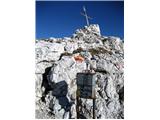 15 15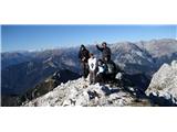 16 16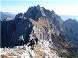 17 17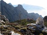 18 18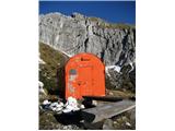 19 19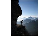 20 20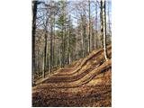 21 21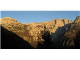 22 22
| (+12) | | |
|
|
|
|
| Lj18. 11. 2012 13:49:35 |
Great photos, the most beautiful to me is no. 20..
| (+4) | | |
|
|
|
|
| IgorZlodej18. 11. 2012 13:59:28 |
Wonderful @svicr, wonderful autumn loop, but anytime it's wonderful there
| (+2) | | |
|
|
|
|
| GITA18. 11. 2012 14:46:43 |
@svicr, beautiful. Saved, written on the wishlist...
| (+2) | | |
|
|
|
|
| svicr18. 11. 2012 16:52:35 |
Thanks, the trip was really nice, I recommend it ... the praise for the photos I'll have to share with our @kofetarco 
| (+3) | | |
|
|
|
|
| IgorZlodej18. 07. 2014 19:45:50 |
This time to the summit from Kanalska dolina Ponte di Muro (around 460) and further along path 429A to the abandoned same-named planina, then long traverse under the eastern walls of Chiavals, and over Chiavals saddle to the summit, descent along path 428. Both mentioned paths are obviously long abandoned and quite overgrown.
| (+2) | | |
|
|
|
|
| IgorZlodej15. 09. 2014 18:54:39 |
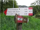
Chiavals can also be reached from Aupa valley. I went yesterday from Dordola village. First to Vualt saddle, there the Sentiero Creste path tempted me and it really is nice. The trail, marked with blue spots, mostly runs right below the ridges, a bit on the eastern side, a bit on the western, some on the ridge itself and is extremely scenic on the surrounding mountains. Just before joining path 422 I spot the bivak Chiasut dal Scior, where it's so nice you shouldn't hurry on. After the break I decided to check below Chiavals, at Vacca saddle I caught up with two cyclists whom I met down at the village parking. We walked together for a while, then I pulled ahead a bit, and met again below bivak Binachi. I went to the unmanned hut Vualt and on to the saddle, where I closed the loop, those two to bivak Chiasut dal Scior. Unfortunately I didn't wait for them down in the village. Recommend for a nice autumn day.
 1 1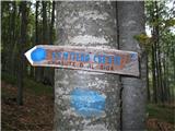 2 2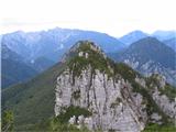 3 3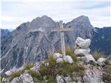 4 4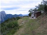 5 5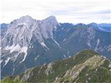 6 6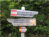 7 7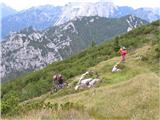 8 8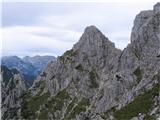 9 9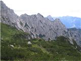 10 10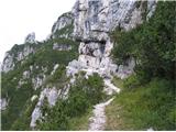 11 11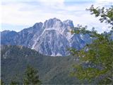 12 12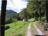 13 13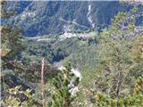 14 14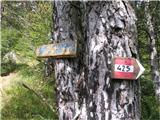 15 15
| (+4) | | |
|
|
|
|
| tine.sl15. 09. 2014 20:26:27 |
It's nice in those places. I've been there many times by bike myself, so I'm curious about your opinion why cyclists are not annoying there but with us 
|
|
|
|
| LidijaJesih26. 12. 2016 18:20:49 |
The name of the path from picture 2 (previous post) has changed. Now it's Sentiero "Palis d'Arint", the sign is different, the paths around here are still nice.
 1 1
| (+1) | | |
|
|
|
|
| malimiha1. 05. 2018 16:40:53 |
Has anyone been up there recently? What are the conditions like? Thanks and best regards.
|
|
|
|
| LidijaJesih1. 05. 2018 17:36:50 |
View from neighboring Monticella, if it helps, two days ago.
 1 1
|
|
|
|
| ljubitelj gora20. 05. 2018 20:58:46 |
Starting point above Val Albo by car along mountain road where I park at a good 1000m. Above Pradis village. Up past bivouac and along southern ridge. Goes without winter gear, i.e. already more bare. Descend and drive above Dogna along mountain road to start for Pipar, also there without winter gear.
| (+4) | | |
|
|
|
|
| Bandzo29. 09. 2018 11:51:51 |
Yesterday, 28.09.2018 my wife and I set off to explore the Carnic Alps from Val Alba valley. After a long time we wanted easier tours where you really don't have to rush anywhere. So we found Monte Chiavals. Just looking at Tabacco map 18 nicely showed us how nice a loop we can make around here. Up path 425, Via Alti, Z ridge to summit and return along southern ridge past renovated bivouac Bianchi and then 428a back to car. Weather forecast promised a day that is a real rarity so you have to seize it.  And so we went and after 2h20min drive we were at 6.40am at parking before no-entry sign. At parking we scared a lynx cub (they stocked the valley with lynxes from Slovenia) and listened a bit to very interesting sounds from the valley And so we went and after 2h20min drive we were at 6.40am at parking before no-entry sign. At parking we scared a lynx cub (they stocked the valley with lynxes from Slovenia) and listened a bit to very interesting sounds from the valley  Well, we'll whistle a bit with the whistle to scare off some bear if it's wandering there And we headed slowly towards Rifugio Vualtu and further past military hospital towards high path. Ascent moderate, nature wonderful and silence cut only by our talk. When joining path 422 we reach sun rays and path becomes even nicer. Continuation on nicely built mulattiera carved into rocks of the seven spires leads past some military ruins. When we descend to Kravja saddle, then only up and up. Views really wonderful. After very steep ascent over Z ridge on summit we rest our souls, drink tea, nap a bit and simply enjoy views where it's clear over entire Alpine world from Austria via Slovenia, Italy to Swiss border not a single cloud in sight. Really, exceptional visibility. Dolomites, Hohe Tauern, Gailtal Alps, Lienz Dolomites, Julian Alps, Triglav, Kepa, Kanin... Nothing missing And of course Po Valley and sea. Really nice viewpoint is Monte Chiavals. On return we meet positive Polona, exchange few words and cheerfully go each our own way. Rest in shade of bivouac Bianchi then short steep descent and leisurely continuation on path 428 to junction left to 428a. From here practically flat walk back to car. Val Alba valley will definitely see us again since it's wonderful Well, we'll whistle a bit with the whistle to scare off some bear if it's wandering there And we headed slowly towards Rifugio Vualtu and further past military hospital towards high path. Ascent moderate, nature wonderful and silence cut only by our talk. When joining path 422 we reach sun rays and path becomes even nicer. Continuation on nicely built mulattiera carved into rocks of the seven spires leads past some military ruins. When we descend to Kravja saddle, then only up and up. Views really wonderful. After very steep ascent over Z ridge on summit we rest our souls, drink tea, nap a bit and simply enjoy views where it's clear over entire Alpine world from Austria via Slovenia, Italy to Swiss border not a single cloud in sight. Really, exceptional visibility. Dolomites, Hohe Tauern, Gailtal Alps, Lienz Dolomites, Julian Alps, Triglav, Kepa, Kanin... Nothing missing And of course Po Valley and sea. Really nice viewpoint is Monte Chiavals. On return we meet positive Polona, exchange few words and cheerfully go each our own way. Rest in shade of bivouac Bianchi then short steep descent and leisurely continuation on path 428 to junction left to 428a. From here practically flat walk back to car. Val Alba valley will definitely see us again since it's wonderful
LP, Ben
 1 1 2 2 3 3 4 4 5 5 6 6 7 7 8 8 9 9 10 10 11 11 12 12 13 13 14 14 15 15 16 16 17 17 18 18 19 19 20 20 21 21 22 22 23 23 24 24 25 25
| (+2) | | |
|
|
|
|
| bagi5. 07. 2019 10:41:06 |
Monte Chiavals, Creta dai Rusei, Monte Vualt … three peaks in the heart of the Carnic Alps that we managed to link in a circular variant. That it's really beautiful here, all who have already hiked here and those who will will agree .
So, how we set it up … we parked quite high at one of the parking lots above Aupa valley. We got there past Pontebba and Pradis village on asphalt road that far exceeds our standards even for settlements, not just mountain roads. And no one collects parking fees.
From there we headed to the completely new Binach bivouac, where we of course obligatorily checked its contents. Along Alta Via C.A.I Moggio we tackled the steepness to the top of Monte Chiavals and descended the other side to the lower transverse path. Continuing west we went down a bit, up a bit and so on all the way to panoramic Creta dai Rusei. In the same style we continued quite a while to bivouac Chiasut dal Scior, with beautiful position high above Aupa valley.
We returned along cleverly laid ridge path Sentiero Palis d'Arint and visited Monte Vualt right at its start. The whole path is marked with blue dots. After long ridge traverse and junction with path 425 we turned left and explored renovated Vualt hut. Though no keeper it's all tidy, mowed and clean. There was also the only water on our entire route. Followed just the grand finale with a bit of road walking to the morning start. Altogether 16 km and 1600m elevation.
Great tour, great company and wonderful weather. Who would want more .
Start (arranged parking high above Pradis) … 46.450911, 13.216498
 1 1 2 2 3 3 4 4 5 5 6 6 7 7 8 8 9 9 10 10 11 11 12 12 13 13 14 14 15 15 16 16 17 17 18 18 19 19 20 20 21 21 22 22 23 23 24 24 25 25 26 26 27 27 28 28 29 29 30 30 31 31 32 32 33 33 34 34 35 35
| (+5) | | |
|
|
|
|
| velkavrh5. 07. 2019 12:26:07 |
Great tour - I believe it! PD Škofja Loka plans to go to Monte Chiavals (2098m) on Sept. 28 this year. Our start will be Val Alba. Zuc dal Bor, Creta Grauzario and Sernio will come maybe next year.
| (+1) | | |
|
|
|
|
| bagi5. 07. 2019 12:56:01 |
No Turbo, none of us noticed the stream, unless it's a more hidden kind and we missed it. Deep down in the gorge there's as much water as you want, but that's a bit too far
Velkavrh ... you'll absolutely enjoy and I wish you weather for views far around
|
|
|
|
| ločanka12. 08. 2025 17:57:08 |
That's what it says in the article about Monte Chiavals, which diligently waited for me in print for eight long years, namely that the name of the land Carnia comes from the Celtic tribe of the Carni who settled these areas in the last centuries BC. Interesting!
Through Mužac or. Moggio Udinese we drove towards Aupa valley, but soon turned right into Alba National Park valley, where at 1040 m we parked at arranged parking. Then we took the nice, initially quite flat path 428a, crossed the dry bed of the Alba river and continued to the renovated Bianchi bivouac standing in an idyllic cirque between Zuc dal Bor and Monte Chiavals. To there a comfortable military path brings us, carved into live rock at the steepest part. The location offers nice views across Aupa valley to Creta Grauzario and Sernio. The view reaches further to the highest Karnic Alps, i.e. M. Coglians.
If no higher goals, just to here is enough reason for trip.
But under bivouac there's still a lively spring with very tasty water, which you hear with little attention if you don't spot it immediately.
After short rest before bivouac we headed into steepness of south marked path to our goal. I have to emphasize this steepness, but it is softened a bit by the sight of many edelweiss growing there. A bit higher the view opens to really bold towers of Zuc dal Bor and we're at the edge when looking to the other side and spotting Montaž silhouette. Then summit is not far.
At summit the view attracts to 7 spires of Crete di Gleris group, between which known notches connect two valleys and allow ascents to these spire summits, which are more climbing kind.
We returned via west steep path to connecting Via Alta CAI Moggio or.425, where we turned left back to bivouac. But wanting to see other shelter around, at one junction continued straight, crossed Rio Cuel Demat where water can be taken like under Bianchi, and soon spotted beautiful Vualt hut, also at exceptional location. This too worth independent trip.
Our path was 14 km long, a bit over 1100 elevation, drive to parking two and half hours.
I have to admit beauty of this tour took us both and I think not long until we return there and visit paths left unhiked.
 1 1 2 2 3 3 4 4 5 5 6 6 7 7 8 8 9 9 10 10 11 11 12 12 13 13 14 14 15 15 16 16 17 17 18 18 19 19 20 20 21 21 22 22 23 23 24 24 25 25 26 26 27 27 28 28 29 29 30 30 31 31 32 32 33 33 34 34 35 35 36 36 37 37 38 38 39 39 40 40 41 41 42 42
| (+4) | | |
|
|
|
You must log in to post a comment:
If you do not yet have a username, you must first
register.