Planina pod Golico - Kahlkogel/Golica (via Ovčarska koča - eastern way)
Starting point: Planina pod Golico (980 m)
| Latitude/Longitude: | 46,46240°N 14,04880°E |
| |
Route name: via Ovčarska koča - eastern way
Walking time: 2 h 45 min
Difficulty: easy unmarked way
Elevation gain: 855 m
Elevation difference along the route: 855 m
Map: Karavanke - osrednji del 1:50.000
Recommended equipment (summer):
Recommended equipment (winter): ice axe, crampons
Views: 19.535
 | 1 person like this post |
Access to starting point:
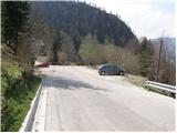
From the highway Ljubljana - Jesenice, we take the exit Lipce (also Hrušica possible) and follow the road ahead in the direction of Jesenice, where signs for Planina pod Golico direct us to an ascending road (the turn-off is marked and is located at the health center in Jesenice). The relatively steep road soon brings us to the mentioned village, where in May we can admire the blooming of daffodils on the surrounding meadows. We park on one of the parking lots at the foot of the ski center Španov vrh.
Route description:
From the parking lot, we continue on the asphalt road, which after a few minutes of walking brings us to a marked crossroad, where we continue left downwards in the direction of Rožca (straight Golica, right Španov vrh). We continue on the road, which takes us past the church of the Holy Cross to an unmarked crossroad (by the cross), where we continue right. From the mentioned road, a marked path soon branches off to the left to Rožca, but we continue straight past a few houses.
The road, which runs along Beli potok, steeply ascends for a short time, then brings us to a decaying house, where we continue right on a relatively steep cart track (left over the small bridge Rožca).
The steepness of the cart track, which runs through dense forest, soon eases, and it brings us after a few minutes of further walking to a junction, where we continue on the right ascending cart track (between both cart tracks, a small cairn is placed on a stump).
The cart track soon leads out of the forest onto a short rocky and panoramic slope, then returns to the forest, where it continues to the forest road. We only cross the mentioned road, then ascend straight up the avalanche slope (this part of the path was entirely destroyed by the avalanche).
When ascending the avalanche slope, we keep to the left side, as after approximately 50 m of ascent on that side we will notice a cart track that continues through the forest.
Already after a few steps of ascent through the forest, we step onto a small clearing, at the edge of which stands a small wooden hut. We continue on the wide path, which crosses a strip of forest, and it soon brings us to the lower part of the alpine pasture, where we reach a small junction. We continue right, cross the grazing fence, and in a few steps ascend to the Golica shepherd hut.
From the shepherd hut, we continue on a pleasant path, which soon brings us to a fence on the upper part of the alpine pasture. We cross the fence and continue the ascent on an ever narrower grassy slope (on this section the path is poorly visible), along which we ascend in a few minutes to an indistinct side ridge, where we notice a small wooden sign with a faded inscription "koča na Golici".
We continue the ascent on a well-traceable path, which ascends diagonally towards the east. Higher up, we join the marked path from Jekljevo sedlo, which we follow to the right. There follows a few minutes of traversing relatively steep slopes, and the path brings us to the hut Koča na Golici.
From the hut, we continue the ascent towards the north on initially gentle then steep grassy slopes. After a good 20 minutes of ascent, the steepness eases and the path turns left. There then follows approximately 15 minutes of walking along the increasingly panoramic summit ridge of Golica.

Photos:
 1
1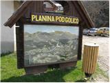 2
2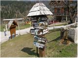 3
3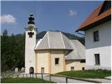 4
4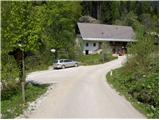 5
5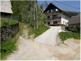 6
6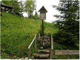 7
7 8
8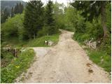 9
9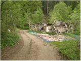 10
10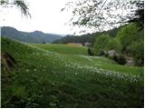 11
11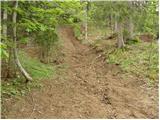 12
12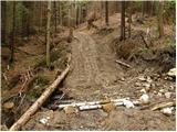 13
13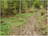 14
14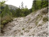 15
15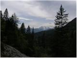 16
16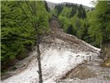 17
17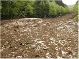 18
18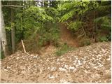 19
19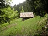 20
20 21
21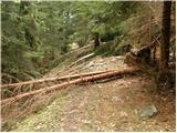 22
22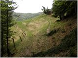 23
23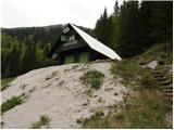 24
24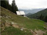 25
25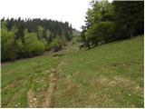 26
26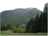 27
27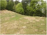 28
28 29
29 30
30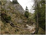 31
31 32
32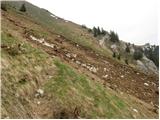 33
33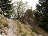 34
34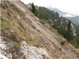 35
35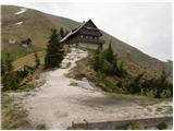 36
36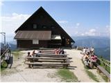 37
37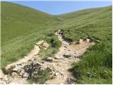 38
38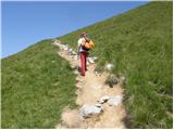 39
39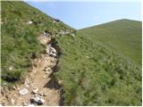 40
40 41
41 42
42 43
43 44
44
Discussion about the trip Planina pod Golico - Kahlkogel/Golica (via Ovčarska koča - eastern way)
|
| Franc6012. 11. 2021 21:33:21 |
For a change, we chose this approach. We got a bit lost, had doubts several times. Mainly due to changes from logging and forest road. So some additions to the otherwise good description.
- the initial track is newly dug, reinforced and very noisy. For foresters it's marked with pink lines and signs. It takes us far to the right - if we follow it of course. From it, we need to turn to the described track, which is hard to notice. The new one cuts it off and hides it. Be careful to find the right continuation on the left side above you. After the narrow passage between rocks, turn right uphill or do it already before the narrow part.
- the junction with the small cairn on the stump is more overgrown than in the picture (14) - fir saplings and ferns.
- when we break through to the forest road (due to the embankment a bit off the original path), we don't cross it, but simply follow it. In summer of course no avalanche debris, for a while it's even concreted. The small hut (picture 20) is now new, the sign tells us it's Volovska planina...
Worth trying! Unlike the usual path, you probably won't meet anyone.
|
|
|
To post a comment you must log in:
If you do not yet have a username, you must first
register.