Planina Polog - Rdeči rob (via Prehodci)
Starting point: Planina Polog (457 m)
| Latitude/Longitude: | 46,23800°N 13,72320°E |
| |
Route name: via Prehodci
Walking time: 5 h
Difficulty: easy unmarked way
Elevation gain: 1456 m
Elevation difference along the route: 1600 m
Map: Julijske Alpe - zahodni del 1:50.000
Recommended equipment (summer): helmet
Recommended equipment (winter): helmet, ice axe, crampons
Views: 2.520
 | 2 people like this post |
Access to starting point:
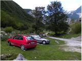
First, we drive to Tolmin, from there we follow the road in the direction of Zatolmin (we leave the main road at the traffic light). In Zatolmin we notice signposts for Javorca, which direct us onto an ascending road towards Javorca. The occasionally quite narrow and in places precipitous road brings us after approximately 8 km of driving to a smaller intersection, where the road towards Javorca branches off to the left uphill. We continue straight, and we follow the road only for approximately 100 m, then at an appropriate place by the barrier we park.
Route description:
From the starting point, we continue on a macadam road (road is closed for public traffic), and after a few minutes of easy walking it brings us to the main part of the mountain pasture, where there are a few cottages. After the mountain pasture, the road becomes even a little worse, and after a few minutes of additional walking brings us to a crossing, where the path branches off to the right towards the mountain pasture Planina na Prodih (access to the mountain pasture is very interesting, because we have to cross the river Tolminka, and this is done by a manual cableway). We continue straight, and the road finally changes into a cart track and higher into a well-preserved mule track. After that, the path becomes a little steeper and past two benches and higher a rockfall (earthquake in Posočje 1998) brings us to a grazing fence, over which we step on the southern edge of the mountain pasture Planina pod Osojnico. Only a few meters ahead the path splits into two parts. We continue on the right lower path, on which in a gentle descent, we quickly get to the hunting cottage at the source of Tolminka.
From the source of Tolminka we continue a gentle ascent through the mountain pasture Planina pod Osojnico, and from the left soon joins the upper path, which is exposed to active rockfall.
We continue in the direction of "planina Prode and Prehodci" on the path which brings us to a mighty torrent bed. We cross the torrent bed and on the other side, we continue left in the direction of Prehodci (slightly right mountain pasture Dobrenjščica). Further, we gently ascend on a well-preserved military mule track, which we can leave a few times because the marked path runs on "shortcuts". Higher bushes and grass are slowly replaced by scree, and the path turns more and more to the left. A little higher, we again come to a mighty torrent gully, which here already joins with nearby scree fields, which fall from the nearby Mali and Veliki Kuntar.
Here to the left across a mighty torrent bed branches off an unmarked path, which leads towards the mountain pasture Lašca and further to Rdeči rob and Male peske, and we continue right on the marked path, which gradually passes into a dense forest. The mule track then ascends in numerous switchbacks and for some time still runs through the forest. Higher the forest thins out, and the path turns more and more towards the right, where it brings us to panoramic and steep slopes. Across an artificial and wide ledge a steel cable assists us, which is useful when there is still snow on the ledge (without snow the passage is undemanding). The path ahead once again moderately ascends and in a few minutes brings us to a marked crossing on Prehodci.
We continue left in the direction of Krn (right Bogatinsko sedlo and mountain pasture Razor) and continue on a gentle and panoramic path. A little further from the right joins another path from Krnsko jezero, and we continue in the same direction. The path ahead from the plateau terrain again brings us onto steep eastern slopes, from which a nice view opens onto the Tolmin side (the area is called Na Tminskem). The path then turns a little to the right and gradually brings us into a smaller high-alpine valley. Here it starts to ascend more steeply and after approximately 20 minutes of additional walking brings us to a large monument to the fallen in the 1st World War.
At the mentioned monument the marked path turns sharply to the right, and right at this spot we leave it and continue on a footpath, which starts descending between the monument and Mali Peski (peak on the right). Less trodden, but easy-to-follow footpath quickly descends to the foot of Mali Peski, where we step onto a long scree slope, across which we descend transversely to the other side, where at the foot of Škofič joins a path (old mule track) from the mountain pasture Lašca. Here we continue right uphill and ascend on a well-visible but completely overgrown mule track on the slopes of the already mentioned Škofič. Further we gently ascend on the mule track for some time, then, when it approaches the south most closely, we leave it and continue the ascent in pathless terrain (direction of ascent is southwest), so that we reach the ridge between Škofič and Rdeči rob. When we reach the ridge we continue left on an initially gentle path, to which from the right almost unnoticeably joins the path across a grassy ledge, which comes from the mountain pasture Leskovica or Sleme. The path ahead steeply ascends along the edge of the precipitous ridge and in 3 minutes of additional walking brings us to Rdeči rob.
We can descend via the shorter path through the mountain pasture Lašca.
Planina Polog - source of Tolminka 1:00, source of Tolminka - Planina na Zgornjih Prodih 0:30, Planina na Zgornjih Prodih - Prehodci 2:20, Prehodci - Mali Peski 1:10, Mali Peski - Rdeči rob 1:00.

Photos:
 1
1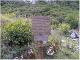 2
2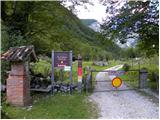 3
3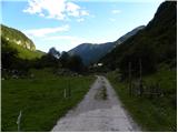 4
4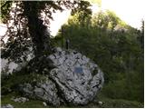 5
5 6
6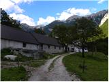 7
7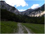 8
8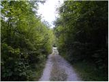 9
9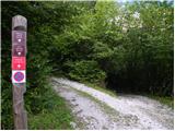 10
10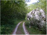 11
11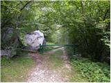 12
12 13
13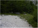 14
14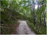 15
15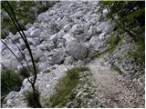 16
16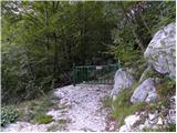 17
17 18
18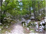 19
19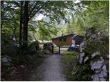 20
20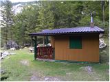 21
21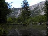 22
22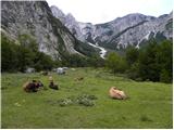 23
23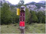 24
24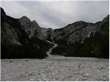 25
25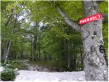 26
26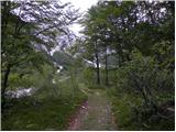 27
27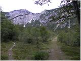 28
28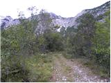 29
29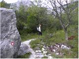 30
30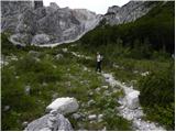 31
31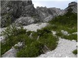 32
32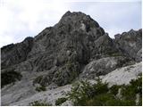 33
33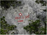 34
34 35
35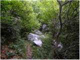 36
36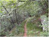 37
37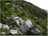 38
38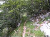 39
39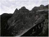 40
40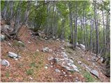 41
41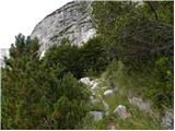 42
42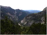 43
43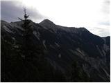 44
44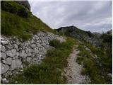 45
45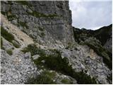 46
46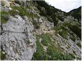 47
47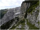 48
48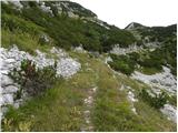 49
49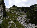 50
50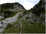 51
51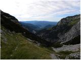 52
52 53
53 54
54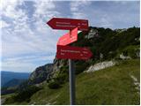 55
55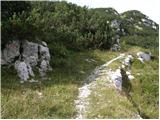 56
56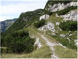 57
57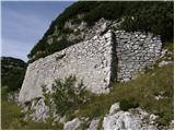 58
58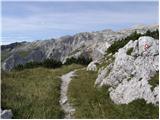 59
59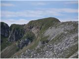 60
60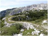 61
61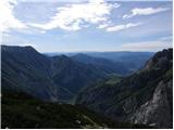 62
62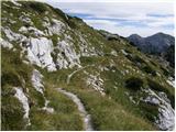 63
63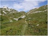 64
64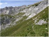 65
65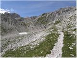 66
66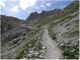 67
67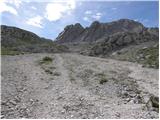 68
68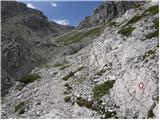 69
69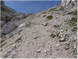 70
70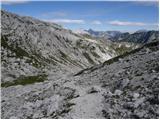 71
71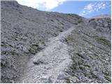 72
72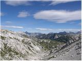 73
73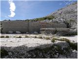 74
74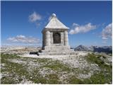 75
75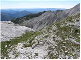 76
76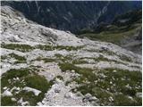 77
77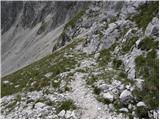 78
78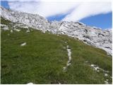 79
79 80
80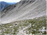 81
81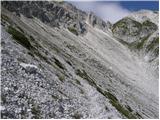 82
82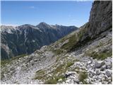 83
83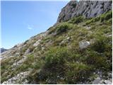 84
84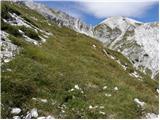 85
85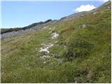 86
86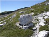 87
87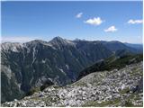 88
88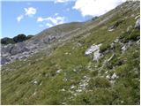 89
89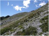 90
90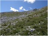 91
91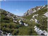 92
92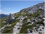 93
93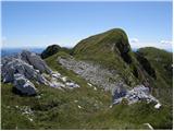 94
94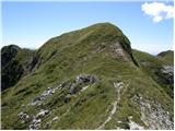 95
95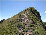 96
96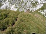 97
97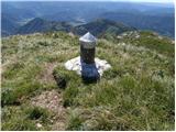 98
98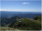 99
99
Discussion about the trip Planina Polog - Rdeči rob (via Prehodci)
|
| keti125. 07. 2021 18:53:03 |
In summer, driving into Tolminka valley is prohibited for personal vehicles. From Tolmin, minibuses run every 2 hours.
|
|
|
|
| darinka425. 07. 2021 21:18:04 |
I think it said the ban applies only for the weekend for personal vehicles.
|
|
|
|
| sezana126. 07. 2021 09:26:30 |
Everything is nicely written on the web. Type in bus transport to Polog and it will all be clear. Complete traffic closure applies every day of the week until 31 August, in September only on weekends...
|
|
|
|
| oraigo22. 09. 2025 19:56:57 |
What's the use when the first bus from Tolmin doesn't leave until 9:00, which is way too late.
|
|
|
|
| mirank23. 09. 2025 08:01:08 |
Time for Sunday foreign tourists of course, otherwise an unusual access to this peak. From Polog via Lašca and over Sleme dol it's a nice fully circular tour. If already via Prehodce, then at the monument straight towards the lake in Lužnica and immediately left to the ridge between R rob and Škofiča. Down as I suggested in the previous variant.
|
|
|
To post a comment you must log in:
If you do not yet have a username, you must first
register.