V Koncu - Grintovec (via Kokrsko and Mlinarsko sedlo)
Starting point: V Koncu (875 m)
| Latitude/Longitude: | 46,34200°N 14,56820°E |
| |
Route name: via Kokrsko and Mlinarsko sedlo
Walking time: 5 h 45 min
Difficulty: very difficult marked way
Elevation gain: 1683 m
Elevation difference along the route: 1750 m
Map: Kamniške in Savinjske Alpe 1:50.000
Recommended equipment (summer): helmet
Recommended equipment (winter): helmet, ice axe, crampons
Views: 104.857
 | 3 people like this post |
Access to starting point:
a) We drive to Kamnik, then follow the signs for Kamniška Bistrica and Črnivec pass. In Stahovica at the traffic light intersection we turn left towards Kamniška Bistrica (straight Črnivec pass) and drive to Dom v Kamniški Bistrici. We bypass the mountain hut on the right side. The asphalt ends a little higher, from there we continue on a gravel road that quickly forks. We keep to the lower left road (right leads to a footpath towards Kokrsko sedlo), and at intersections we follow the signs for Grintovec. We park at the parking lot at the lower station of the freight cable car to Kokrsko sedlo. Driving and parking beyond the freight cable car is prohibited (there is no prohibition sign, but fines of €1,000 are regularly issued). In winter, driving from Koča v Kamniški Bistrici to the parking lot V Koncu is prohibited by a traffic sign, which extends the route by almost an hour.
b) From the direction of Gornji Grad we drive to Črnivec pass, then start descending towards Kamnik. When we reach Stahovica, at the traffic light intersection we turn right towards Kamniška Bistrica (straight Kamnik) and drive to Dom v Kamniški Bistrici. We bypass the mountain hut on the right side. The asphalt ends a little higher, from there we continue on a gravel road that quickly forks. We keep to the lower left road (right leads to a footpath towards Kokrsko sedlo), and at intersections we follow the signs for Grintovec. We park at the parking lot at the lower station of the freight cable car to Kokrsko sedlo. Driving and parking beyond the freight cable car is prohibited (there is no prohibition sign, but fines of €1,000 are regularly issued). In winter, driving from Koča v Kamniški Bistrici to the parking lot V Koncu is prohibited by a traffic sign, which extends the route by almost an hour.
c) From Luče we drive to Podvolovljek, then on a steep road we ascend to Volovljek pass (the pass is also known as Kranjski Rak after the inn there). From there we start descending towards Kamnik. Lower we join the road from Črnivec pass, where we turn right downhill. When we reach Stahovica, at the traffic light intersection we turn right towards Kamniška Bistrica (straight Kamnik) and drive to Dom v Kamniški Bistrici. We bypass the mountain hut on the right side. The asphalt ends a little higher, from there we continue on a gravel road that quickly forks. We keep to the lower left road (right leads to a footpath towards Kokrsko sedlo), and at intersections we follow the signs for Grintovec. We park at the parking lot at the lower station of the freight cable car to Kokrsko sedlo. Driving and parking beyond the freight cable car is prohibited (there is no prohibition sign, but fines of €1,000 are regularly issued). In winter, driving from Koča v Kamniški Bistrici to the parking lot V Koncu is prohibited by a traffic sign, which extends the route by almost an hour.
Route description:
From the parking lot we turn left onto the marked footpath towards Cojzova koča on Kokrsko sedlo, Grintovec and Skuta (straight unmarked paths across Gamsov skret and Žmavčarje). The path initially leads along the right side of the freight cableway but soon enters the forest, through which it begins to ascend first moderately, then quite steeply. The well-maintained path higher up leads us to a short, steeper step. Two short cables used to be installed here but have been removed. In dry conditions the passage is not demanding, though more caution is needed especially on descent and when wet.
Above the steep section we reach a bench where we can take a short rest. The path then continues through the forest for some time. After crossing a torrent we first enter a belt of low trees, then pass under the cliffs of Mali vrh (1915 m), where there is increased risk of falling rocks especially in spring and after rain.
Further on the path becomes more gravelly and steep, which may require some extra energy. In return we are rewarded with wonderful views of the mountains above the Kamniška Bistrica valley, with the imposing walls of nearby Kalška gora standing out. This is followed by some traversing ascent across scree, after which the rocky path transitions to scenic grassy slopes. Along these we ascend to Kokrsko sedlo, where we see the mountain hut on the left and, straight ahead, a fine view towards the Kokra valley.
From Kokrsko sedlo we continue right towards Grintovec, Skuta and Kamniško sedlo via Sleme (left Kalška gora, Kalški greben and Krvavec, straight down Kokra and Suhadolnik). We first ascend quite steeply on slopes rising north of the saddle. After ten minutes the gradient eases and we reach a marked junction, where we turn right towards Skuta (slightly left Kočna and Grintovec).
The path ahead is initially a little harder to follow as it crosses a grassy section, but higher up it becomes clearer and in moderate ascent leads us to the picturesque passage across Mala Vratca.
Here or slightly earlier an formerly marked path to Grintovec via Dolge stene branches left, which today is considered more of an unmarked approach to Grintovec, while we continue straight on the marked path towards Skuta. After the narrow passage of Mali Vratca the path begins to descend a steep and occasionally exposed slope. At the end of the descent, where we lose a little more than 50 metres of elevation, some protection aids us, followed by crossing a gully. After that we reach the world of high plateaus, across which we begin to ascend towards Bivak pod Grintovcem or Bivak Pavla Kemperla, which we reach after about half an hour of ascent.
From the bivouac we continue on the marked path, which quickly brings us to a junction where the path splits.
We continue straight towards Grintovec and Skuta (right Kamniško sedlo) on a relatively gentle path that leads us across the karst terrain of Veliki podi to the next junction.
Again we choose the left path (right Skuta), which continues across a fissured world full of cracks and abysses. On this section we carefully follow the markings and ascend to Mlinarsko sedlo, where Frischaufova pot from Jezersko or Češka koča on Spodnje Ravne joins.
We turn left towards Grintovec (right Dolgi hrbet and Skuta via Dolgi hrbet, sharply right Skuta below Dolgi hrbet) and continue on technically more demanding terrain. The path leads along an occasionally exposed ridge and beside it, ascending mainly southwest, then moves to the shady side of the ridge where it temporarily becomes somewhat easier.
Here the path from Dolška škrbina joins from the right; we keep slightly left towards the summit of Grintovec.
The path ahead becomes somewhat harder, but numerous protections help so that ascent on occasionally sheer sections is fairly safe. In the final part the path is also quite exposed to falling rocks; we follow the steep path all the way to the summit of Grintovec, from which a magnificent view opens.
Descent is possible by the easier path via Streha.
Starting point - Kokrsko sedlo 2:30, Kokrsko sedlo - junction above the saddle 0:10, junction above the saddle - Mala Vratca 0:15, Mala Vratca - Bivak pod Grintovcem 0:50, Bivak pod Grintovcem - Veliki podi 0:25, Veliki podi - Mlinarsko sedlo 0:35, Mlinarsko sedlo - junction below Grintovec 0:40, junction below Grintovec - Grintovec 0:20.

Photos:
 1
1 2
2 3
3 4
4 5
5 6
6 7
7 8
8 9
9 10
10 11
11 12
12 13
13 14
14 15
15 16
16 17
17 18
18 19
19 20
20 21
21 22
22 23
23 24
24 25
25 26
26 27
27 28
28 29
29 30
30 31
31 32
32 33
33 34
34 35
35 36
36 37
37 38
38 39
39 40
40 41
41 42
42 43
43 44
44 45
45 46
46 47
47 48
48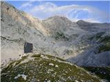 49
49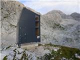 50
50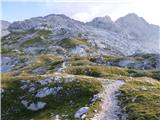 51
51 52
52 53
53 54
54 55
55 56
56 57
57 58
58 59
59 60
60 61
61 62
62 63
63 64
64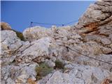 65
65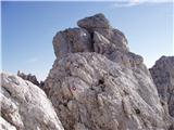 66
66 67
67 68
68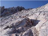 69
69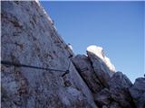 70
70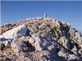 71
71 72
72
Discussion about the trip V Koncu - Grintovec (via Kokrsko and Mlinarsko sedlo)
Show older messages
|
| Gost4. 09. 2007 |
This weekend I went along this path. Yes, really nice, up to the low chain at the notch. While crossing it - I was scared to death. The feeling at the top of Grintovec was total triumph for me! I don't recommend this path to inexperienced people and those afraid of precipices or vertigo! (I myself have no problem with that). What do others think?
Good luck!
|
|
|
|
| velkavrh4. 08. 2008 |
Today I did this route or variant to Grintovec. First time from Kamniška Bistrica. I must warn that at the bottom, at the first parking lot right after the hut in Kamniška Bistrica for the Kokrsko sedlo direction, it is poorly marked, specifically the junction shortly after the parking for Kokrsko sedlo is poorly marked. The path to the saddle is quite steep, gives no rest. The path from Suhadolnik from the Kokrska direction suits me much better. Then to the bivouac there is nothing special. The bivouac is still in a desperate state, same as I described it last year. Then literally rocks begin. To Mlinarsko sedlo it is all rock. In the sun it can be very hot. Then ascent to Grintovec, unfortunately it was already foggy and back via Streha. I must warn that there are some pitons from which the attached cables are pulled out.
|
|
|
|
| velkavrh4. 08. 2008 |
The bivouac under Grintovec is open - it has really good locks that I haven't seen elsewhere. Simply no one can lock you inside - good system. But to arrange the bivouac, the manager really needs to be informed.
|
|
|
|
| the dancer4. 01. 2009 |
I'm a bit curious about the situation from Tovorka to Kokrško and further towards Grintavec, from a hiking perspective and for snowshoeing? 
|
|
|
|
| Pohodnik1112. 09. 2009 |
What are the conditions like on this route? I'm interested if there's a very dangerous section somewhere, if it's well protected. I would return via Streha. Also, does anyone know if there's a high risk of rockfall on this trail. Thanks. Best regards
|
|
|
|
| miranm28. 06. 2010 |
I'm interested in the current conditions in this direction, are there any dangerous parts, is there still any snow? Thanks, regards
|
|
|
|
| steleu30. 06. 2011 |
I don't know where you got the name Grintavec from... The correct name is of course Grintovec...
lpu
|
|
|
|
| free30. 06. 2011 |
Dry throughout. The biggest problems are swarms of wasp-disguised flies (or whatever those bugs are) at Mlinarsko sedlo. Securing gear is fine, no dangerous sections (?), but on such a path you have to avoid risky behavior, right? With careful observation you can also encounter chamois, Chamois and marmots on the way. and marmots on the way.
|
|
|
|
| jax28. 09. 2011 |
Up today, I think alone. I have to say the path is actually a bit harder than I expected, but very beautiful. After the suffering to Kokrsko sedlo it quickly becomes more pleasant and already on the scree below Mlinarsko sedlo I quickly forgot about that steep slope under the cable car 
Otherwise, the path seemed very well maintained and secured to me. Actually, a good part of the path is unprotected, but there I didn't miss the aids, and where they are needed, they are reliable. Perhaps the fact that it seemed a bit harder than expected is also related to having to climb down most of the difficult spots. That's of course much harder, although the spots themselves weren't problematic.
Well, let me also mention the (at least for me) most beautiful passage: it's also in the last picture in row 9. Cliff on the right, on the left a nasty red chimney opens in the rock - I'm not going there - in between just one rock with a mark. Where now? Actually, here you have to do a sort of "step of faith": simply trust the marking and climb onto that rock (on the ridge edge itself), without seeing what's behind it. Well, once you're up, a completely easy passage down opens up suddenly
Anyway, the path seemed quite demanding to me, but I definitely recommend it. By the way: scree is of course present on it, as everywhere in our high mountains (and actually the most tricky spots for me were precisely those in the red and crumbly rock), but positively, besides that, there are quite a few spots with nice solid rock on this path. One more good side.
|
|
|
|
| pohodnik3810. 07. 2012 |
The predecessor already wrote something about the path, which I did on Sunday 8.7. I imagined it harder but personally it didn't seem so demanding to me though it's long. Well protected on key sections. Some snapshots below.
VIDEO
Regards!Tone
|
|
|
|
| Domch19. 07. 2012 |
Beautiful tour and good for maintaining fitness. The path is interesting especially from Kokrsko sedlo onwards towards the new bivouac below Grintovec. There are still some snow patches in the hollows. From Mlinarsko sedlo onwards follows a well-protected ridge that is no longer very exposed, but a little care is needed especially in following the markers, which go all the time left and right along the ridge. Then a short ascent to the summit. At the top, fog greeted us today at least after 11 o'clock.
|
|
|
|
| lakkon24. 07. 2012 |
I plan to go to Skuta:
http://www.hribi.net/izlet/suhadolnik_skuta_cez_kokrsko_sedlo/3/28/648
Depending on mood and weather, on the way back I could also go to Grintovec, which I haven't summited yet. It's too close, at least on the map practically on the way back, to skip it in that situation. From Skuta I would go to Mlinarsko sedlo and then on this trail:
http://www.hribi.net/izlet/_v_koncu_grintovec_cez_kokrsko_in_mlinarsko_sedlo/3/16/538
here it says: ...from Mlinarsko sedlo continue towards Grintovec on a path that becomes technically demanding. The path further leads along and beside locally exposed ridge, then passes to the shady side of the ridge, where it becomes somewhat more difficult, but numerous belays help us. The path, exposed to falling rocks in the upper part, brings us to the summit after about 1 hour from Mlinarsko sedlo. Recommend descent via Streha Grintovca…
But is it only because of that stated for this trail: very demanding marked path? On the map Grintovci 1:25 000 this entire section is marked with dots. It doesn't say that a via ferrata set is needed, which is usually where paths are more difficult.
I have never gone on a path stated as very demanding marked path. Usually because a via ferrata set is required. I'm not afraid of heights. I don't overestimate my abilities. I've already hiked where it wouldn't go without pegs and cables. I also have experience with crossing some ridges up and down and slips and know to be careful. I am aware of how much food, drink, clothing and equipment I would need.
Should I try given that I'll already do that path to Skuta before?
Thanks for help.
|
|
|
|
| jprim24. 07. 2012 |
If I understand you correctly, you would first go to Skuta, then descend back to Mlinarsko sedlo and to Grintavec.
Usually if going first to Skuta and still planning Grintovec, one crosses Dolgi hrbet.
LP!
|
|
|
|
| pohodnik3824. 07. 2012 |
Through Mlinarsko sedlo there are belays, on one part the path is very open because you walk on the ridge which is less than 1 meter wide, but the cable for grip is routed lower near the ground not high like on the ridge e.g. on Triglav, if you're used to heights and drops it won't be a problem.
|
|
|
|
| danicak25. 07. 2012 |
On Sunday I plan to go to Kokrsko sedlo. Just a question-regarding difficulty, what is the difference between the path to Kamniško sedlo (which I have walked) and to Kokrsko sedlo? I know it is steep, that won't be an extra obstacle, I have more concerns about possible exposed sections.
thanks
|
|
|
|
| danicak25. 07. 2012 |
yes, I watched all available films from previous years about this run beforehand, nice thanks for the suggestion-
the seventh and eighth pictures in the gallery above scare me a bit.....
|
|
|
|
| LidijaJesih26. 07. 2012 |
No fear. Wide enough. This year, if I remember correctly, there's no steel cable anymore.
|
|
|
|
| danicak26. 07. 2012 |
ga. Lidija thanks for the info,
D.
|
|
|
|
| petra9. 06. 2013 |
Hey, has anyone hiked to Grintovec these days?? How much snow is left?
|
|
|
|
| davidge4. 08. 2013 |
hi yesterday on the way between Kamniška Bistrica and Kokrško sedlo I lost my glasses. Possibly also somewhere on the Grintovca path. They are black from Drty Dog Fertme. If someone finds them by chance
|
|
|
|
| primaky9. 08. 2014 |
I'm interested in the starting point in Koncu... they say it's not possible by car to the foot of the cable car, the car has to be left at the house in Kamniška Bistrica... this extends the path by about 1h.
At the top it says walking time to Cojzova koča is 2:15, I'm interested if this is from the hut in KB or from the foot of the cable car?
|
|
|
|
| SunBurned9. 08. 2014 |
As far as I know, it is no longer explicitly prohibited. However, the road just before the cable car used to be destroyed to the point of being impassable at times, so the last 5 minutes had to be done on foot.
|
|
|
|
| SunBurned9. 08. 2014 |
Now up to the base of the cable car.
|
|
|
|
| Merymery24. 08. 2014 |
Hey has anyone driven by car to the starting point in Konec this year what's the road like we plan to climb Grintovec and Skuta so that hour would come in quite handy
|
|
|
|
| acjom24. 08. 2014 |
The road is very nice, the only potential problem is the weather, which this summer has too often prevented us from enjoying our mountains
|
|
|
|
| Merymery24. 08. 2014 |
thanks for the information, I hope next weekend it will be possible to conquer at least something in these parts
regards
|
|
|
|
| sebo30622. 09. 2014 |
has anyone been on this path to Grintovec recently? Is winter gear needed to cross snowfields - so I don't carry it unnecessarily?
|
|
|
|
| redbull22. 09. 2014 |
up to today there was no snow,, if some falls tonight you'll see it tomorrow morning
|
|
|
|
| Nastasja21. 03. 2015 |
On March 19, crampons were found on the path to Grintovec. If you miss them, contact Marjan Kastelic (Marjan Kastelic-Muša) on FB.
|
|
|
|
| Barentoter26. 10. 2015 |
Tomorrow I plan to pop up to Grintovec. Are there still winter conditions at the summit?
|
|
|
|
| mančika30. 10. 2015 |
How are the winter conditions? Do you need crampons? Maybe Barentoter?
|
|
|
|
| Barentoter30. 10. 2015 |
Was up there on Wednesday, crampons stayed in the backpack.
|
|
|
|
| navrhu21. 01. 2016 |
On Saturday I would go from this starting point (V KONCU) to Grintovec. Is it possible to reach the starting point by car via the forest road?
|
|
|
|
| Ringo24. 04. 2016 |
Hello, does anyone know if it's possible to reach Grintovec normally from Cojzo hut? On Wednesday 27.4 or Thursday 28.4, I am
Beginner
|
|
|
|
| KJ24. 04. 2016 |
There might still be or again some snow under the hut.. But it will be cold and windy.
|
|
|
|
| redbull25. 04. 2016 |
Stay nicely at home, because on Wednesday a nice load of snow is forecast. If you know the path, don't forget gaiters.
Good luck
|
|
|
|
| mukica25. 04. 2016 |
From the Kamnik side, snow starts right as you exit the forest, not recommended for beginners without knowledge of using winter gear, plus a new snowfall is forecast. Likewise from the hut onwards, snow and mandatory winter gear. Careful and good luck
|
|
|
|
| Ringo25. 04. 2016 |
Thank you very much for the information, good luck
|
|
|
|
| Ringo13. 05. 2016 |
I'm interested in what the path to Grintovec is like and if I need winter gear, I would go on Sunday thanks LP
Ekolog
|
|
|
|
| ben18. 08. 2017 |
It will match if you're just some fast mountain runner, but the timetable too If I calculated correctly they estimated around 3.5 hours... yeah you have to be quite fast!!
|
|
|
|
| denist18. 08. 2017 |
Above it says 5h, I planned 3h-3.5h, thanks for the info
Lp!
|
|
|
|
| ben18. 08. 2017 |
Yes, above it says 4 hours and 5 minutes. On this portal it only says to Skuta 5:15 and that's from below from parking under the waterfall, you would go from Dom planincev, then need to reach Grintovec too, add another 3 hours. So between 8 and 9 hours by marked times one way. If you're super fast then no problem!!
LP B
|
|
|
|
| Gost18. 08. 2017 |
As I understand the above description the start is at Grintovec and the goal in Logarska and even so some times seem suspiciously short to me.
|
|
|
|
| N3bULA30. 08. 2017 |
Tour to Grintovec successful.
Today we had super weather so the whole ascent was pure pleasure.
Road to parking in Konc is open and passable.
I walked approx. 5 hours.
Path well maintained and secured, also not too much for those with mild vertigo.
At the top the stamp pad is dry, so bring your own.
best regards
|
|
|
|
| danilol13. 07. 2019 |
I'm interested in what the trail is called that cuts directly from the bivouac under Grintavec to Grintovec. It is marked with a dashed black line on the map, but in reality there are old faded red markers along the trail. The trail branches off to the left if we go from the bivouac towards Mlinarsko sedlo. Actually, it's a shortcut so you don't have to go over Mlinarsko sedlo. It was quite varied but I can't find a description of the trail anywhere.
|
|
|
|
| danilol14. 07. 2019 |
I learned that it's called the old hunting path, but there's no description on hribi.net
|
|
|
|
| franca15. 07. 2019 |
nor on older maps is there any path from the bivouac to the top of Grintovec. The marked path is the one through Dolge stene, description is in the guidebooks and on hribi.net. Old hunting paths are through Žmavcarje, Gamsov skret and through Jurjevec.
|
|
|
|
| gipeon3. 07. 2022 13:06:33 |
Yesterday I did the mentioned path. The path initially leads through the forest, but soon the sun reaches the hiker. I recommend an early start, as the path is not short. Between Cojzova koča and the bivouac there are two exposed sections that require care, where you have to be focused. The bivouac is not the same as in the picture, but renovated, three-story, in short pleasant, with blankets inside. Between Cojzova koča and the bivouac yesterday around 10 a.m. I spotted about 12 ibex, be careful on the right side along the path. You can approach them to 5m. Towards the summit the section is quite demanding, but you don't need a via ferrata set, nor do I know where you could use it. A few scrambles, nice cliffs on left and right and you're at the top. I recommend descent to Cojzova koča on the other, easier side, as legs are quite tired. I was at the summit, at a moderate pace, in about 4.5 hours.
|
|
|
To post a comment you must log in:
If you do not yet have a username, you must first
register.