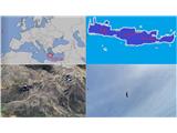
Agion Pneuma (Avrakondes) - Spathi (Crete)
Starting point: Agion Pneuma (Avrakondes) (1130 m)
| Latitude/Longitude: | 35,14141°N 25,48132°E |
| |
Walking time: 4 h
Difficulty: easy marked way
Elevation gain: 1018 m
Elevation difference along the route: 1100 m
Map:
Recommended equipment (summer):
Recommended equipment (winter):
Views: 243
 | 1 person like this post |
Access to starting point:
The starting point on the Greek island of Crete is located above the well-known and attractive Lasithi Plateau (Οροπέδιο Λασιθίου in Greek; Oropedio Lasithiou). On this vast plateau, a unique natural wonder that lies entirely 800 meters above sea level, in the village of Avrakondes (Αβρακόντες in Greek), a 5-kilometer-long narrow road with a concrete surface branches off from a very small square (as shown in the picture). The road is steep in places (manageable only in first gear of a rented car) and has some long sections where passing is not possible. The road crosses a saddle, offering a view of Mount Spathi, and then descends 50 meters to some mountain farms. Park before the crossroads of cart tracks near the chapel of the Holy Spirit (Άγιον Πνεύμα in Greek; Agion Pneuma). The parking spot is shown in the picture.
Route description:
From the parking spot, continue straight towards Mount Spathi. The mountain, which at this point the hiker sees ahead, will be completely circled from the right side in the continuation. First, continue along a cart track with lots of debris and stones, and near the large torrent bed, the path begins, running on the left side of the torrent bed and turning away from the mountain. The path is easy to lose sight of, but even in this case, alternative routes are indicated by numerous cairns. On this bed, Spathi is still visible, but later you will lose sight of it for a long time. Eventually, the path turns right from the bed into steeper terrain, where the ascent and crossings towards the beautiful plateau terrain begin, over which the path then runs in a SW direction. The path then slowly turns left towards the south and in the ascent transitions to a flatter section with beautiful views of the neighboring mountain Afentis Christos (Αφέντης Χριστός; Holy Jesus), which at 2141 meters is only slightly lower than Spathi. When the flatter section ends, after a short ascent at around 1800 m above sea level, the path to Afentis Christos also branches off to the right, while the path to Spathi leads left (or straight), ascending slightly through a beautiful but scorching plateau terrain in the summer months, heading east.
The path then descends and directs to the SW ridge of Mount Spathi. The ascent is indicated by cairns and red dots. The summit slope is crossed on the south and east sides, and then the peak is reached.
Description and pictures are from June 5, 2024 (on the return at 15:00 it was 30°C, with the temperature slightly dropping with altitude, there was no wind except for a breeze from 1800 m above sea level onwards; protect yourself from the sun with a wide-brimmed hat and sunscreen).

Photos:
 1
1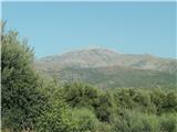 2
2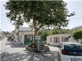 3
3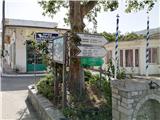 4
4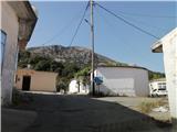 5
5 6
6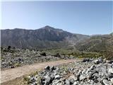 7
7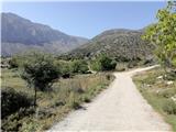 8
8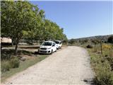 9
9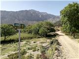 10
10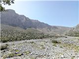 11
11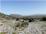 12
12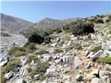 13
13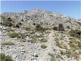 14
14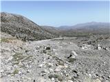 15
15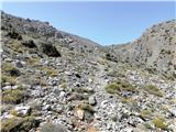 16
16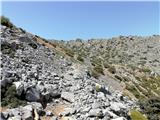 17
17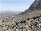 18
18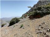 19
19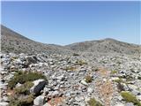 20
20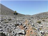 21
21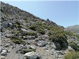 22
22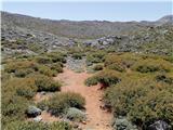 23
23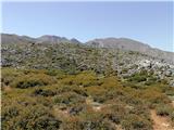 24
24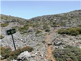 25
25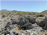 26
26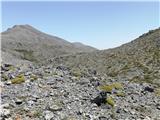 27
27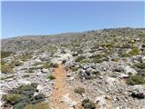 28
28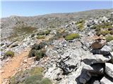 29
29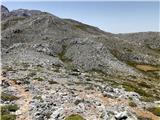 30
30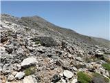 31
31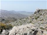 32
32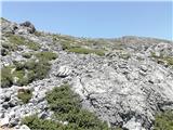 33
33 34
34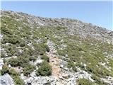 35
35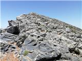 36
36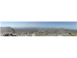 37
37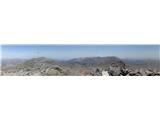 38
38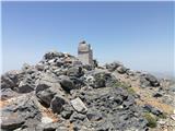 39
39
Discussion about the trip Agion Pneuma (Avrakondes) - Spathi (Crete)
|
| Pi_is_exactly_320. 07. 2024 10:52:25 |
Useful information about the trail is also from user j. under the Current Conditions forum for Crete (at this link, post 13. 07. 2022 17:46:10).
|
|
|
To post a comment you must log in:
If you do not yet have a username, you must first
register.