Aljažev dom v Vratih - Kredarica (Tominšek route)
Starting point: Aljažev dom v Vratih (987 m)
| Latitude/Longitude: | 46,41280°N 13,84660°E |
| |
Route name: Tominšek route
Walking time: 5 h
Difficulty: very difficult marked way
Elevation gain: 1554 m
Elevation difference along the route: 1555 m
Map: Triglav 1 : 25.000
Recommended equipment (summer): helmet, self belay set
Recommended equipment (winter): helmet, self belay set, ice axe, crampons
Views: 226
 | 1 person like this post |
Access to starting point:
We drive to Mojstrana, then follow the signs for Vrata valley. We continue along the toll road, which is closed to public traffic in winter, following it to the large parking lot located a few minutes before Aljažev dom v Vratih.
Route description:
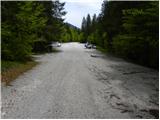
From the large parking lot we continue along the road closed to public traffic, arriving at Šlajmerjev in a few minutes and a little further to Aljažev dom v Vratih.
Before Aljažev dom the path to Škrlatica branches off to the right, we continue straight towards Triglav, Luknja, Pogačnikov dom na Kriških podih and numerous other destinations along a wide path that leads us into the forest past the chapel, further on it is fairly gentle.
We continue past the winter bivouac, upon leaving the forest we arrive at the famous memorial wedge in Vrata valley dedicated to the fallen partisan mountaineers.
Here we leave the wide gentle path continuing towards the valley head and turn left towards Tominšek route. We proceed through scree into the forest where the ascent begins on a well-made path that is quite steep with wooden steps in some places. After a bit more than one and a half hours of steep path the forest thins out and we reach the start of the climbing section where the first fixed protections assist us.
Further on the path becomes more precipitous and exposed to falling rocks, gradually transitioning from the slopes of Rjavčevih glav to the slopes of Begunjski vrh. The climbing part of Tominšek route mainly follows a traversing ascent to the right, occasionally ascending steeply upwards with the aid of protections.
Above 2000 m above sea level the path gradually becomes less demanding and joins the path over Prag, shortly after reaching Begunjski studenec.
We continue the steep ascent, technically not demanding here, after about 15 minutes reaching the next junction where the path to Dom Valentina Staniča pod Triglavom branches left; we go straight following markings to Triglav and Triglavski dom na Kredarici.
The path ahead temporarily flattens, bypasses Kotel on the right and leads to Triglavske pode where orientation is somewhat difficult especially in fog. On the upper part of Triglavskih podov the path steepens again becoming technically demanding with protections on harder sections.
Above the steep part the path flattens again and with improving views we reach Triglavski dom na Kredarici in a few minutes.
Continue sharply left towards Kredarica summit, Dom Valentina Staniča and Kot valley (straight Krma valley and Pokljuka, right Triglav summit) ascending past the water intake with fine views to the viewpoint platform on Kredarica. Here the marked path turns right ascending the gradually narrowing ridge to the cairn on the highest point of Kredarica.
Starting point - Aljažev dom 0:05, Aljažev dom - Kozja dolina 1:50, Kozja dolina - Begunjski studenec 1:45, Begunjski studenec - Kotel 0:15, Kotel - Triglavski dom 1:00, Triglavski dom - Kredarica 0:05.

Along the route: Aljažev dom v Vratih (1001m), Spomenik padlim partizanom gornikom (1020m), Kozja dolina (1749m), Begunjski studenec (2091m), Kotel (2166m), Triglavski podi (2400m),
Triglavski dom na Kredarici (2515m)
Photos:
 1
1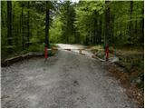 2
2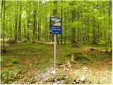 3
3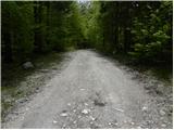 4
4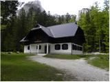 5
5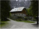 6
6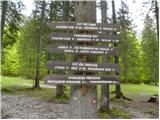 7
7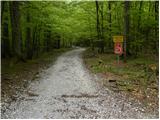 8
8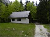 9
9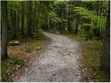 10
10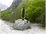 11
11 12
12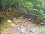 13
13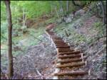 14
14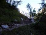 15
15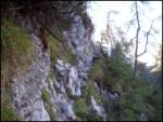 16
16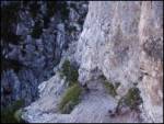 17
17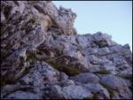 18
18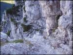 19
19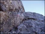 20
20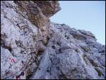 21
21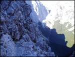 22
22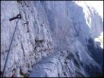 23
23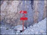 24
24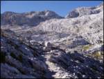 25
25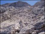 26
26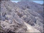 27
27 28
28 29
29 30
30 31
31 32
32 33
33 34
34 35
35 36
36 37
37 38
38 39
39 40
40
Discussion about the trip Aljažev dom v Vratih - Kredarica (Tominšek route)
To post a comment you must log in:
If you do not yet have a username, you must first
register.