Avsa - Dom na Matajure (old path)
Starting point: Avsa (880 m)
| Latitude/Longitude: | 46,19850°N 13,58470°E |
| |
Route name: old path
Walking time: 2 h 30 min
Difficulty: easy marked way
Elevation gain: 665 m
Elevation difference along the route: 700 m
Map: Julijske Alpe - zahodni del 1:50.000
Recommended equipment (summer):
Recommended equipment (winter): ice axe, crampons
Views: 2.450
 | 1 person like this post |
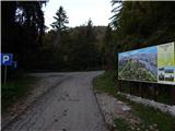
Access to starting point:
A) We drive to Tolmin, and then we continue driving towards Kobarid. When we get to the settlement Idrsko, we turn left in the direction of the settlement Livek, from Livek we follow the signs for Avsa and Matajur. From Avsa we continue a good 300 meters ahead, and then we park on the marked parking lot.
B) From Kobarid we drive towards Tolmin, but only to the settlement Idrsko, where we turn right in the direction of the settlement Livek, and from Livek we follow the signs for Avsa and Matajur. From Avsa we continue a good 300 meters ahead, and then we park on the marked parking lot.
Route description:
From the parking lot, we go on a marked path in the direction of Matajur, where we at first walk through the forest and transitionally step on a cart track. Next follows an ascent through two shorter meadows, and then we return into a dense forest, through which we ascend moderately to steeply, and here and there the path also slightly descends. Higher, we cross a metal fence, behind which the path turns right and continues on a cart track. The cart track soon ends, and we continue on a footpath which continues through a partly grassy slope, surrounded by lanes of forest. A little further, the path turns left and on the slopes of Srednji vrh entirely flattens.
Here we can on pathless terrain in a few minutes ascend to Srednji vrh, otherwise we continue on the marked path, which crosses the slopes of the mentioned summit and a little ahead joins the forest road. We follow the road to the right, along which we quickly arrive at a marked junction, which is located in a smaller valley between Mrzli vrh and Srednji vrh.
At the junction a marked path but without blazes branches off to the right to Mrzli vrh, Srednji vrh and Idrska planina, and we continue on the road, which on the west side of Mrzli vrh splits.
We continue on the left road (right Idrska planina), to which a little further the "new" path from Avsa or Livek joins.
From the poorly noticeable junction we still walk on the road and arrive at the next, this time well-marked junction.
To the right continues the normal path to Matajur, and we continue straight in the direction of Dom na Matajure and still walk on the road, which a little ahead we leave because the blazes direct us right into the forest. Next follows an ascent through the forest, then we cross a wider cart track, which from the road a little higher branches off to the right. We continue ascending on a quite steep mountain path, which gradually flattens and when we step out of the forest joins the forest road.
Still before we reached the road, we practically unnoticeably crossed the national border, a little higher we arrive at a stone-built hut, which is situated near the cave Glava / Grotta di Casera. We continue on the road, higher on a footpath we cut the right turn, then when the forest already gets quite thinner, we arrive at a marked junction, which is situated on the left hairpin turn of the road.
From the hairpin turn straight ahead continues the path to Matajur, and we continue on the increasingly poor road, which further crosses the southeastern slopes of Matajur. After a few minutes of crossing we reach the southeastern ridge and also a marked junction, where we join the path from Koča Pelizzo.
We continue straight in the direction of Dom na Matajure (left downwards Koča Pelizzo, right summit Matajur) and still cross grassy slopes. We follow the panoramic and nicely maintained footpath to Dom na Matajure, which we reach after approximately 10 minutes of additional walking.

Photos:
 1
1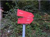 2
2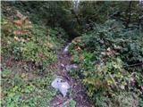 3
3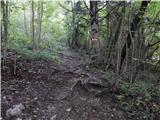 4
4 5
5 6
6 7
7 8
8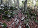 9
9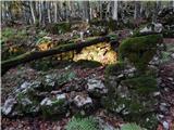 10
10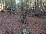 11
11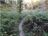 12
12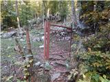 13
13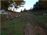 14
14 15
15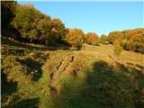 16
16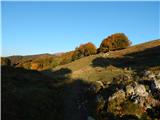 17
17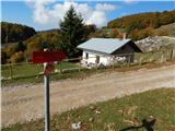 18
18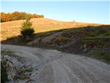 19
19 20
20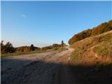 21
21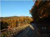 22
22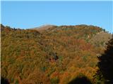 23
23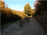 24
24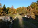 25
25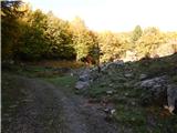 26
26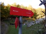 27
27 28
28 29
29 30
30 31
31 32
32 33
33 34
34 35
35 36
36 37
37 38
38 39
39 40
40 41
41 42
42 43
43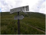 44
44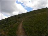 45
45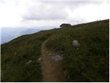 46
46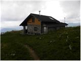 47
47
Discussion about the trip Avsa - Dom na Matajure (old path)
To post a comment you must log in:
If you do not yet have a username, you must first
register.